The cold front is moving in too quickly!
3-7-26. 2pm This update is brought to you by Dietz Mclean Optical Company. www.dmoptical.com As a family-owned business, our independence, in house lab, great customer service and eyewear warranties, allows us to tailor your eyeglasses, lenses, and fittings: we want you to only expect the best after working with us. With six conveniently located optical shops in San Antonio, Boerne, Marble Falls and Temple, it’s easy to love what you see.
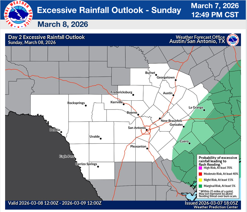
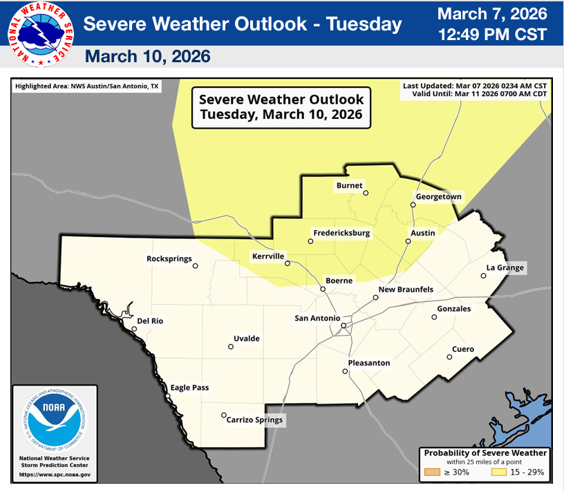
We really can’t catch a break around here! Our cold front that was supposed to go stationary to our north is not only moving south, but has colder air behind it than any of the models were forecasting. The good news is that the better rain odds are shifting to south Texas, where they need the rain even more than our northern counties. Here is what the NWS is saying: “The greatest potential for severe storms will be along/south of I-10/US HWY 90 through the rest of today. The locally heavy rainfall potential remains but has lowered as the cold front quickly moved into and across the Hill Country and the I-35 corridor. A second round of strong to severe weather is forecast for Tuesday. We will monitor the situation and keep you informed.”
If you live north of a Del Rio to San Antonio line it still doesn’t mean you don’t have to keep an eye out for severe storms…as of post time the front is still to your north and storms are forming as I work on this post. Also, if this first round doesn’t drop as much rain as you were hoping, rain will continue to be in our forecast through Wednesday.
Below are the latest updates and model runs.
Mark

This update is brought to you by Dietz Mclean Optical Company. www.dmoptical.com As a family-owned business, our independence, in house lab, great customer service and eyewear warranties, allows us to tailor your eyeglasses, lenses, and fittings: we want you to only expect the best after working with us. With six conveniently located optical shops in San Antonio, Boerne, Marble Falls and Temple, it’s easy to love what you see.
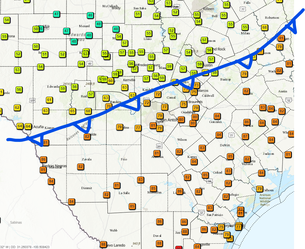
2:30pm location of our front.
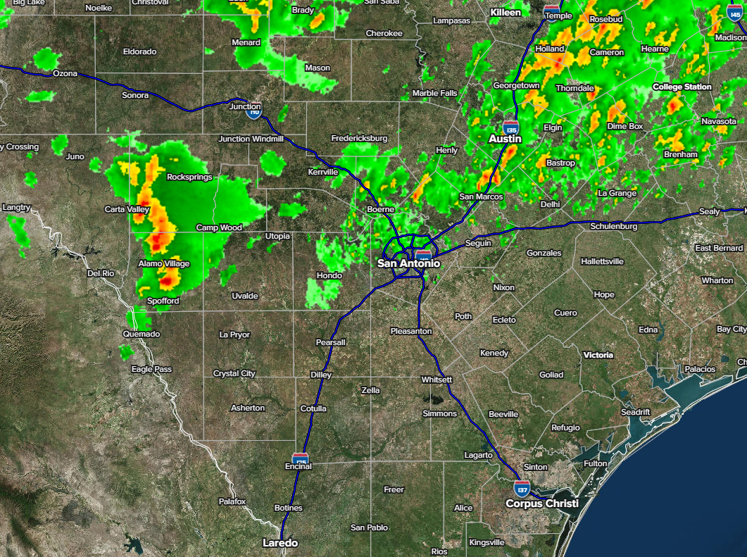
2:30pm radar update.
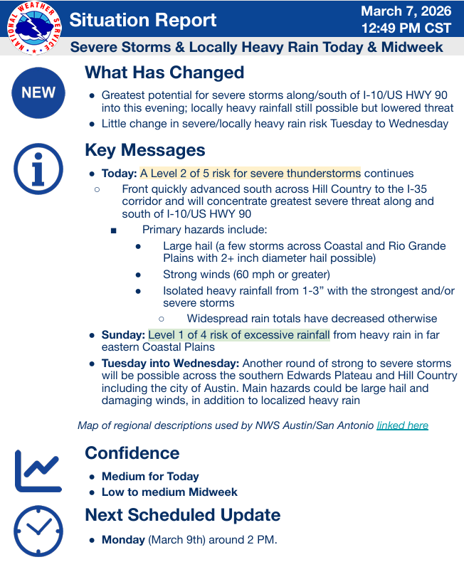
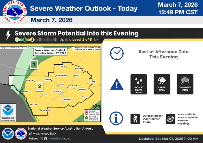
The latest NWS update. Click on images to see them larger.


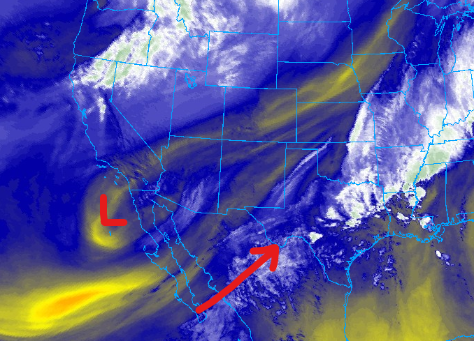
A cut-off low has formed off the coast of Baja and will impact our weather through Wednesday.
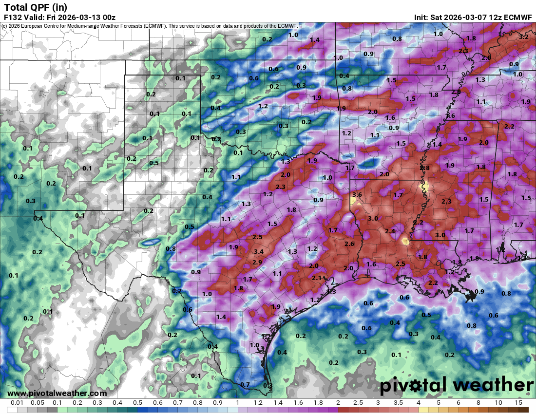
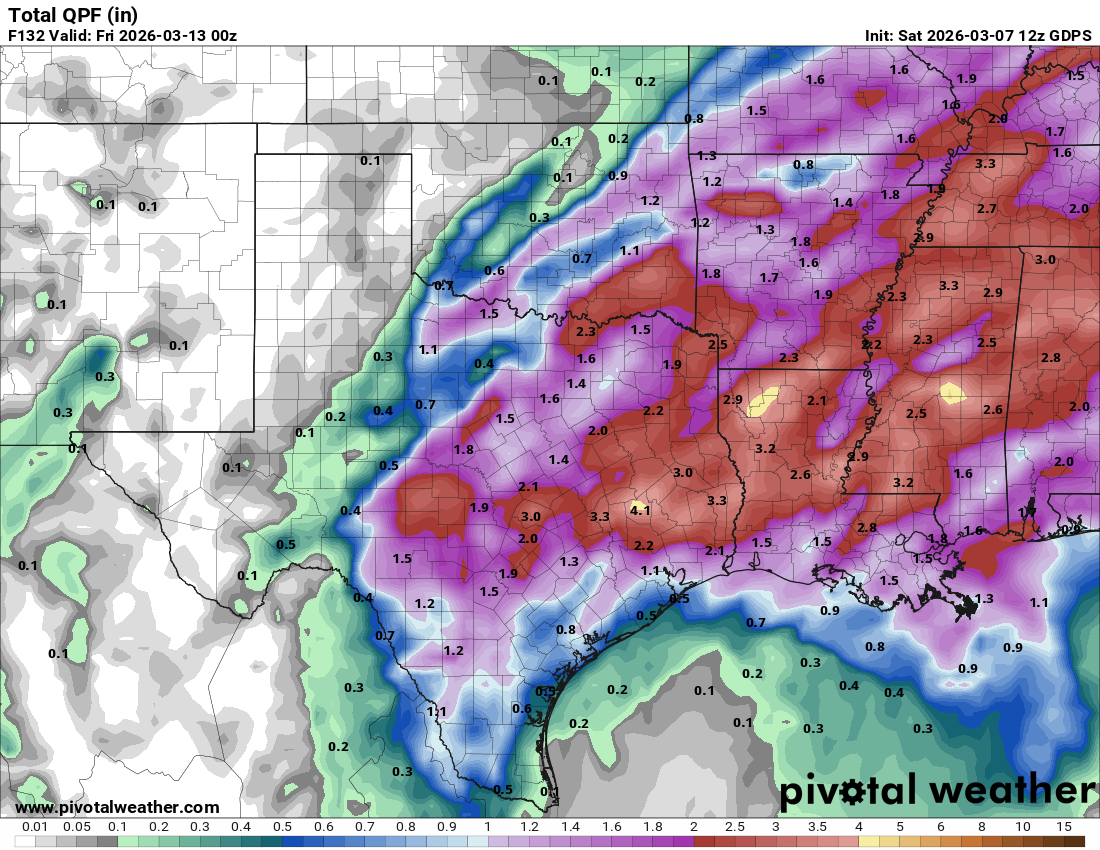
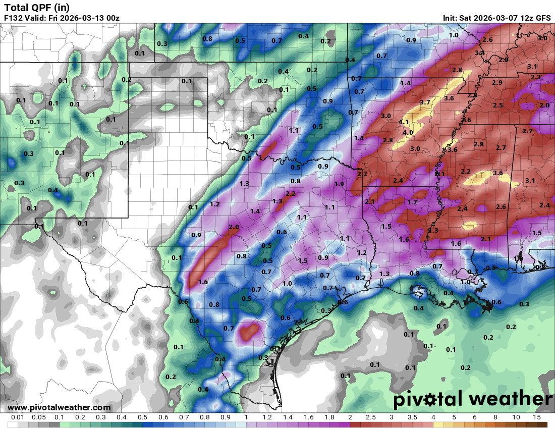
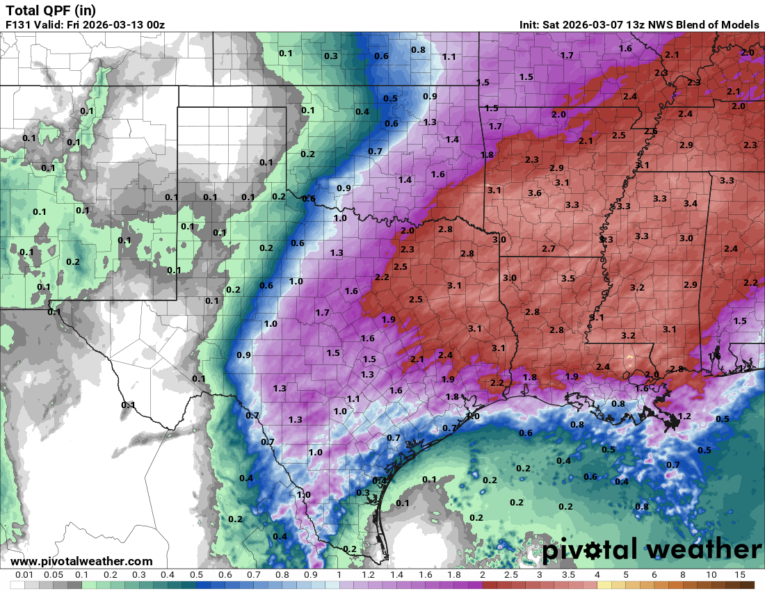
How much rain the latest models think will fall between today and Wednesday. Click on images to see them larger.