Stormy along the coast this afternoon…
11-22-25. 3:30pm. This post is sponsored by Standby Solutions. With the potential for severe storms later this week, now is the time to get a quote from our sponsor since it takes only one storm to potentially take out your power for days! Synergy Standby Solutions is a trusted provider of sales, maintenance, repairs, and fueling services for standby generators in South Central Texas. We specialize in ensuring your backup power systems remain reliable and fully operational, giving you peace of mind during power outages. With a commitment to excellence and customer satisfaction, our expert team is ready to handle all your generator needs. Learn more at www.synergystandby.com.
Thanks to a stationary front along the coast, some hefty storms have formed this afternoon, dropping some decent rain totals and prompting a flood advisory: ..FLOOD ADVISORY IN EFFECT UNTIL 430 PM CST THIS AFTERNOON... * WHAT...Flooding caused by excessive rainfall is expected. * WHERE...A portion of south Texas, including the following counties, Jim Wells, Nueces and San Patricio. * WHEN...Until 430 PM CST. Storms are slowly moving north and could move further inland depending on whether the frontal boundary moves slightly north. Over the next 24hrs more scattered storms will continue in far south Texas, eventually moving further north and west, impacting our border cities and hopefully the brush country and coastal plains.
On Monday, our next front will move through, giving everyone a chance for more rain, but unfortunately, the best odds will stay in central and north Texas as the low pressure over Baja kicks to the NE, taking it north of the Panhandle. One of these days I want to see a low from Mexico track directly east over our area!
We will see some cooling behind the next front on Monday, but it will take a booster front on Wednesday to cool us down to seasonal temperatures, just in time for Thanksgiving! Look for lows in the 30’s and 40’s and highs in the upper 50’s and 60’s on Thursday under sunny skies. Our next chance for rain will come towards the end of the month along with some colder temperatures…I’ll have daily updates next week.
Mark

This post is sponsored by Standby Solutions. With the potential for severe storms later this week, now is the time to get a quote from our sponsor since it takes only one storm to potentially take out your power for days! Synergy Standby Solutions is a trusted provider of sales, maintenance, repairs, and fueling services for standby generators in South Central Texas. We specialize in ensuring your backup power systems remain reliable and fully operational, giving you peace of mind during power outages. With a commitment to excellence and customer satisfaction, our expert team is ready to handle all your generator needs. Learn more at www.synergystandby.com.

Current location of our stationary front.

3pm radar

Rainfall totals from this afternoon's storms.

A low pressure will move NE over the next couple of days, sparking some great rain for central and north Texas.
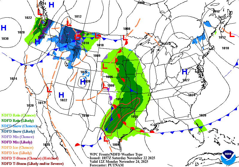
Forecast map for Monday.
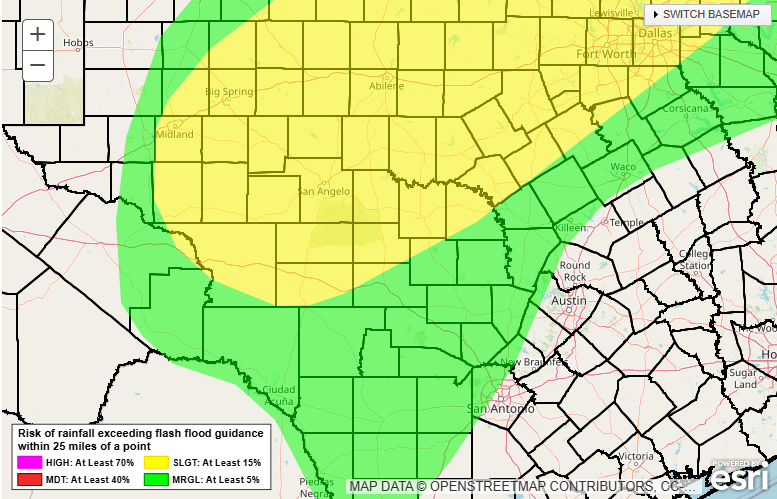
Best odds for excessive rain will be in the yellow zone on late Sunday and Monday.
Excessive rain forecast for Monday-Tuesday morning.

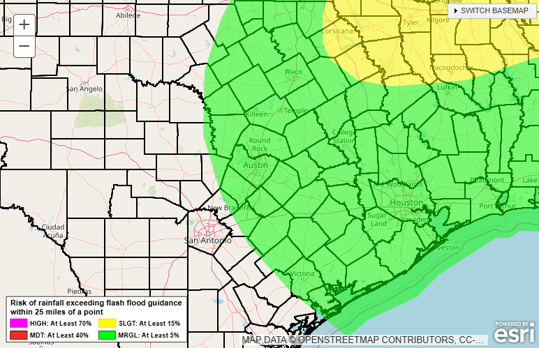
There will be a chance for severe storms on Monday, mainly in the yellow zone.
How much rain the latest models think will fall from today through Monday. Click on images to see them larger.


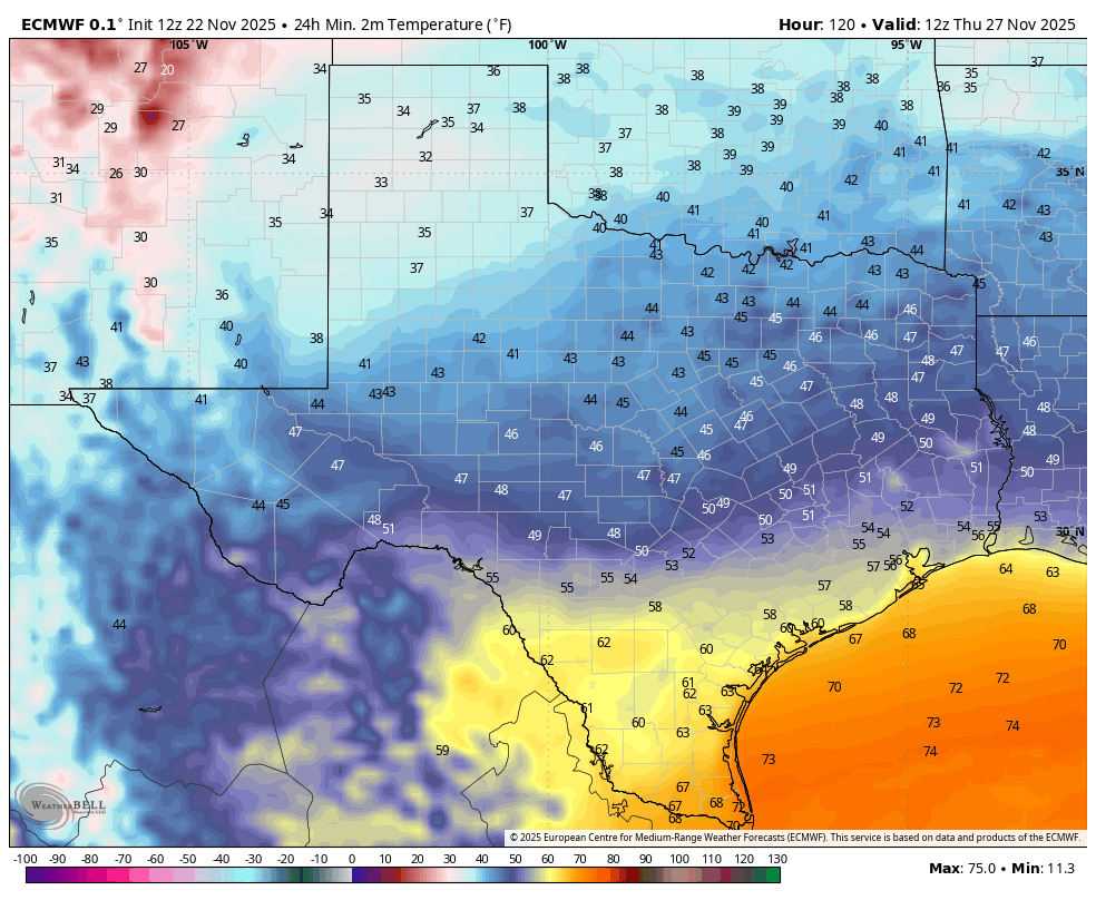
Forecast lows for Thanksgiving Day.
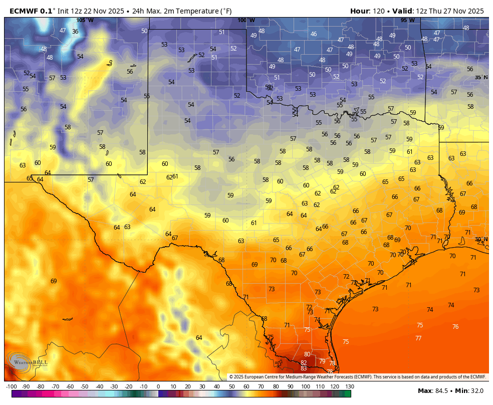
Forecast highs for Thanksgiving Day.
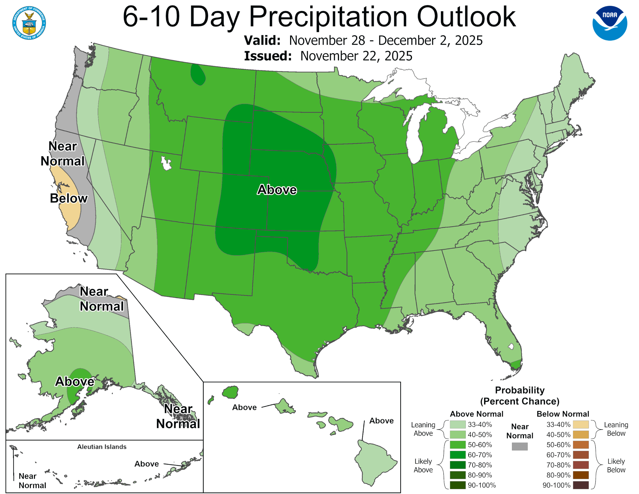
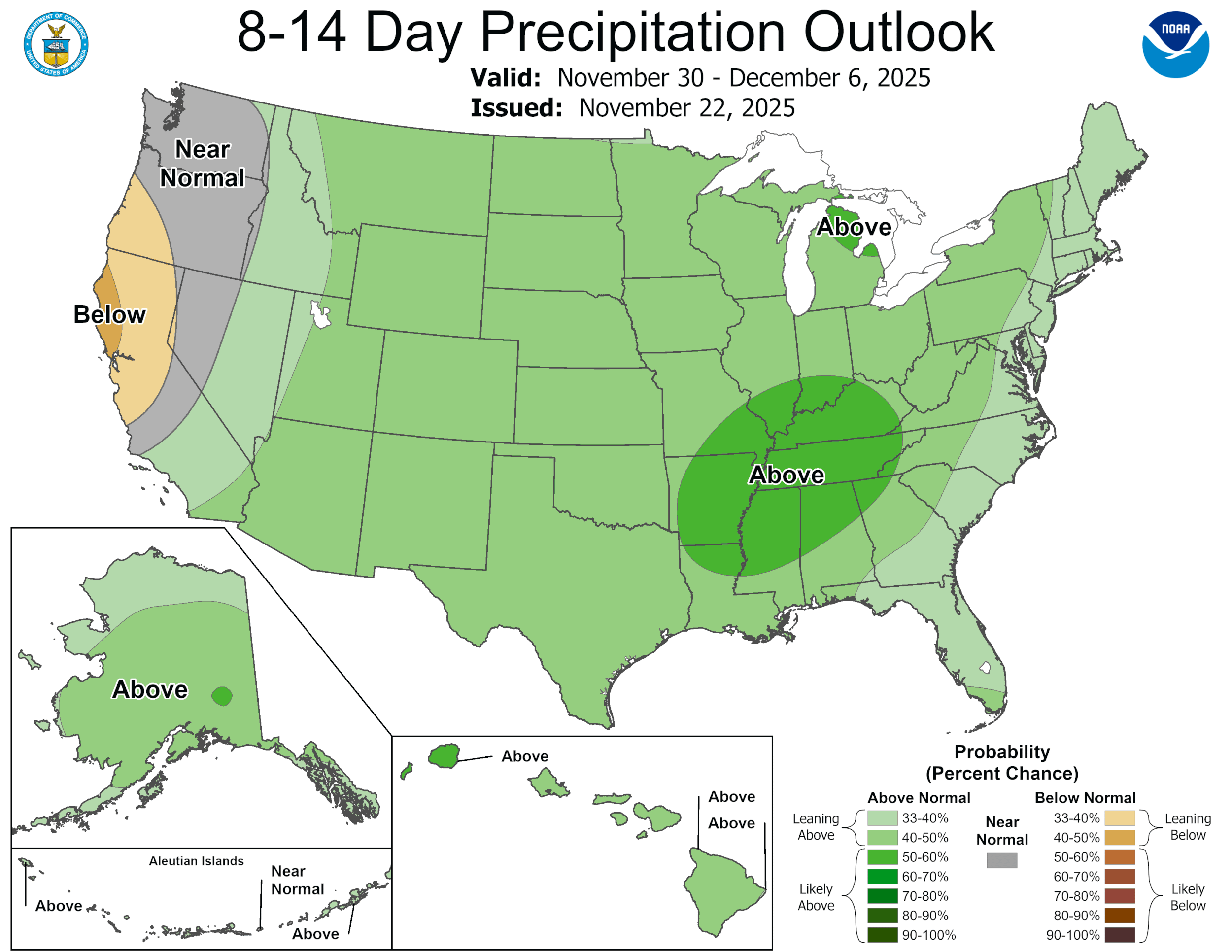
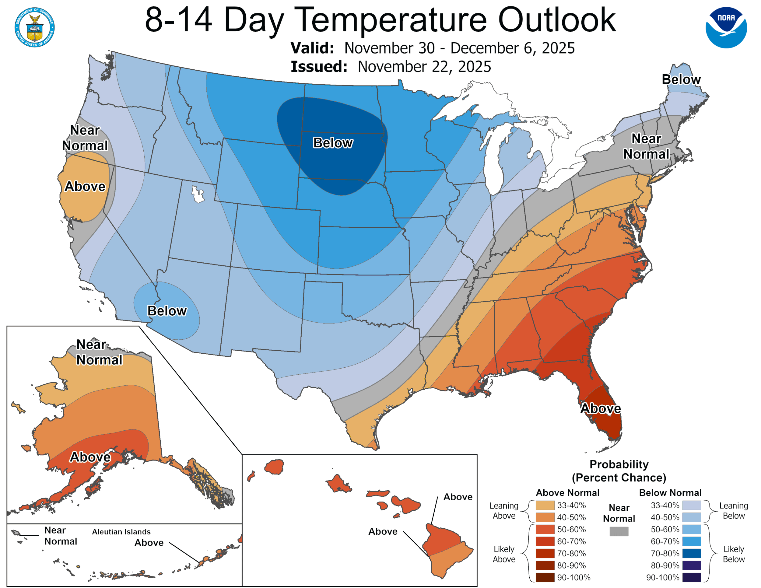
The latest CPC outlooks. Click on images to see them larger.