Chance for severe storms Sunday evening.
5-9-26. 3:15pm. This update is brought to you by Dietz Mclean Optical Company. www.dmoptical.com As a family-owned business, our independence, in house lab, great customer service and eyewear warranties, allows us to tailor your eyeglasses, lenses, and fittings: we want you to only expect the best after working with us. With six conveniently located optical shops in San Antonio, Boerne, Marble Falls and Temple, it’s easy to love what you see.
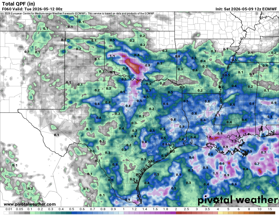
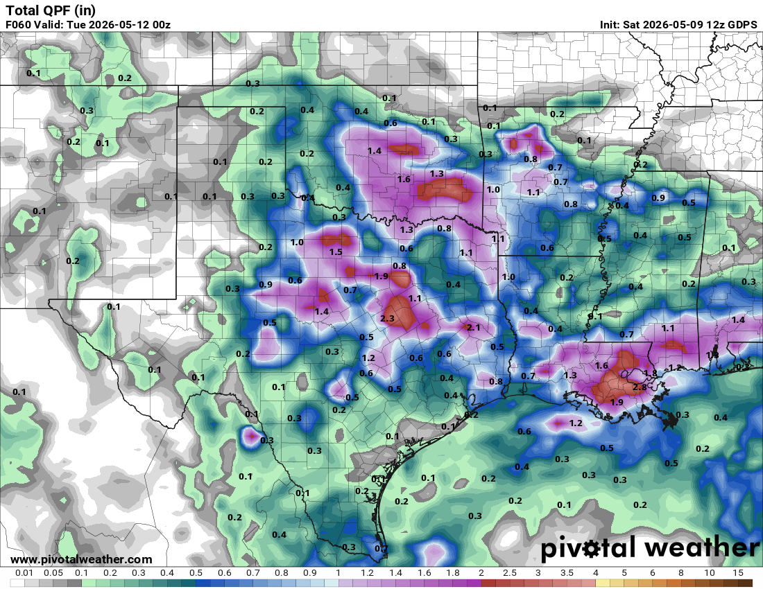
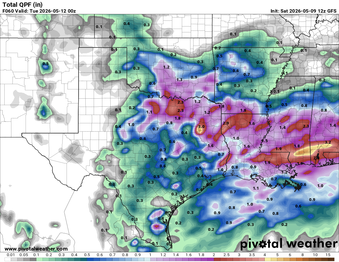
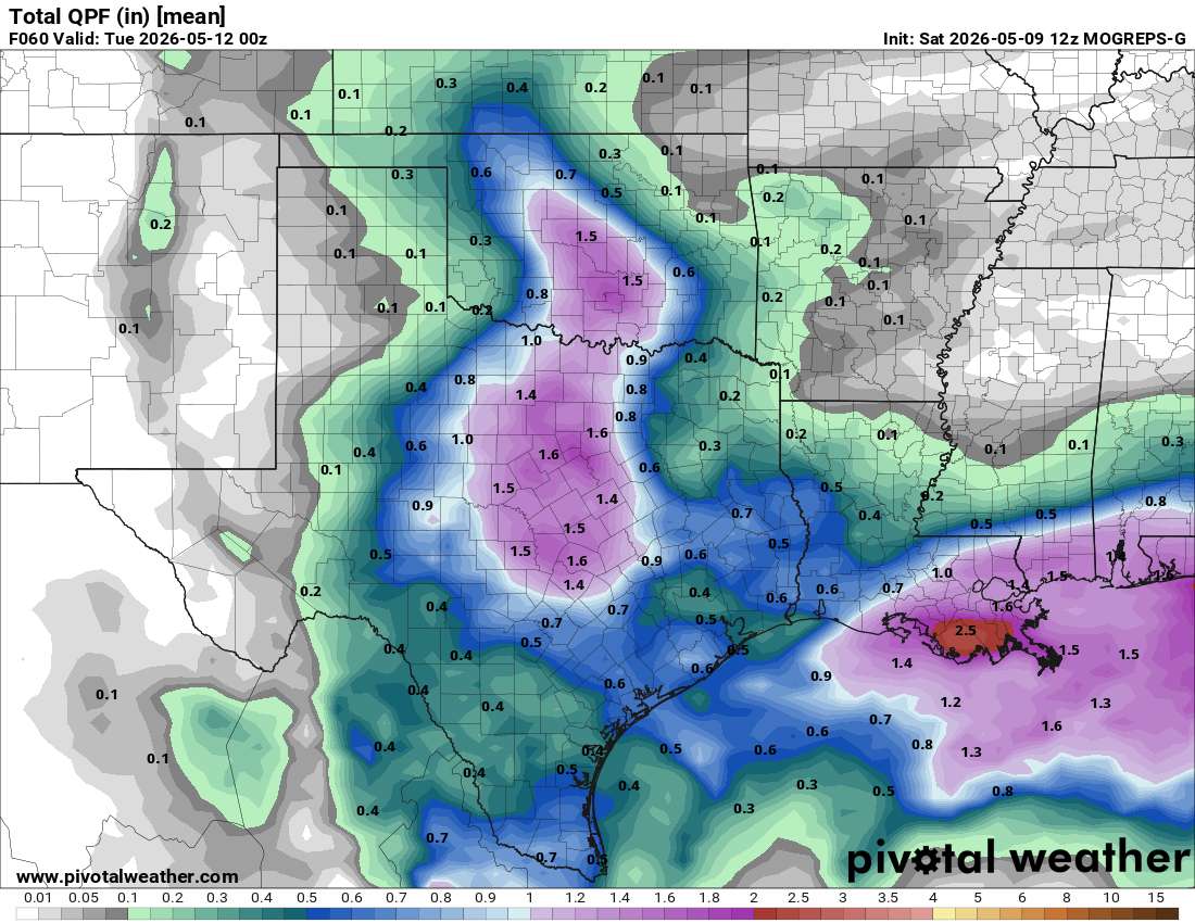
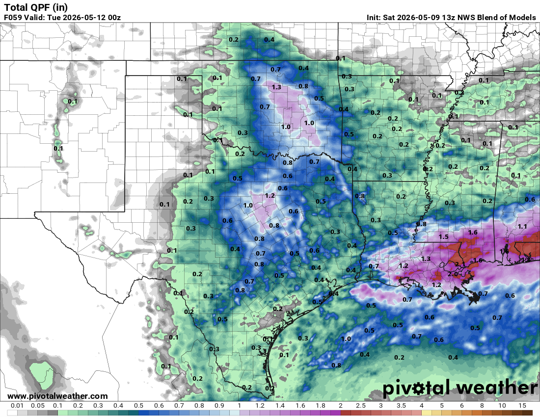
Except for some locations in deep south Texas, our upper-level low was quite a disappointment for most of us, with rainfall totals generally under a tenth of an inch. We will try again tomorrow afternoon and evening as a cold front moves through, giving south-central Texas a good chance for some severe storms.
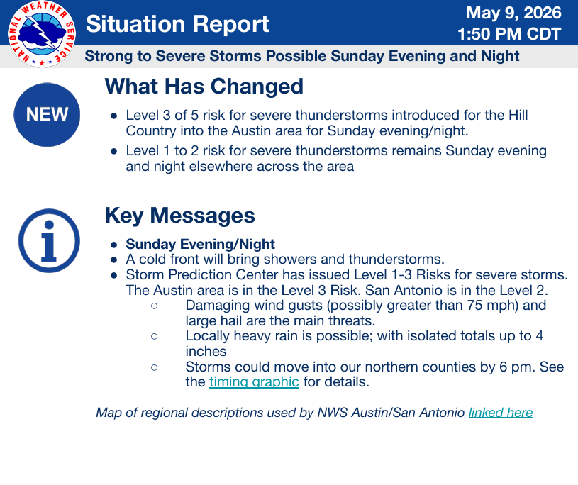
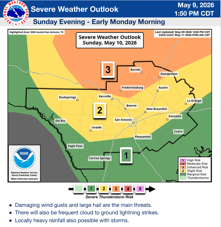
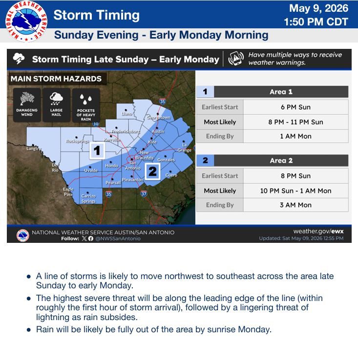
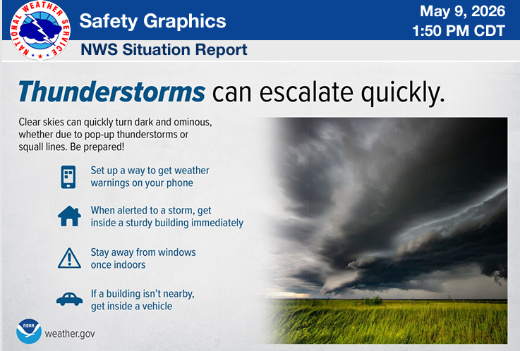
From the NWS: “A cold front will bring showers and thunderstorms Sunday evening and night. The Storm Prediction Center has issued Level 1-3 Risks for severe storms. The Austin area is in the Level 3 Risk. San Antonio is in the Level 2. Damaging wind gusts (possibly greater than 75 mph) and large hail are the main threats. Locally heavy rain is possible with isolated totals up to 4 inches. Storms could move into our northern counties by 6 pm.”
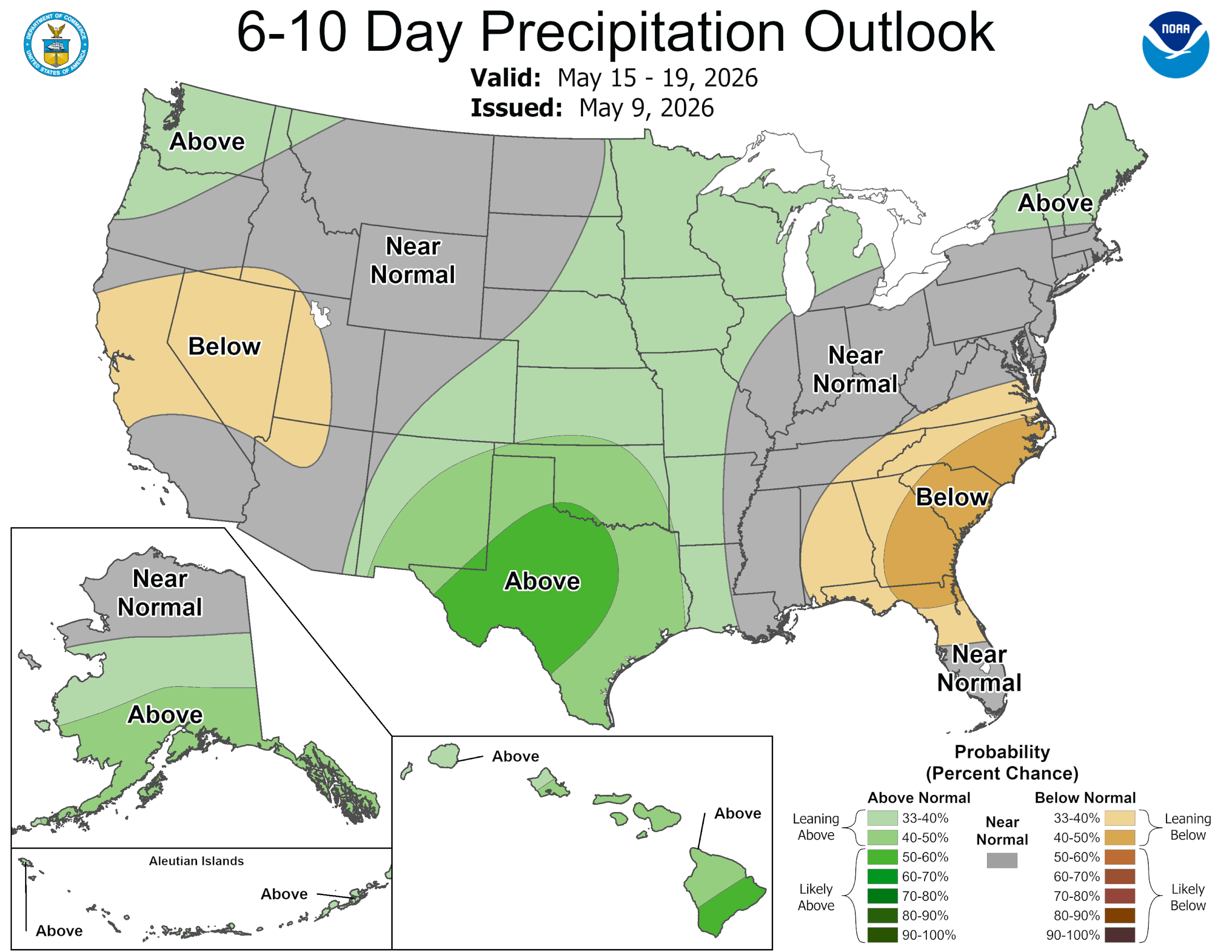
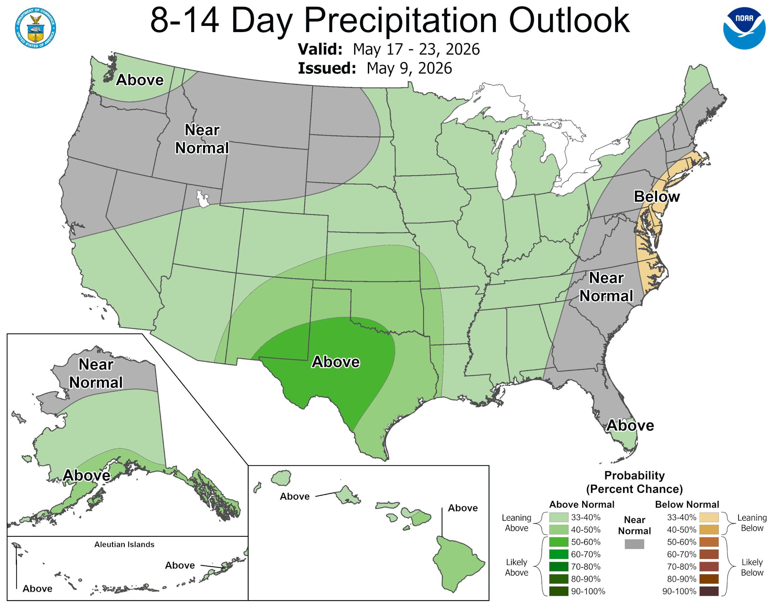
After the storms on Sunday night and early Monday morning, we will dry out for the rest of the week. The latest CPC outlooks continue to give us better than 50-50 odds for above normal precipitation through the 23rd.
Mark

This update is brought to you by Dietz Mclean Optical Company. www.dmoptical.comAs a family-owned business, our independence, in house lab, great customer service and eyewear warranties, allows us to tailor your eyeglasses, lenses, and fittings: we want you to only expect the best after working with us. With six conveniently located optical shops in San Antonio, Boerne, Marble Falls and Temple, it’s easy to love what you see.
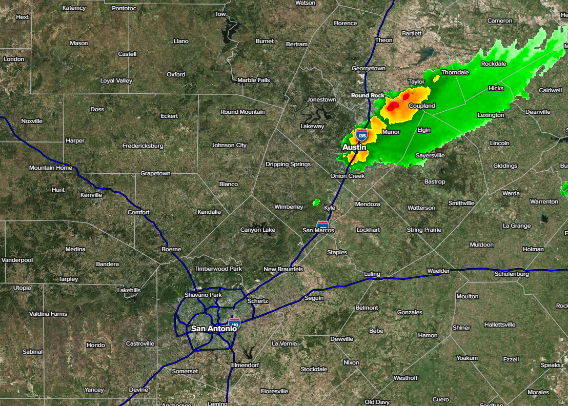
2:45pm radar update...some hail has been reported in the Austin area from this storm.
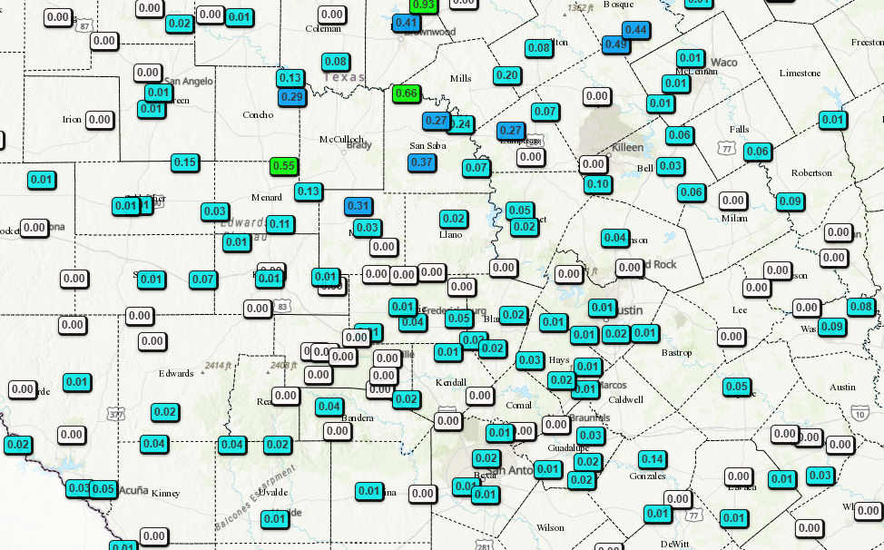
48hr rainfall totals so far.
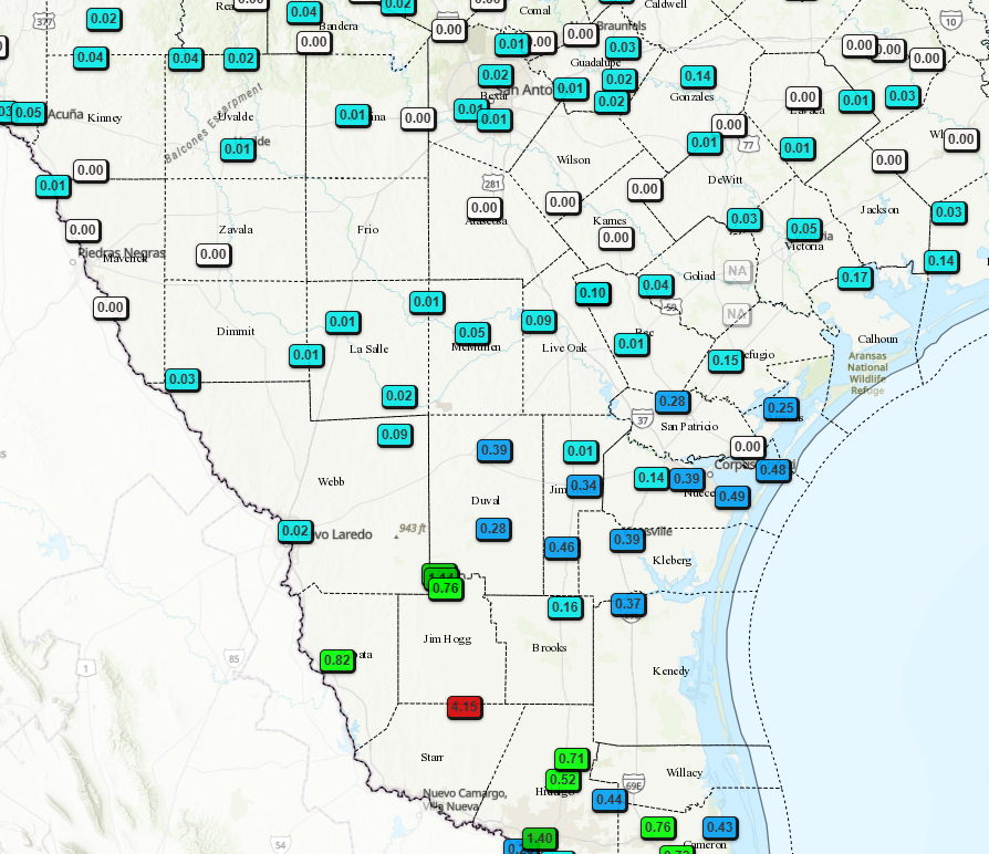
48hr rainfall totals so far.
NWS Severe Weather threat update. Click on images to see them larger.
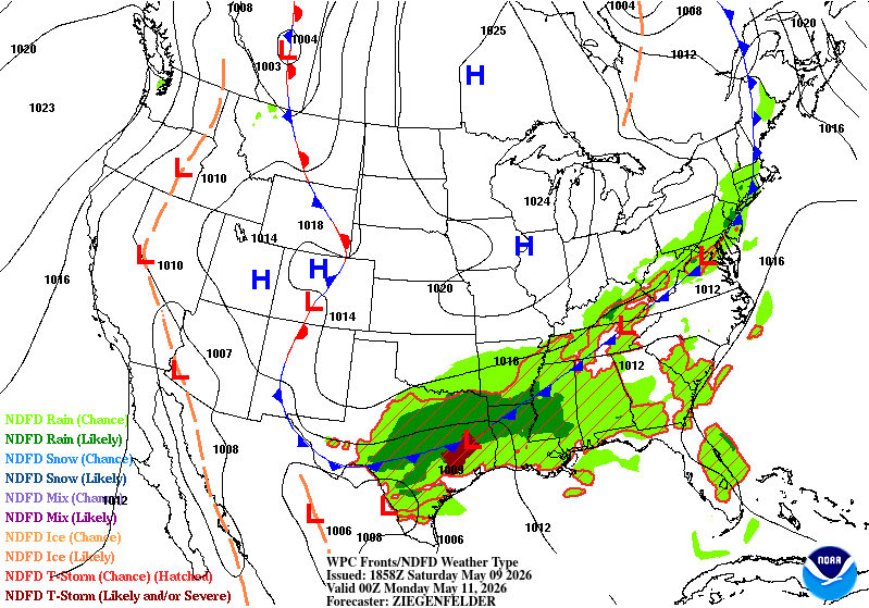
Surface map forecast for Sunday afternoon.
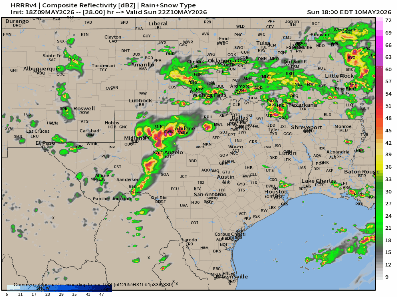
How the HRRR model thinks our radar will look like late tomorrow afternoon through Monday morning.
How much rain the latest models think will fall between today and Monday morning. Click on images to see them larger.