El Niño update…
8-14-26. 2pm. This update is brought to you by Dietz Mclean Optical Company. www.dmoptical.com As a family-owned business, our independence, in house lab, great customer service and eyewear warranties, allows us to tailor your eyeglasses, lenses, and fittings: we want you to only expect the best after working with us. With six conveniently located optical shops in San Antonio, Boerne, Marble Falls and Temple, it’s easy to love what you see.
Before we dive into an El Niño update, there is an inverted trough along the coast that will usher in some wildly scattered sea breeze storms this afternoon. In fact, some of these storms are showing up on radar and moving NW. By tomorrow, we are back to hot and humid conditions with almost zero odds for rain over the next 7days. Beyond that, there may be a chance for rain towards the end of the month. The two tropical waves in the Atlantic are still out there, but one will be going poof soon and the other may also go poof by next week due to wind shear (typical with an El Niño pattern).
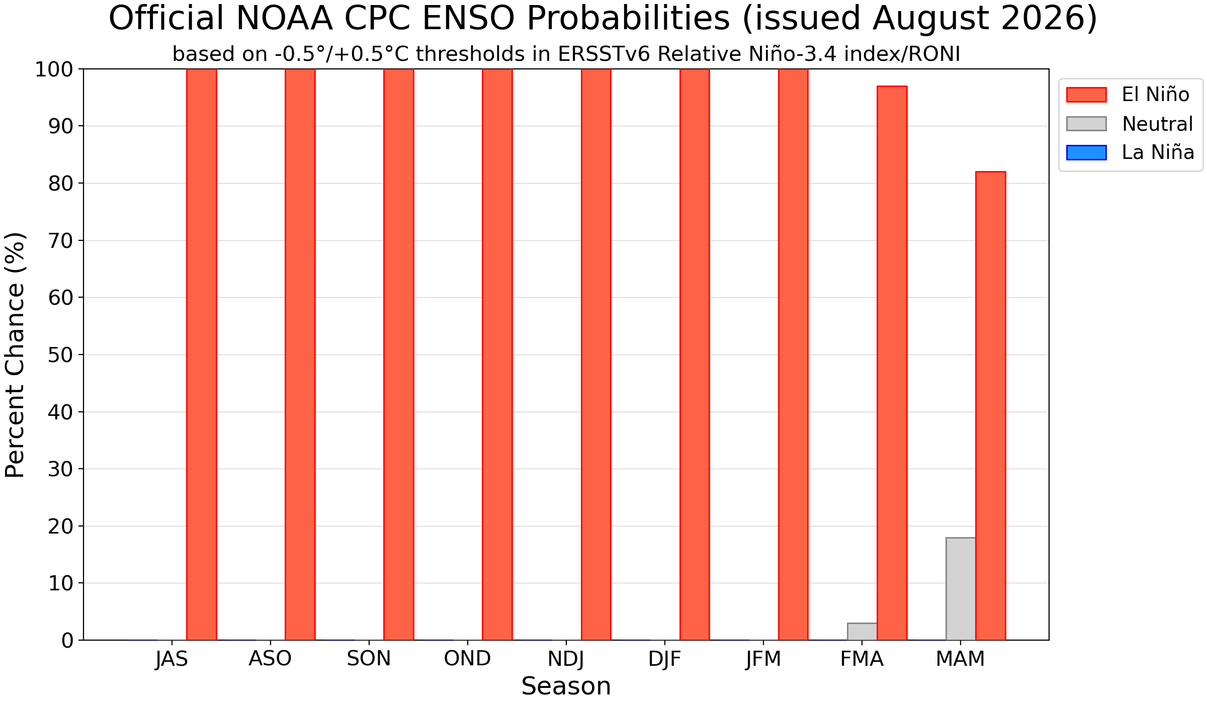
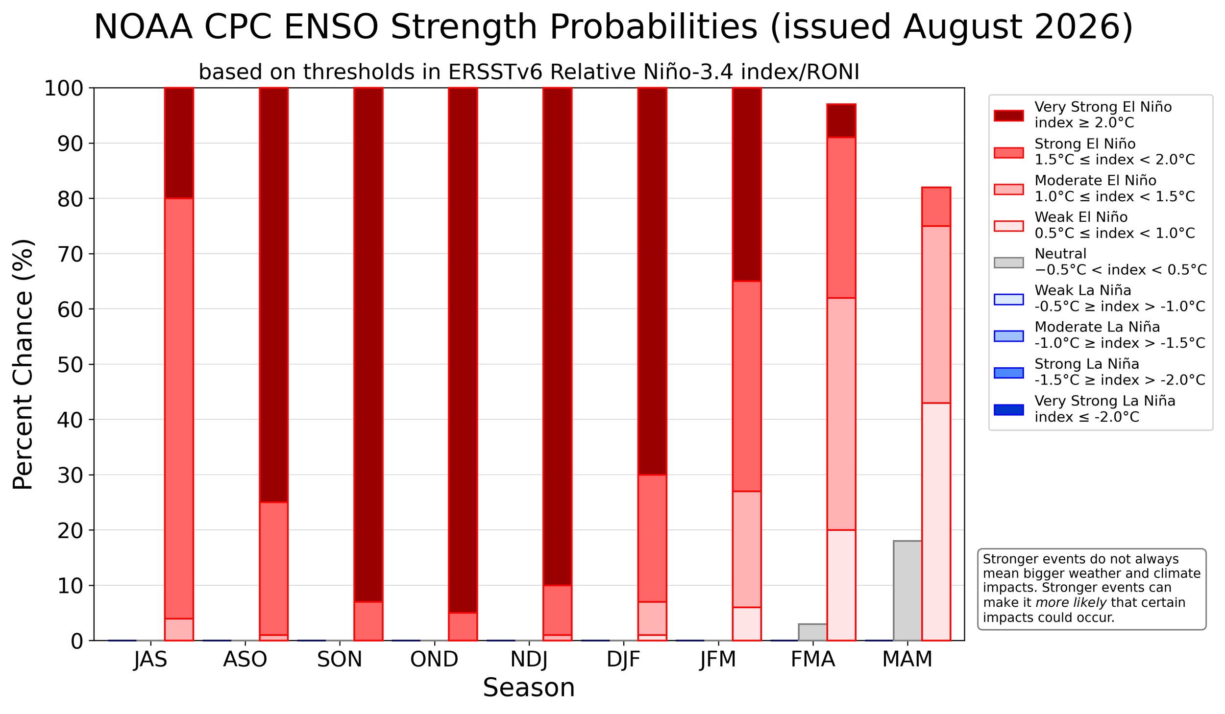
Speaking of El Niño pattern, below are the latest graphics from the CPC. Here’s what the CPC is saying: “Synopsis: El Niño is strengthening, with a greater than 90% chance of a very strong event during the Northern Hemisphere fall and winter 2026-27. El Niño strengthened over the past month, with sea surface temperature anomalies exceeding +2.0C in the eastern equatorial Pacific. During the October-December 2026 season, there is a 69% chance of a historic event that would exceed the strength of previous El Niño events dating back to 1950. With an event of this magnitude, the chances of experiencing impacts consistent with El Niño are larger, but they are not guaranteed.”
Mark
This update is brought to you by Dietz Mclean Optical Company. www.dmoptical.com As a family-owned business, our independence, in house lab, great customer service and eyewear warranties, allows us to tailor your eyeglasses, lenses, and fittings: we want you to only expect the best after working with us. With six conveniently located optical shops in San Antonio, Boerne, Marble Falls and Temple, it’s easy to love what you see.
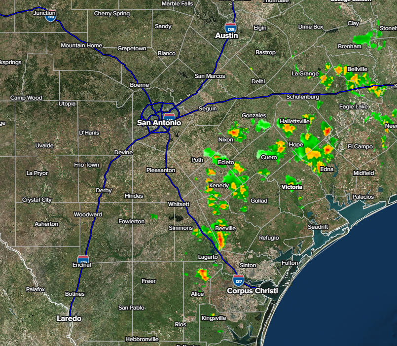
Post time radar.
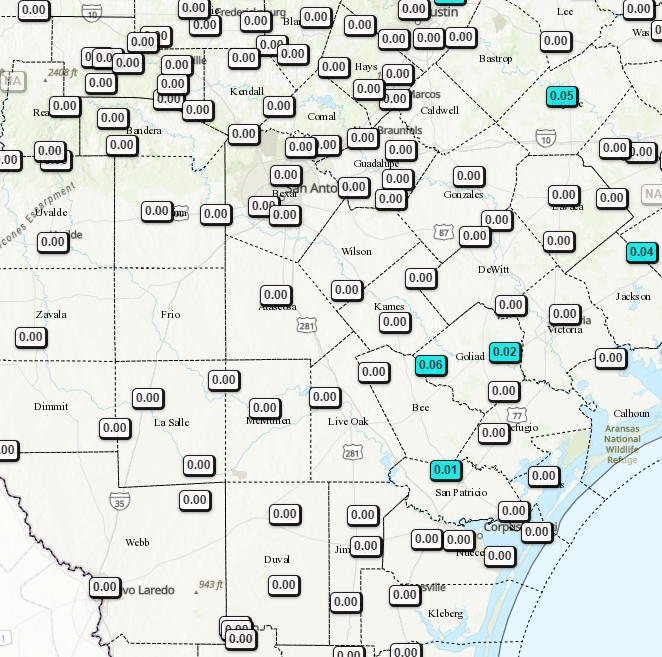
24hr rainfall totals so far.
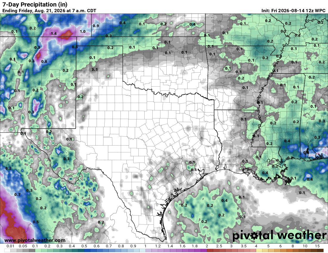
7day rainfall forecast.
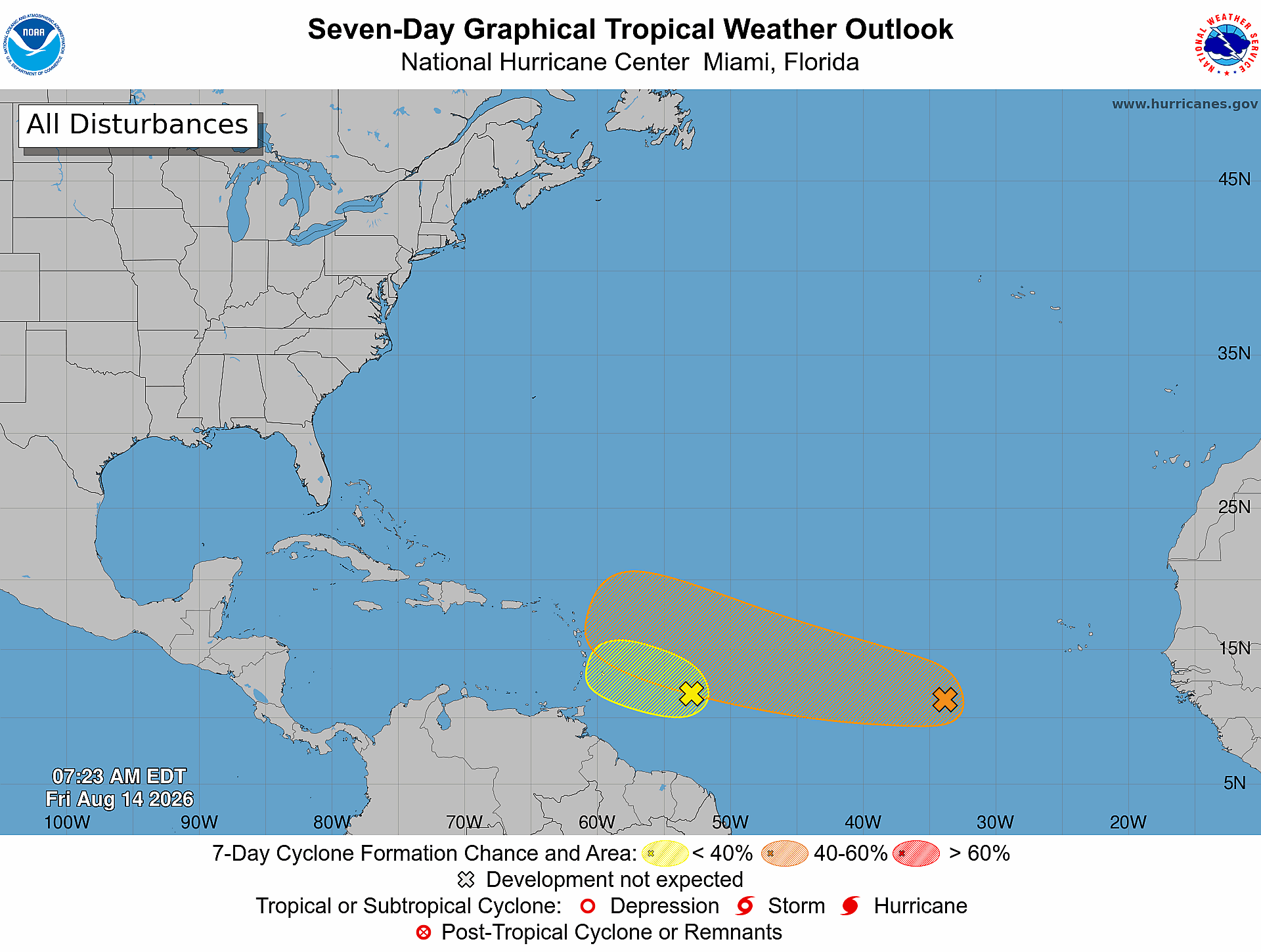
1. Central Tropical Atlantic (AL92):
A tropical wave located about 350 miles east of the Windward Islands
is producing gusty winds and a large area of showers and
thunderstorms. This system is moving into a region of increasing
upper-level winds and dry air, and the potential of development
continues to decrease. Even though development is highly unlikely,
strong gusty winds and areas of heavy rain are possible across
portions of the Lesser Antilles tonight and on Saturday.
* Formation chance through 48 hours...low...10 percent.
* Formation chance through 7 days...low...10 percent.
2. Eastern Tropical Atlantic (AL94):
A tropical wave over the central tropical Atlantic, located more
than 1000 miles west of the Cabo Verde Islands, continues to produce
disorganized showers and thunderstorms. While environmental
conditions are conducive for some development over the next few
days, the system could encounter strong upper-level winds next week,
decreasing its chances for development.
* Formation chance through 48 hours...low...30 percent.
* Formation chance through 7 days...medium...40 percent.