One more day of tropical poppers!
7-27-25. 3pm This Update is brought to you by Davy Ranch Supply. We have an extensive supply of fencing materials including barbed and netting wire, t-posts, cedar and treated posts, brace and twist pipe, staples, clips, and welded panels. We also stock 7 different types of medium and heavy-duty gates ranging in length from 4 ft-20 ft. We sell galvanized portable panels and 24 ft free-standing pipe panels, too. We have concrete and poly water troughs in various sizes along with a selection bunk and hay feeders. www.davyranchsupply.com
More tropical pm poppers are showing up on radar this afternoon as our inverted trough continues to spark activity even though the trough is now in Mexico. 2:30pm radar shows some pretty hefty scattered storms near Seguin, Nixon and Kennedy. Earlier, some cells went through Bexar county as well. We should continue to see more scattered showers and thunderstorms form throughout the afternoon, winding down around sunset.
Drier air moves in tomorrow and we should be mainly rain free through Thursday. By Friday, yet another inverted trough will move through the Gulf, bringing back a chance for scattered storms for a couple of days. As of post time, most of the rain is forecast to stay to our east.
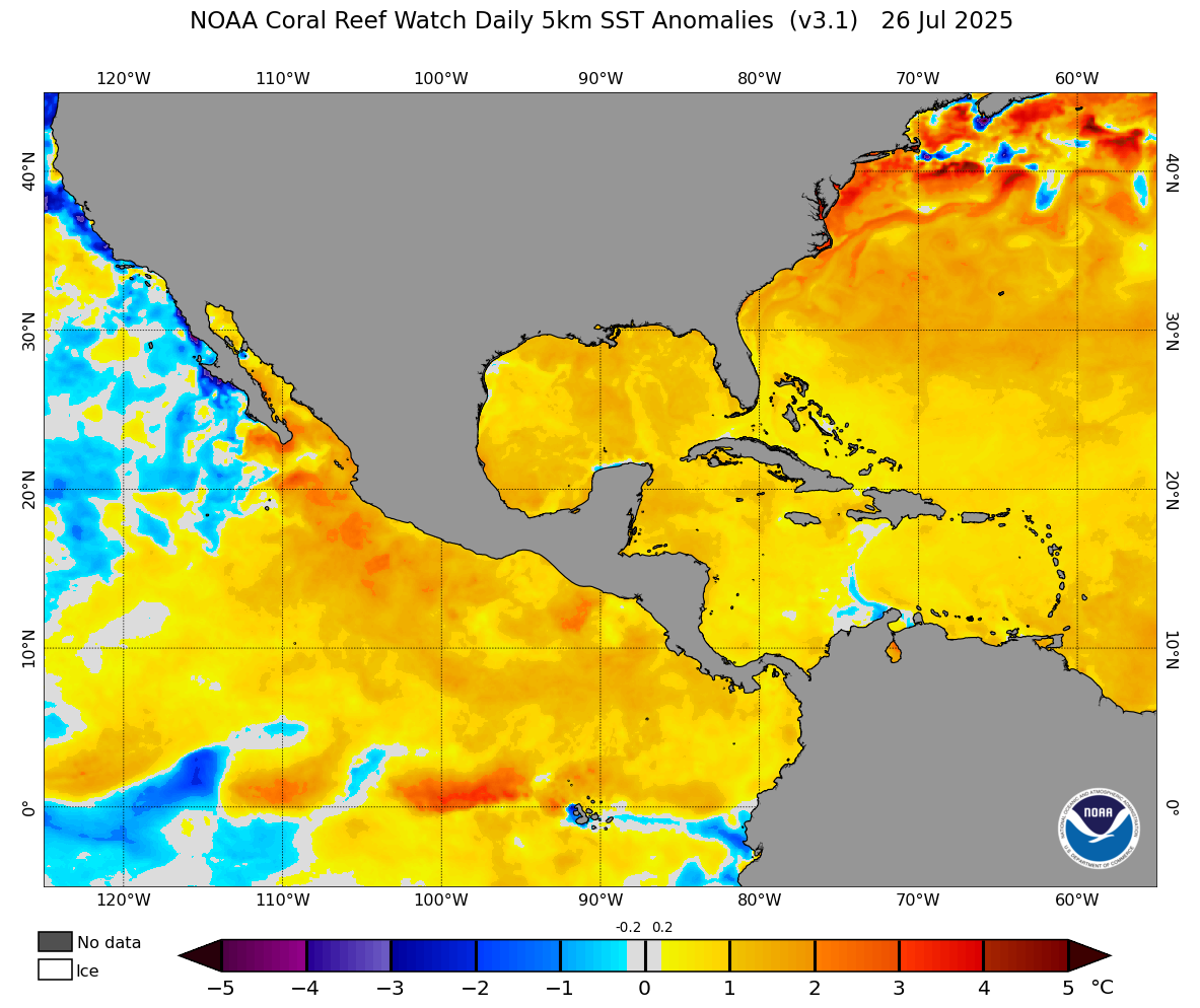
Even though nothing is forecast to develop in the tropics over the next 7 days, there is an article from USA Today on the 24th, indicating that August could get busy: "The tropical environment should become more conducive for Atlantic hurricane activity in the next few weeks," said Colorado State University meteorologist Phil Klotzbach in a July 24 email to USA TODAY.” Here is a link to the story: Hurricane season 2025 is about to heat up, forecast says See surface temperatures are currently running above normal in the Gulf and Atlantic.
Mark

2:30pm radar.

24hr rainfall totals from Texmesonet.org

Excessive rainfall forecast for today.

7day rainfall forecast from the NWS.