Scattered storms Thursday-Friday.
8-26-26. 9:45am. This update is brought to you by Dietz Mclean Optical Company. www.dmoptical.com As a family-owned business, our independence, in house lab, great customer service and eyewear warranties, allows us to tailor your eyeglasses, lenses, and fittings: we want you to only expect the best after working with us. With six conveniently located optical shops in San Antonio, Boerne, Marble Falls and Temple, it’s easy to love what you see.
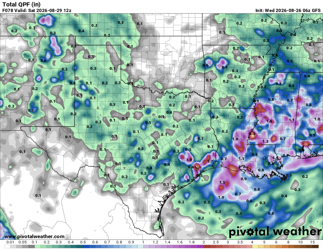
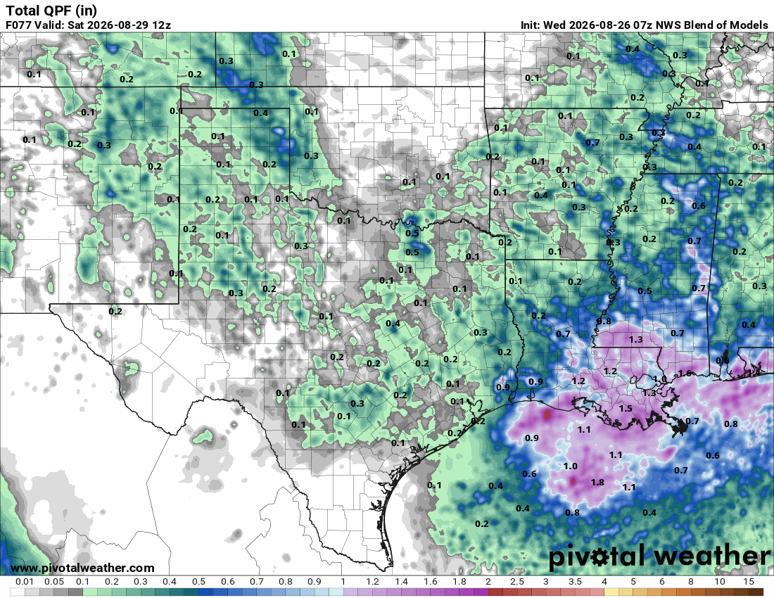
I’ll be out of town this afternoon, but here’s a quick update on our rain chances for Thursday-Friday. As I have mentioned, our Hell High will drift to our NW for a couple of days, allowing for a couple of disturbances to move down from north Texas along with a cool front that should go poof in the Hill Country. From the NWS: “A few disturbances may develop and move south into the area with the highest rain chances beginning Thursday afternoon as a front slowly moves towards the area. Moisture and peak heating will likely allow for some shower and thunderstorm development near this feature, though we are not expecting widespread rain across the area. Any convection that does manage to develop will likely be high-based and would pose a gusty wind threat in any of the stronger cells.”
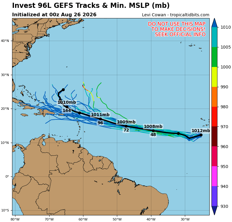
96L in the Atlantic is now looking less likely to become a tropical something…another victim of wind sheer!
Mark

This update is brought to you by Dietz Mclean Optical Company. www.dmoptical.com As a family-owned business, our independence, in house lab, great customer service and eyewear warranties, allows us to tailor your eyeglasses, lenses, and fittings: we want you to only expect the best after working with us. With six conveniently located optical shops in San Antonio, Boerne, Marble Falls and Temple, it’s easy to love what you see.
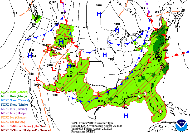
A dying cool front will sag into the Hill Country tomorrow, boosting rain chances for Thursday and Friday.
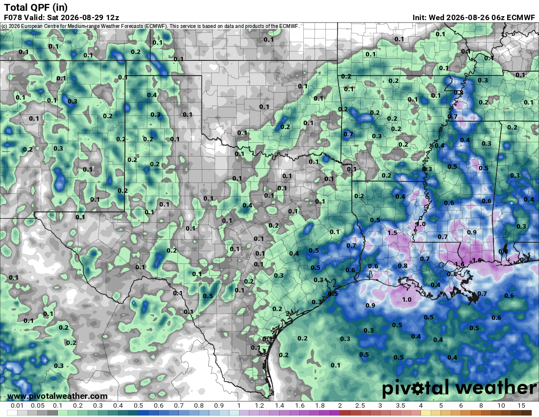
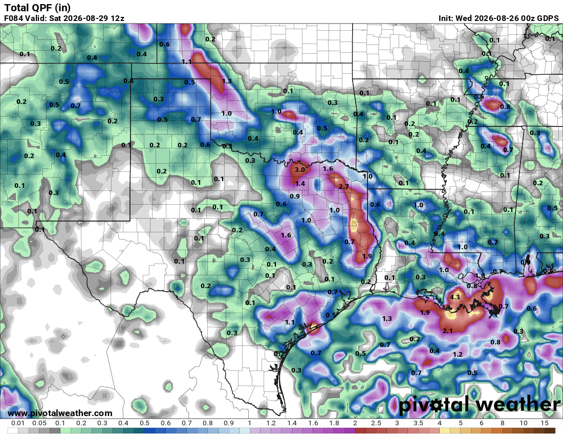
How much rain the latest models think will fall Thursday-Friday. Click on images to see them larger.
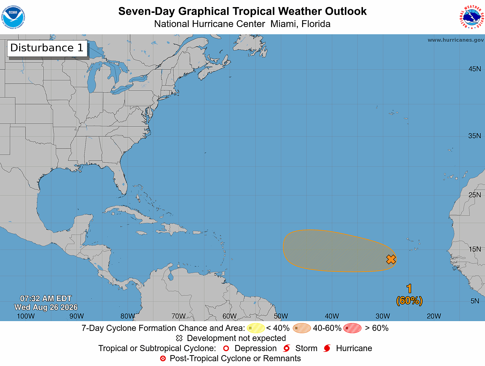
Eastern Tropical Atlantic (AL96):
An area of low pressure, associated with a tropical wave, is
located a few hundred miles southwest of the Cabo Verde Islands.
Showers and thunderstorms associated with this system remain
disorganized. Environmental conditions are somewhat favorable for
development over the next couple of days, and a tropical depression
could form over the next day or two as the system moves westward to
west-northwestward across the eastern and central tropical Atlantic.
Environmental conditions are forecast to become less favorable by
this weekend, potentially ending its chances for development.
* Formation chance through 48 hours...medium...60 percent.
* Formation chance through 7 days...medium...60 percent