High moving out, rain moving in!
8-17-25. 3:45pm. August and September are perfect months to get a quote from our sponsor since it takes only one tropical storm to potentially take our your power for days! This Update is brought to you by Synergy Standby Solutions. Synergy Standby Solutions is a trusted provider of sales, maintenance, repairs, and fueling services for standby generators in South Central Texas. We specialize in ensuring your backup power systems remain reliable and fully operational, giving you peace of mind during power outages. With a commitment to excellence and customer satisfaction, our expert team is ready to handle all your generator needs. Learn more at www.synergystandby.com.
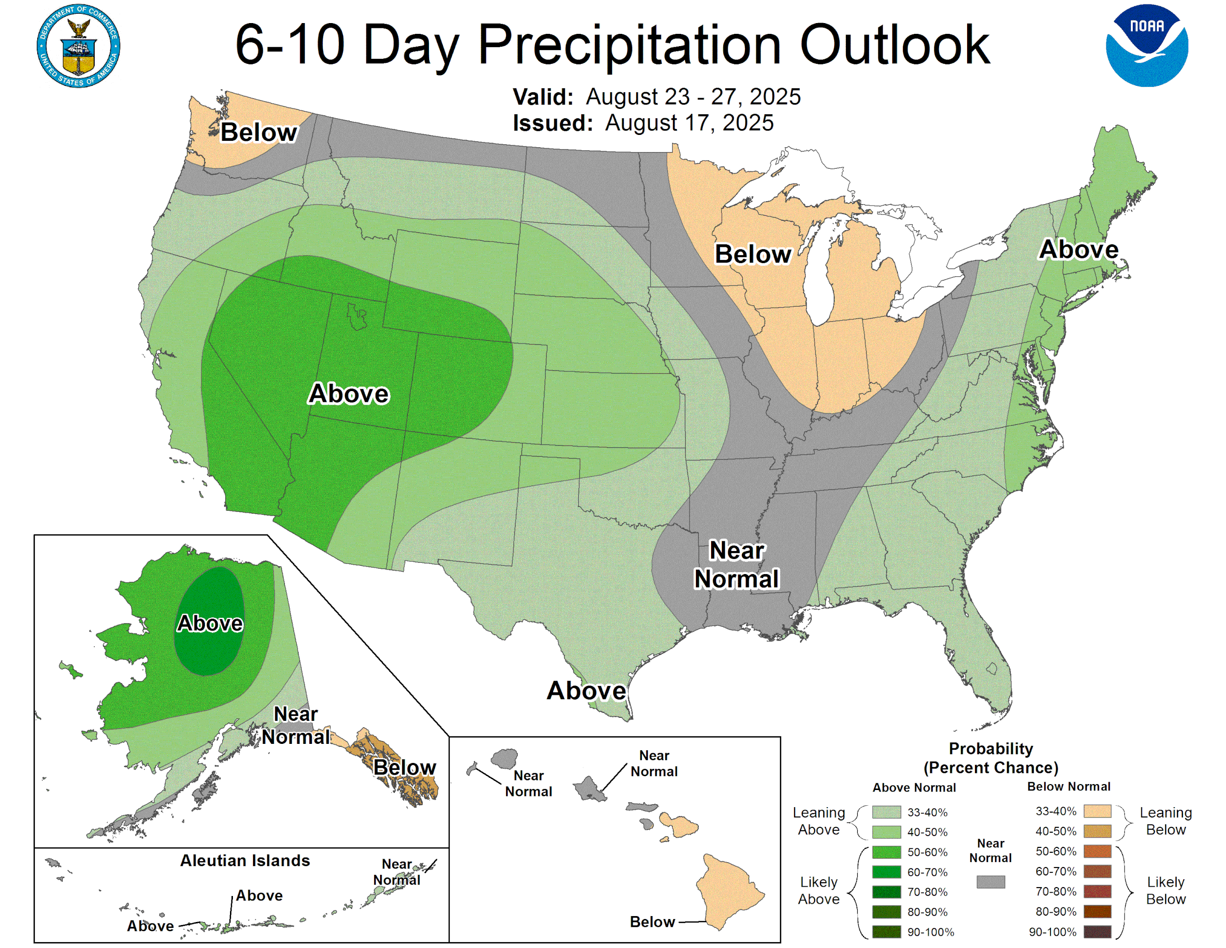
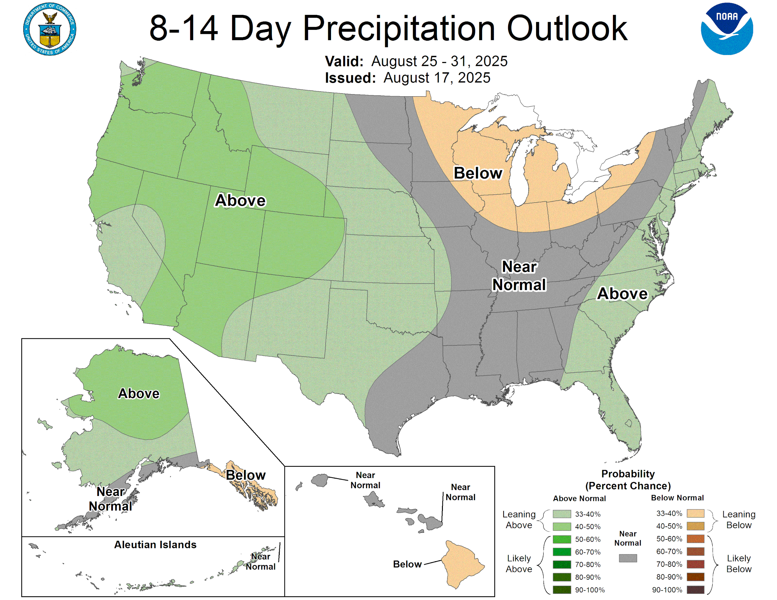
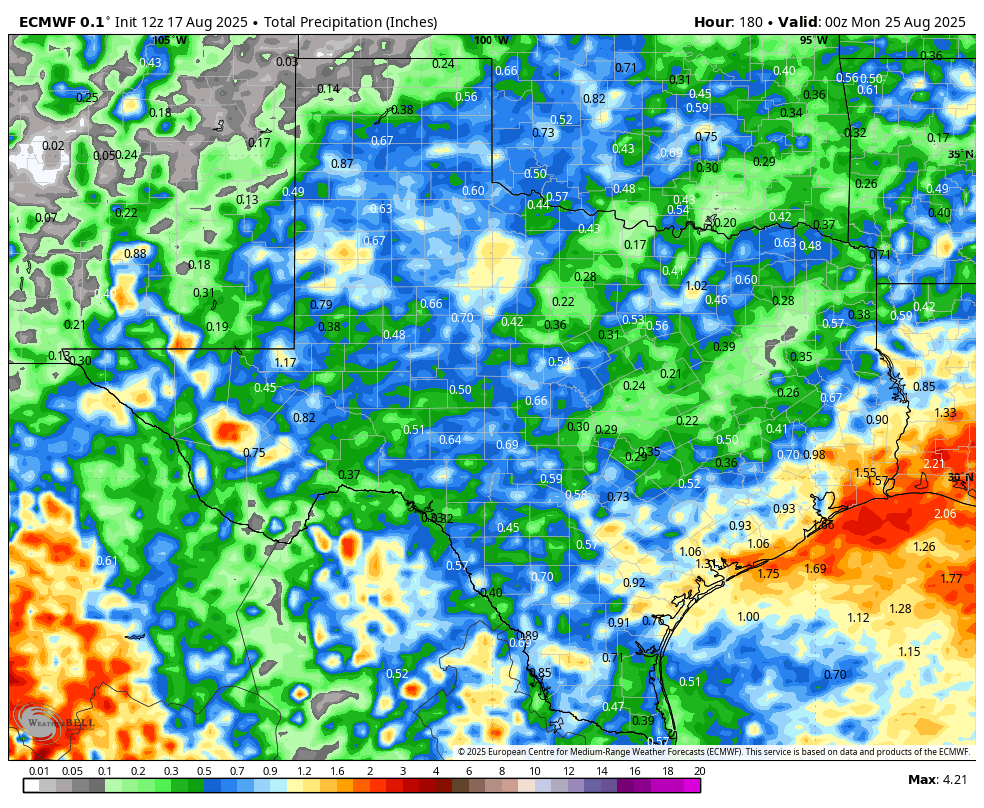
Hot and muggy out there today with most locations seeing a heat index of 100 or more degrees as of 3pm. High pressure will move to our west, centering itself over the four corners by Tuesday. This will allow sea breeze storms to form in the afternoon and not get squished by the evil high! On Thursday, a dying cool front will move into our area, bolstering our rain odds even more, through the weekend. As I mentioned yesterday, this will not be a drought breaker, but most of the models are forecasting 1/2 to an inch for most locations from Tuesday-Sunday. If you want more rain than that, root for the Canadian model, which is forecasting 2-4 inches of rain for many of us!
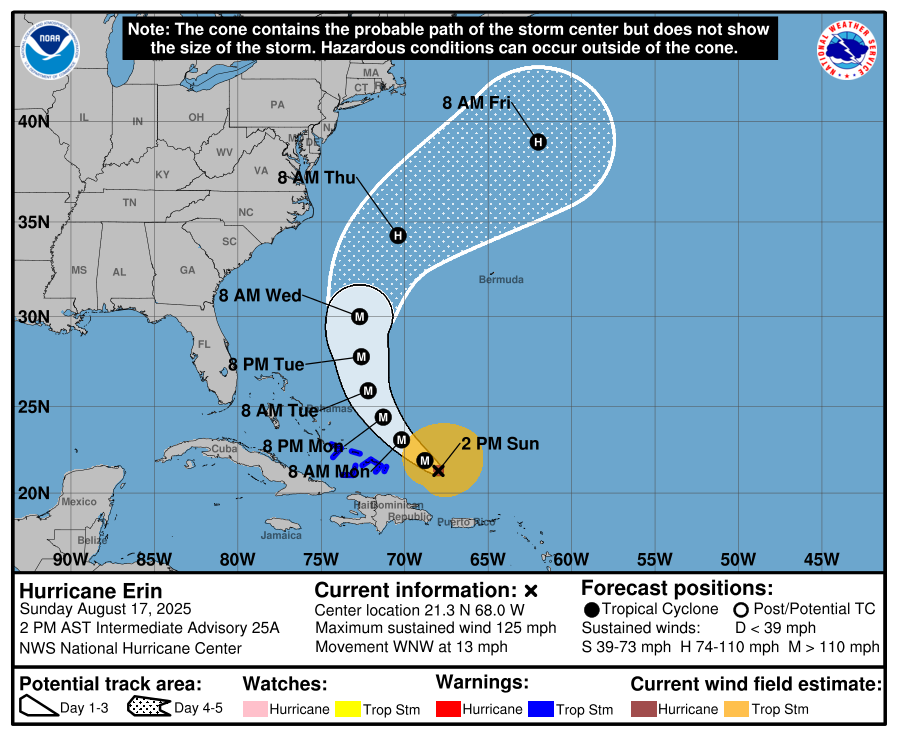
As far as the tropics go, Hurricane Erin lost a little strength over the past 24hrs and is now a cat 3 storm with sustained winds of 125mph, but is expected to gain some strength over the next couple of days as it moves NW. There is a tropical wave off the coast of Africa that has a 30% chance of becoming a depression over the next week. The GFS model continues to think it might become a hurricane in the Gulf in the next 10 days, but for now, none of the other models agree, so let’s not worry about it for now.
Mark

August and September are perfect months to get a quote from our sponsor since it takes only one tropical storm to potentially take our your power for days! This Update is brought to you by Synergy Standby Solutions. Synergy Standby Solutions is a trusted provider of sales, maintenance, repairs, and fueling services for standby generators in South Central Texas. We specialize in ensuring your backup power systems remain reliable and fully operational, giving you peace of mind during power outages. With a commitment to excellence and customer satisfaction, our expert team is ready to handle all your generator needs. Learn more at www.synergystandby.com.

3pm heat index temps!
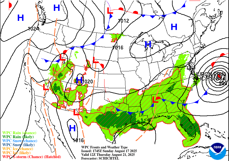
High pressure will move NW into the four corners, allowing daily pm poppers to form and possibly a cool front by Thursday to impact our weather.
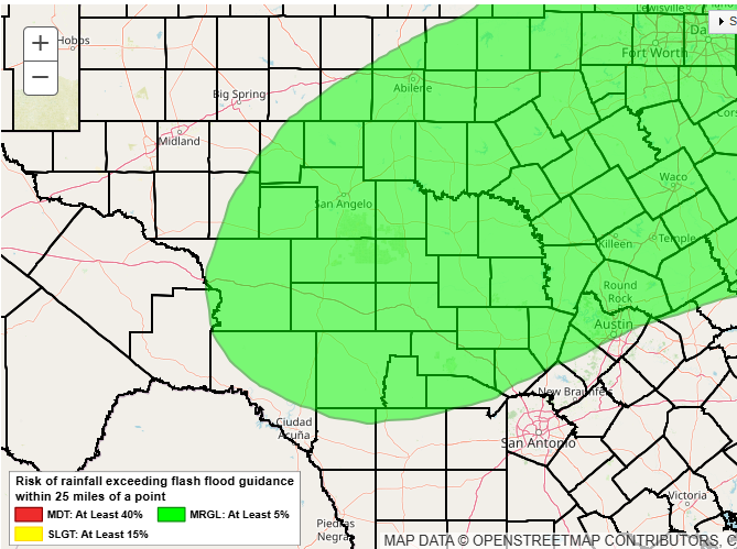
Excessive rain is possible in the green counties on Wednesday-Thursday.
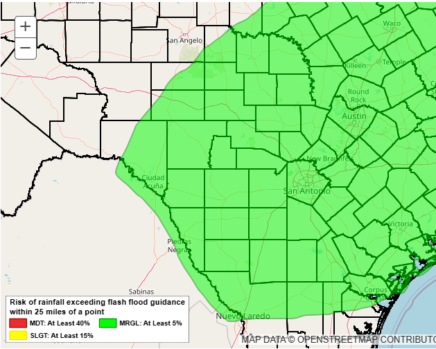
Excessive rain is possible in the green counties on Thursday-Friday.
How much rain the latest models think will fall from Monday-Sunday. Click on images to see them larger.


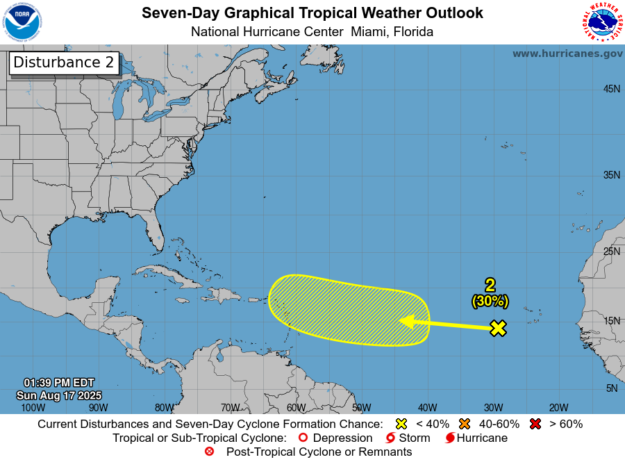
A tropical something may form in this area over the next week.