Flooding is possible for some areas over the next 36hrs…
9-6-25. 2:45pm. September and October are perfect months to get a quote from our sponsor since it takes only one bad storm to potentially take our your power for days! This Update is brought to you by Synergy Standby Solutions. Synergy Standby Solutions is a trusted provider of sales, maintenance, repairs, and fueling services for standby generators in South Central Texas. We specialize in ensuring your backup power systems remain reliable and fully operational, giving you peace of mind during power outages. With a commitment to excellence and customer satisfaction, our expert team is ready to handle all your generator needs. Learn more at www.synergystandby.com.
A stationary front over the Hill Country, Pacific moisture in the mid-levels of the atmosphere and lots of Gulf moisture are combining to form some hefty cells this afternoon. As of post time, we have already seen rainfall totals over 2 inches in Gillespie and Blanco counties. The radar will continue to be active over the next 36hrs, with excessive rain a possibility for anyone in south-central and south Texas. As is almost always the case with convective systems, there will also be some of you who get very little rain through Monday.
Here’s what the NWS is saying about this system: “Today's rains are likely to concentrate over the Hill Country, portions of the I-35 corridor including Austin and San Antonio metros, southern Edwards Plateau, Rio Grande, and coastal plains areas. Highest rainfall amounts of 1 to 3 inches are possible. Isolated amounts up to 5 inches can't be ruled out. Showers and storms return on Sunday as the frontal boundary remains across the coastal plains and a few upper level perturbations push across the local area. There is the chance for locally heavy rain and localized flooding especially across parts of the Hill Country, southern Edwards Plateau, Rio Grande, and coastal plains. New rainfall amounts of 1 to 2 inches are possible with higher amounts.”
As always, please tune to your local NOAA radio or emergency apps for warnings!
Please keep us posted if you find any rain in your gauge today and tomorrow...and don't forget to share your location.
Mark

September and October are perfect months to get a quote from our sponsor since it takes only one bad storm to potentially take our your power for days! This Update is brought to you by Synergy Standby Solutions. Synergy Standby Solutions is a trusted provider of sales, maintenance, repairs, and fueling services for standby generators in South Central Texas. We specialize in ensuring your backup power systems remain reliable and fully operational, giving you peace of mind during power outages. With a commitment to excellence and customer satisfaction, our expert team is ready to handle all your generator needs. Learn more at www.synergystandby.com.

2:30pm radar.

A stationary front will drift slowly south over the next 24hrs, then go "poof" over south Texas by Monday.

Water vapor imagery shows Pacific moisture moving in from Mexico into the mid levels of the atmosphere.

Rainfall totals so far today.

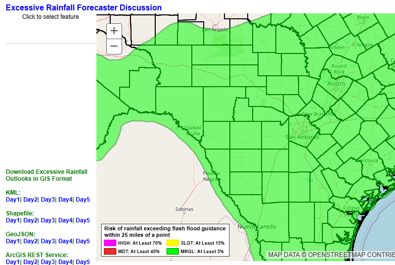
Excessive rainfall forecast for today.
Excessive rainfall forecast for Sunday-Monday morning.
How much rain the latest models think will fall from today through Monday. Click on images to see them larger.


Our system in the tropics is looking wimpy.
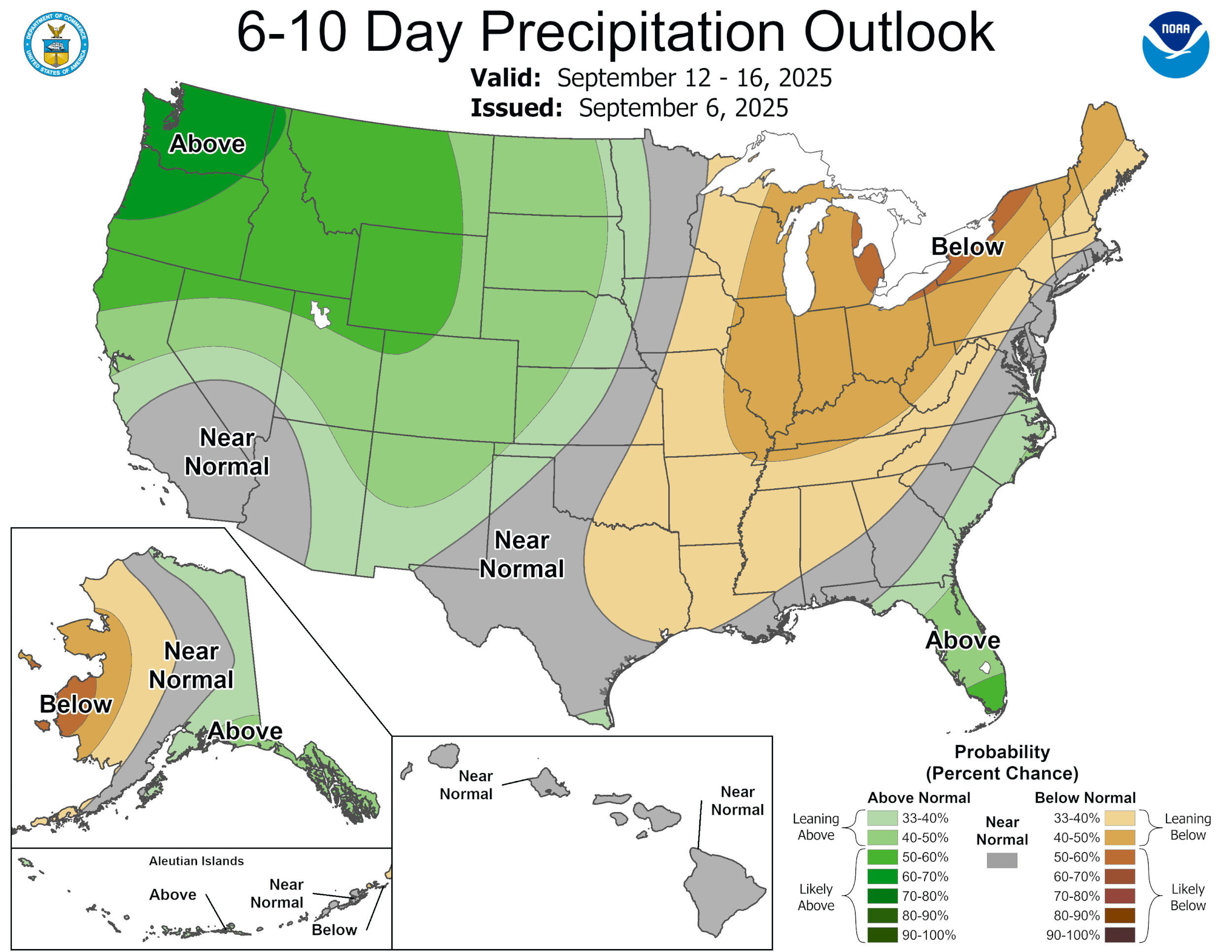
The latest CPC outlooks. Click on images to see them larger.