Arctic front and possibly a wintry mix this weekend!
1-19-26. 2:45pm This Update is brought to you by Dietz Mclean Optical Company. www.dmoptical.com As a family-owned business, our independence, in house lab, great customer service and eyewear warranties, allows us to tailor your eyeglasses, lenses, and fittings: we want you to only expect the best after working with us. With six conveniently located optical shops in San Antonio, Boerne, Marble Falls and Temple, it’s easy to love what you see.
Well, we’ve all been wanting to see a pattern change since November and now it looks like we are going to finally see a major one starting this week! Unfortunately, the weather gods like to go with major pattern changes all at once instead of a nice slow transition!
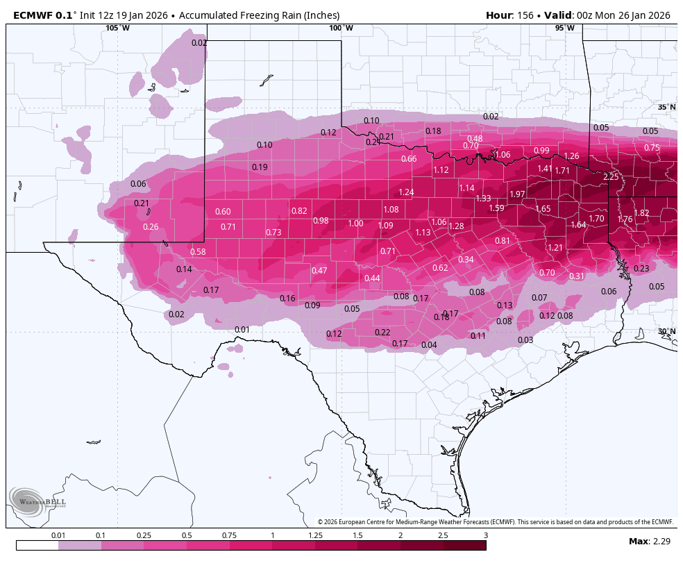
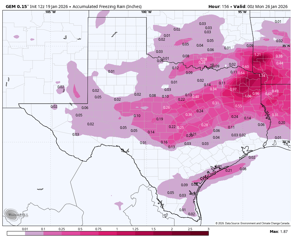
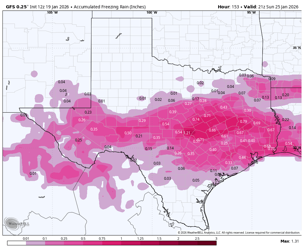
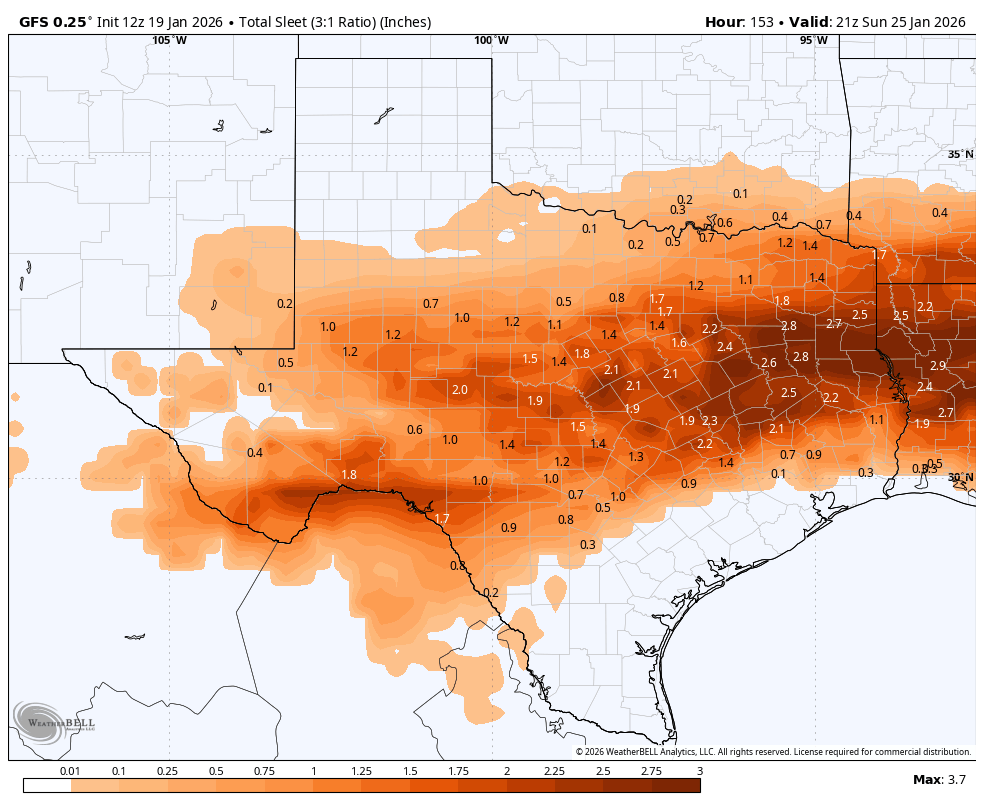
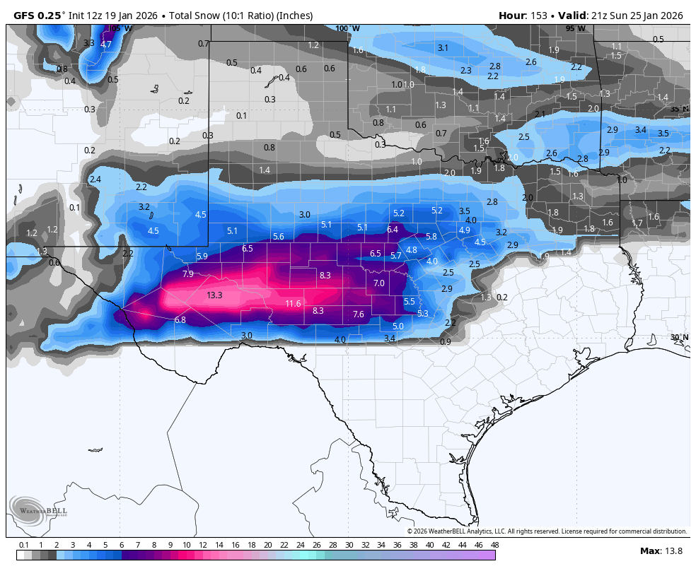
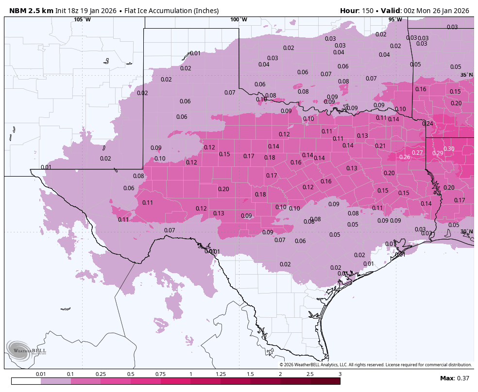
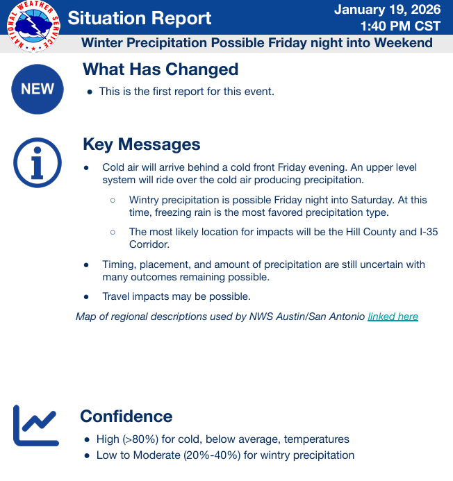
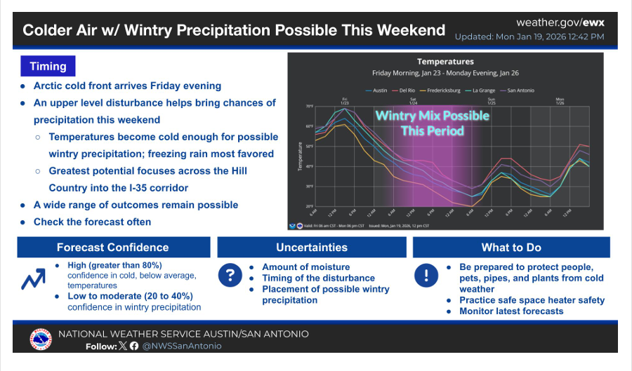
OK, not to frighten any of you, but if you live along and north or HWY 90 and I-10 east, I would start preparing for a good chance for ice, sleet and possibly snow this weekend. If you live south of that line, I’d still start doing some preparations for ice, just in case. As of post time, the models are forecasting an arctic front to roar through our area late on Friday, dropping temperatures 20-30 degrees within hours of the frontal passage. On Saturday, disturbances from the SW will start moving over our very cold air, initiating a combo of rain, freezing rain, sleet and snow, depending on your elevation and how far north you are within our area. While I would love to see only snow fall, (it’s easier to deal with than ice), ice will be the biggest threat since the arctic air will be very shallow and a likely inversion will take place as the moisture moves in from the SW from the Pacific. This means it will be warmer above the arctic air, with rain likely falling through the cold air. That scenario usually produces freezing rain…the most destructive of winter precipitation, since ice builds up on power lines and trees, causing power outages.
Temperatures will drop to below freezing for all of south-central Texas by early Saturday along with the northern counties of south Texas. We may rise above freezing by late on Sunday if the sun breaks out, but it is pretty likely many of us will stay below freezing for 24-36hrs.
Remember...we are still 4 days out on this event, so forecasts will likely be changing as we get closer!
In the short term, our potential rainmaker for this week, has almost gone poof, with most of us lucky to see a tenth of an inch from late Tuesday-Wednesday.
Mark

This Update is brought to you by Dietz Mclean Optical Company. www.dmoptical.com As a family-owned business, our independence, in house lab, great customer service and eyewear warranties, allows us to tailor your eyeglasses, lenses, and fittings: we want you to only expect the best after working with us. With six conveniently located optical shops in San Antonio, Boerne, Marble Falls and Temple, it’s easy to love what you see.
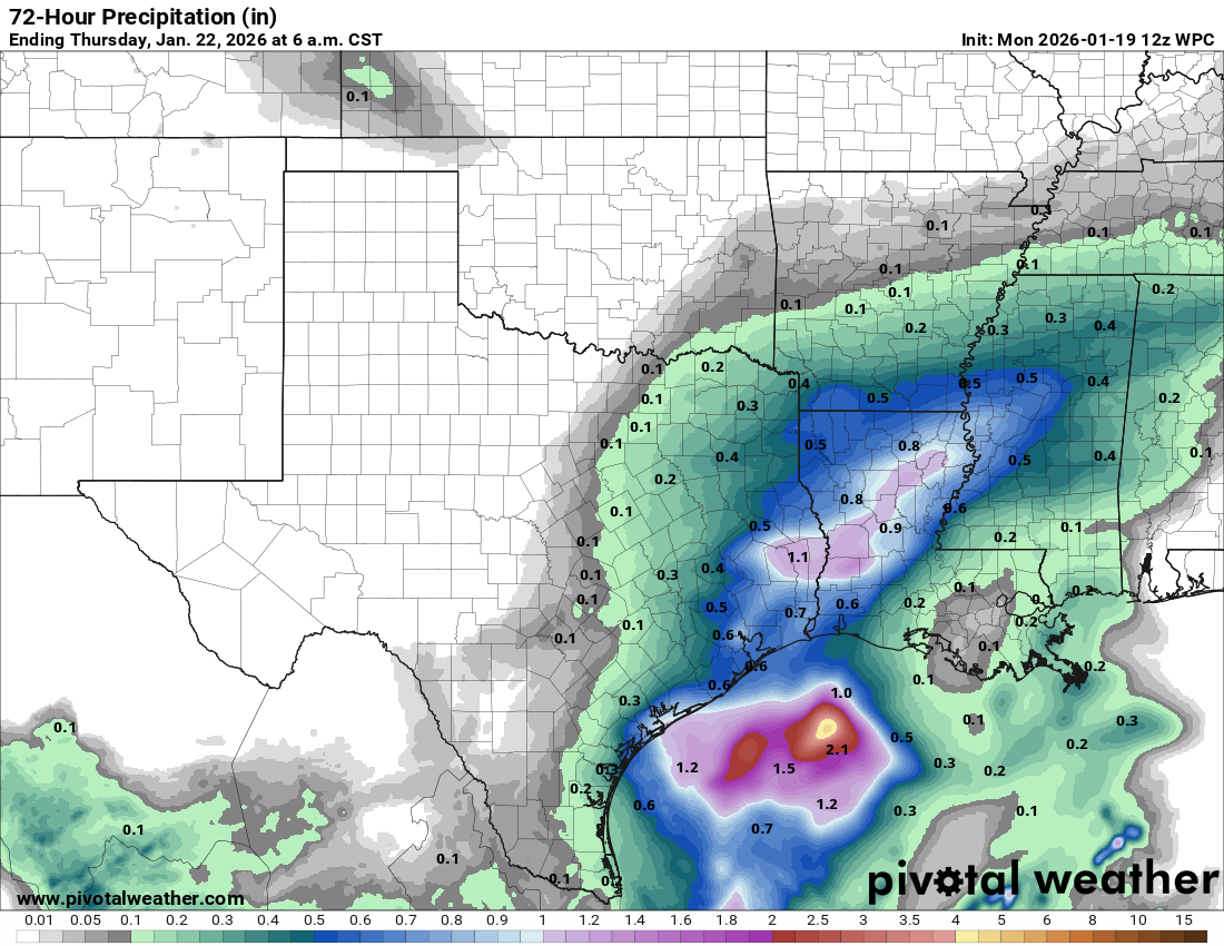
Rainfall forecast from late Tuesday-Wednesday.
Prepare! AI by Mark
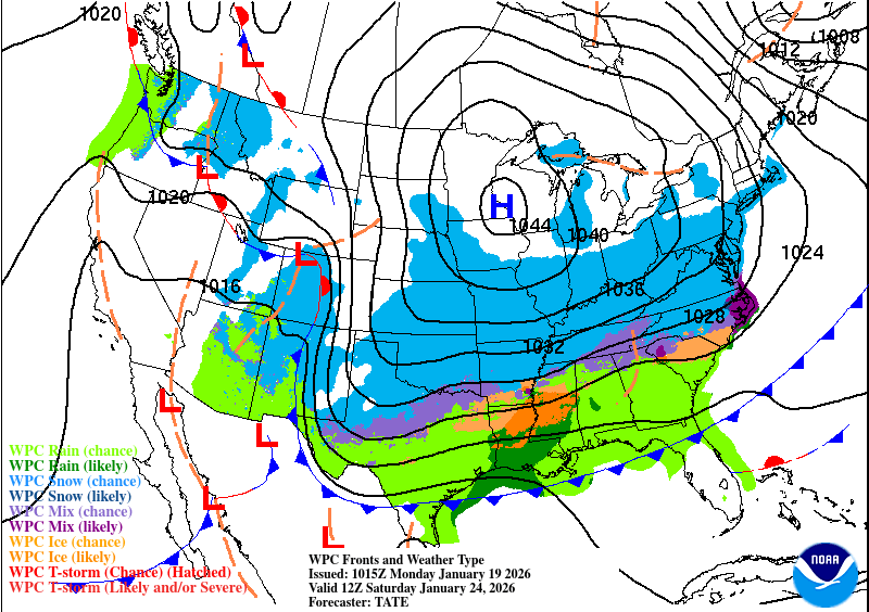
An Arctic front (thanks to the Polar Vortex) arrives late on Friday.
NWS Update on the arctic front. Click on images to see them larger.
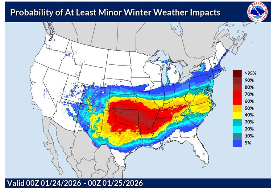
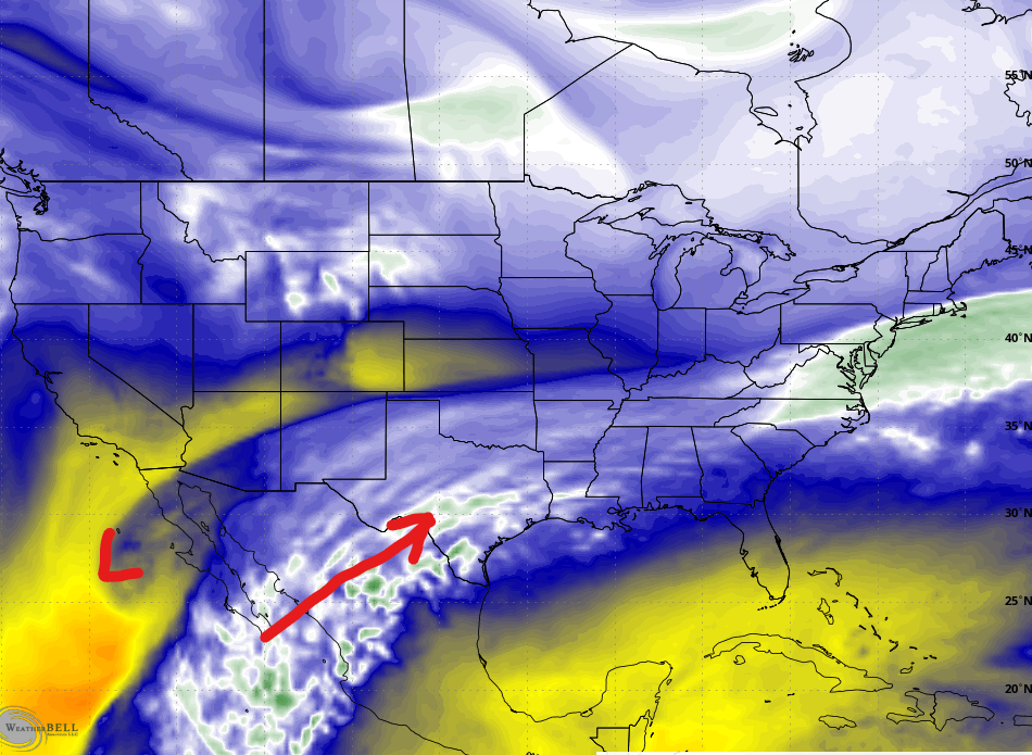
Moisture from the Pacific will start flowing into our area on Saturday.
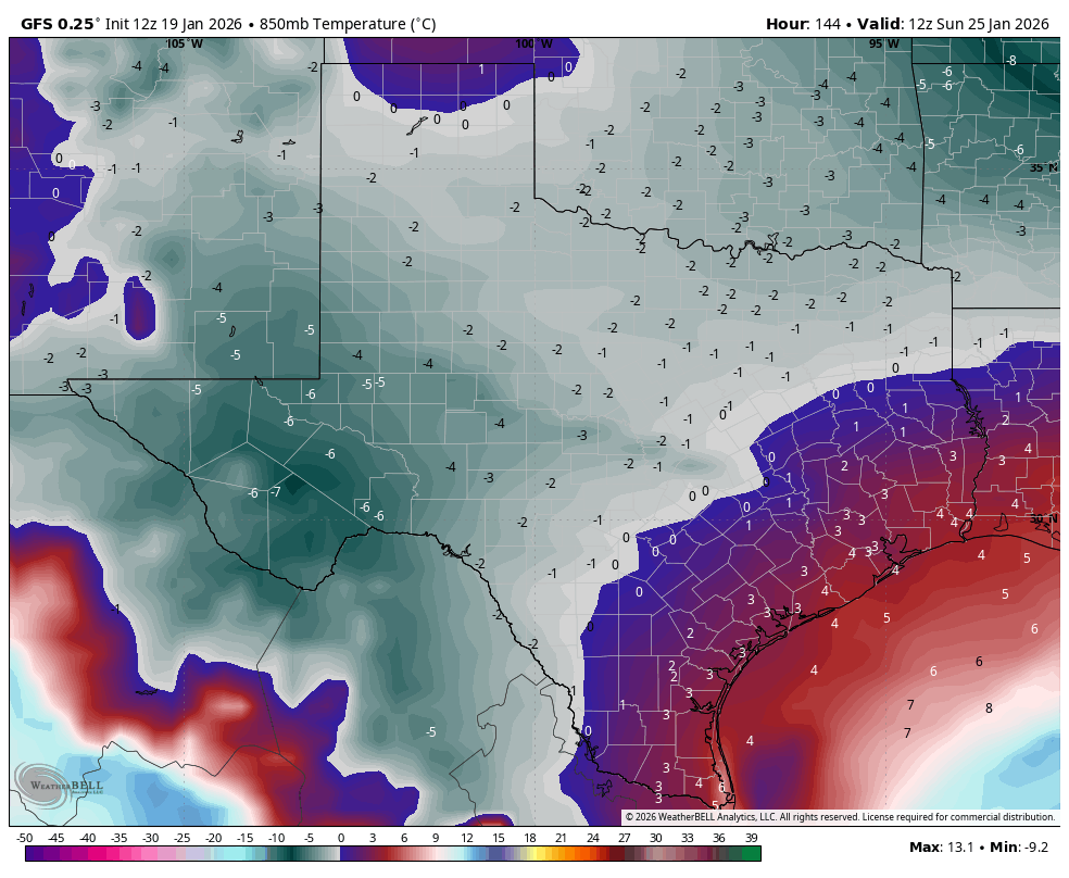
The GFS model is the most bullish for snow this weekend, forecasting upper level temperatures to be below freezing for the areas in light green. This would produce snow instead of freezing rain. Temps are in Celsius...zero is freezing.
How much snow and ice the latest models are forecasting for this weekend. Click on images to see them larger.