Dust and rain chances this week…
6-28-25. 3:15pm This Update is brought to you by Davy Ranch Supply. We have an extensive supply of fencing materials including barbed and netting wire, t-posts, cedar and treated posts, brace and twist pipe, staples, clips, and welded panels. We also stock 7 different types of medium and heavy-duty gates ranging in length from 4 ft-20 ft. We sell galvanized portable panels and 24 ft free-standing pipe panels, too. We have concrete and poly water troughs in various sizes along with a selection bunk and hay feeders. www.davyranchsupply.com
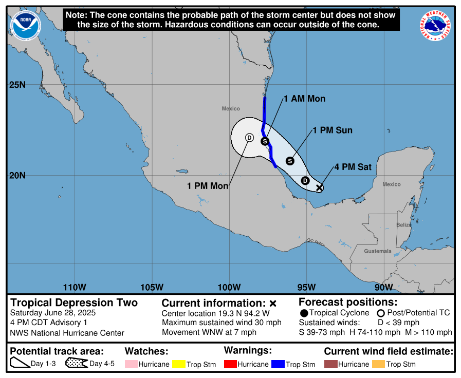
I just checked the latest update from the NHC and was surprised to see that there is now a 70% chance that a tropical something (Now 91L) may form in the Gulf, before heading into Mexico. Looking at how far south it is, I’m not feeling very bullish on rainfall from this system going far enough north to impact south or south-central Texas although a few of the models are tracking it NNW. If that were to occur, we could see increased rain odds. The NWS is thinking that we could see an increase in tropical moisture in the form of PWAT (Precipitable Water) by mid-week, which might be from this system as it moves into Mexico on Monday.
Here is the latest on 91L from the NHC: Recent surface observations, satellite imagery, and radar data from Mexico suggests a well-defined surface circulation is developing with the area of low pressure located in the Bay of Campeche near the Mexican coastline. In addition, shower and thunderstorm activity is also starting to show signs of organization. If these trends continue, a tropical depression is likely to form, possibly as soon as this afternoon, in the Bay of Campeche. This system is forecast to continue moving west-northwestward this weekend towards eastern Mexico, ultimately moving inland by Monday. An Air Force Reserve Hurricane Hunter aircraft is in route to investigate the system, and interests in southeastern Mexico should monitor the progress of this system. Tropical Storm Watches or Warnings could be required for portions of the Mexican Gulf coast as soon as this afternoon. Regardless of tropical cyclone formation, locally heavy rains are ongoing over portions of Guatemala and southeastern Mexico, and will continue during the next few days.
Meanwhile, Saharan dust is starting to flow into Texas and will be on the uptick starting tomorrow. The good news is that high pressure will be situated to our north and east, giving us a slight weakness in the atmosphere that will allow for more pm poppers this week. As we saw last week, most of these storms will stay in the coastal plains and along the coast, but a few will have the strength to make it into south-central Texas. One thought that hit me as I was working on this post, is the possibility of “yellow-orange rain” from the precipitation falling through the dust cloud!
Mark

This Update is brought to you by Davy Ranch Supply. We have an extensive supply of fencing materials including barbed and netting wire, t-posts, cedar and treated posts, brace and twist pipe, staples, clips, and welded panels. We also stock 7 different types of medium and heavy-duty gates ranging in length from 4 ft-20 ft. We sell galvanized portable panels and 24 ft free-standing pipe panels, too. We have concrete and poly water troughs in various sizes along with a selection bunk and hay feeders. www.davyranchsupply.com
4pm update…

Satellite imagery of 91L
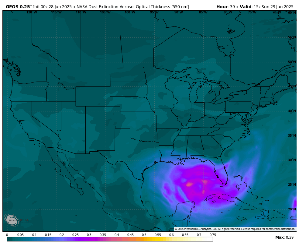
Saharan dust model forecast.

So, if it rains this week with the Saharan Dust over us, could it look like this?
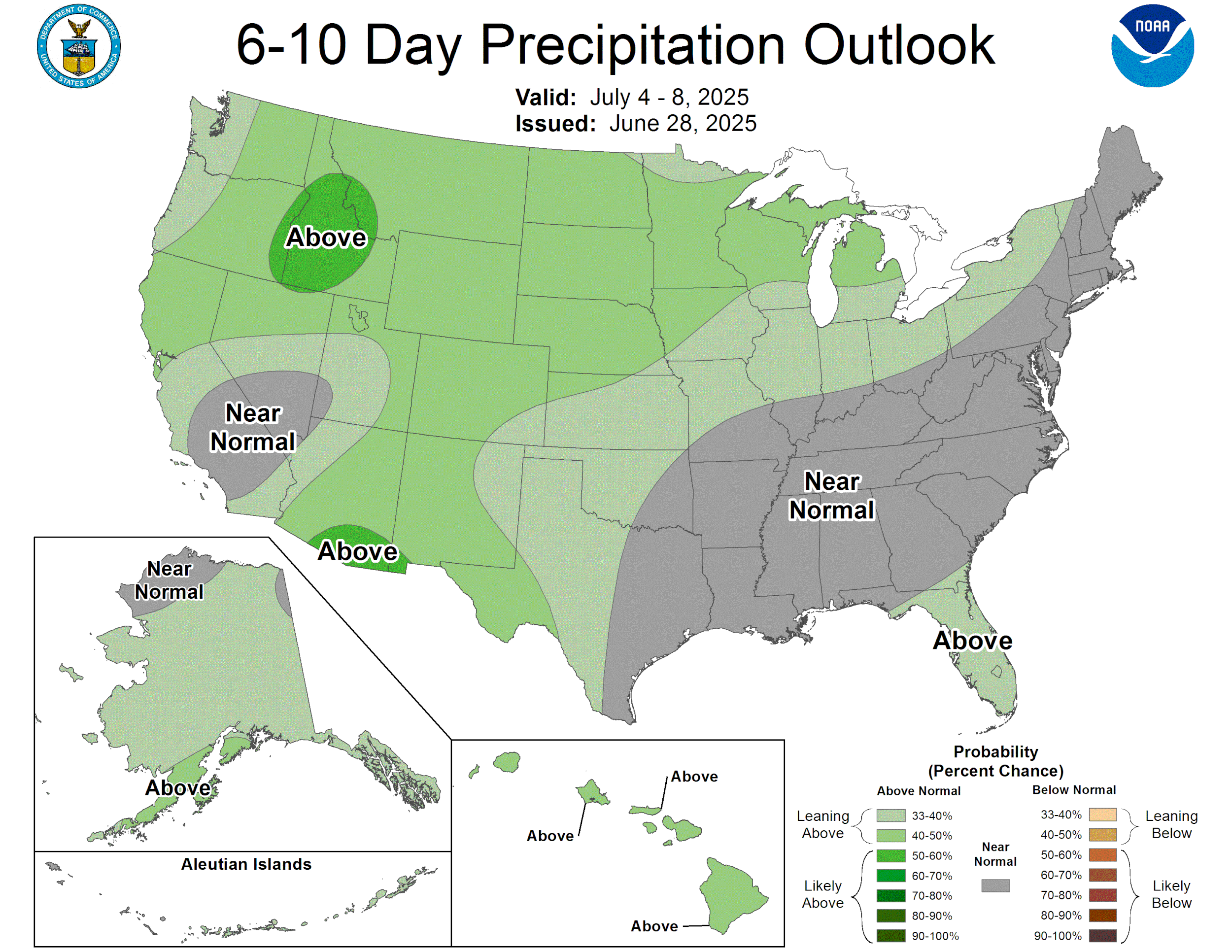
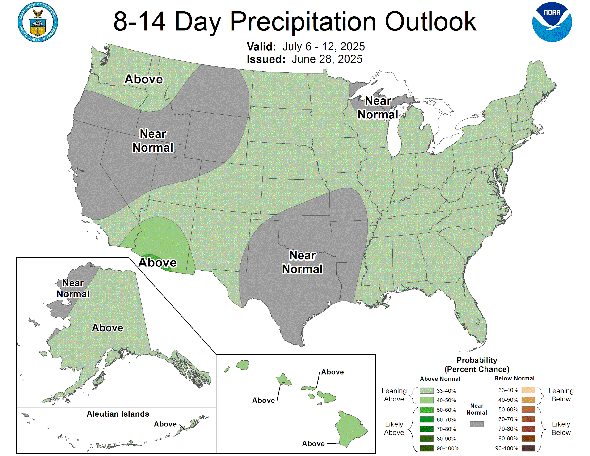
How much rain the latest models think will fall this week. Click on images to see them larger.