Serious rainfall is occurring right now in NW San Antonio!
7-11-26. 2:30pm With chances for rain increasing, it's a great time to consider new sod for your yard! This update is brought to you by South Texas Grass Farms. South Texas Grass Farms LLC is a family owned and operated business located just outside of Pearsall, Texas. We specialize in growing Tifway 419 Bermuda, Scotts ProVista St. Augustine, Raleigh St. Augustine and Floratam St. Augustine. We are conveniently located 1 +/- hour from San Antonio, 1.5 +/- hours from Del Rio and Laredo, 2 +/- hours from Austin. Customer pickup available at the farm. We also have delivery and installation options. We have drivers willing to deliver just about anywhere in Texas. Contact us for more information (210) 875-3532.
We have a rain train going on in NW Bexar County, where my weather station has recorded 6.50 inches of rain since this morning in the Helotes area.
The National Weather Service in Austin/San Antonio has issued a
* Flash Flood Warning for...
  Northwestern Bexar County in south central Texas...
* Until 600 PM CDT.
* At 1250 PM CDT, Doppler radar indicated thunderstorms producing
  heavy rain across the warned area. Between 1 and 2 inches of rain
  have fallen. Additional rainfall amounts of 1 to 3 inches are
  possible in the warned area. Flash flooding is ongoing or expected
  to begin shortly.
HAZARD...Life threatening flash flooding. Thunderstorms producing flash flooding.
* Some locations that will experience flash flooding include...
  San Antonio, Leon Valley, Helotes, Fair Oaks Ranch, Shavano Park,
  Cross Mountain, Government Canyon State Natural Area, Sea World,
  Leon Springs, The Dominion, Grey Forest, Fiesta Texas, San
  Geronimo and Scenic Oaks.
There is a big red area (see below) where there will continue to be a threat for flooding rains this afternoon. Rains should wind down after sunset and Sunday and Monday look drier with only a small chance for rain. Rain odds boost back up again Monday night through Wednesday as an upper-level low moves through the area along the southern rim of high pressure. In addition, there will be a cool front that goes stationary in central Texas. We will talk more about that tomorrow.
Please let us know how much rain you have received over the past 24hrs and your location.
Mark
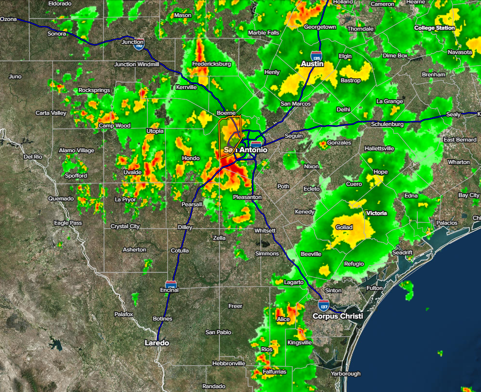
2:15pm radar. Movement is north.
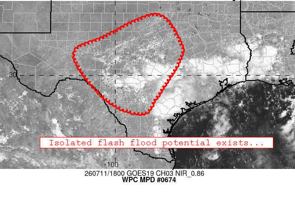
Area where we could see more heavy rain this afternoon.

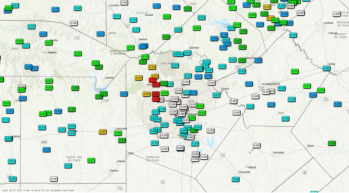
24hr rainfall totals so far.
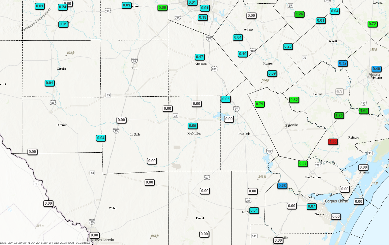
24hr rainfall totals so far.
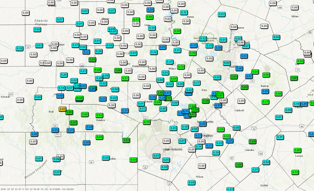
24hr rainfall totals so far.