Cold, windy and a chance for more rain.
11-29-25. 3:15pm This Update is brought to you by Blackland Ag Solutions. Boost your farm’s performance with Blackland Ag Solutions. We carry the latest Precision Planting technology to help you plant smarter and grow stronger. Plus, our rugged WAM Affordable Mud Wheels are priced at only $99. With trusted brands like Yetter, Martin, Wearparts 360 Yield Center, Unverferth and more, we’ve got the solutions that keep your operation ahead of the curve. Parts inventories available in Bartlett and Itasca Texas or shipped directly to your farm. Contact us with any of your planter parts needs.
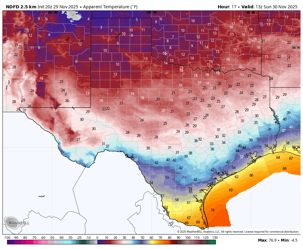
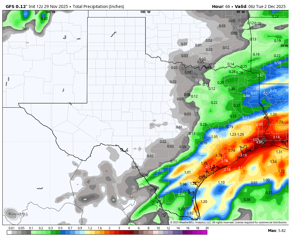
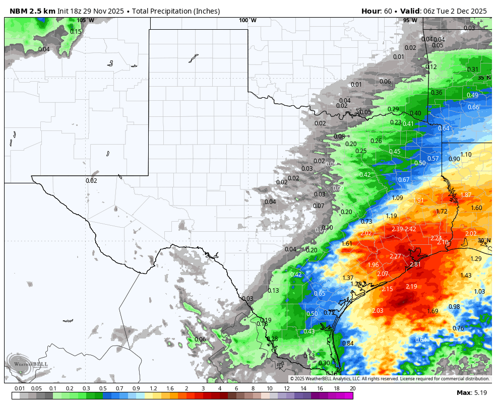
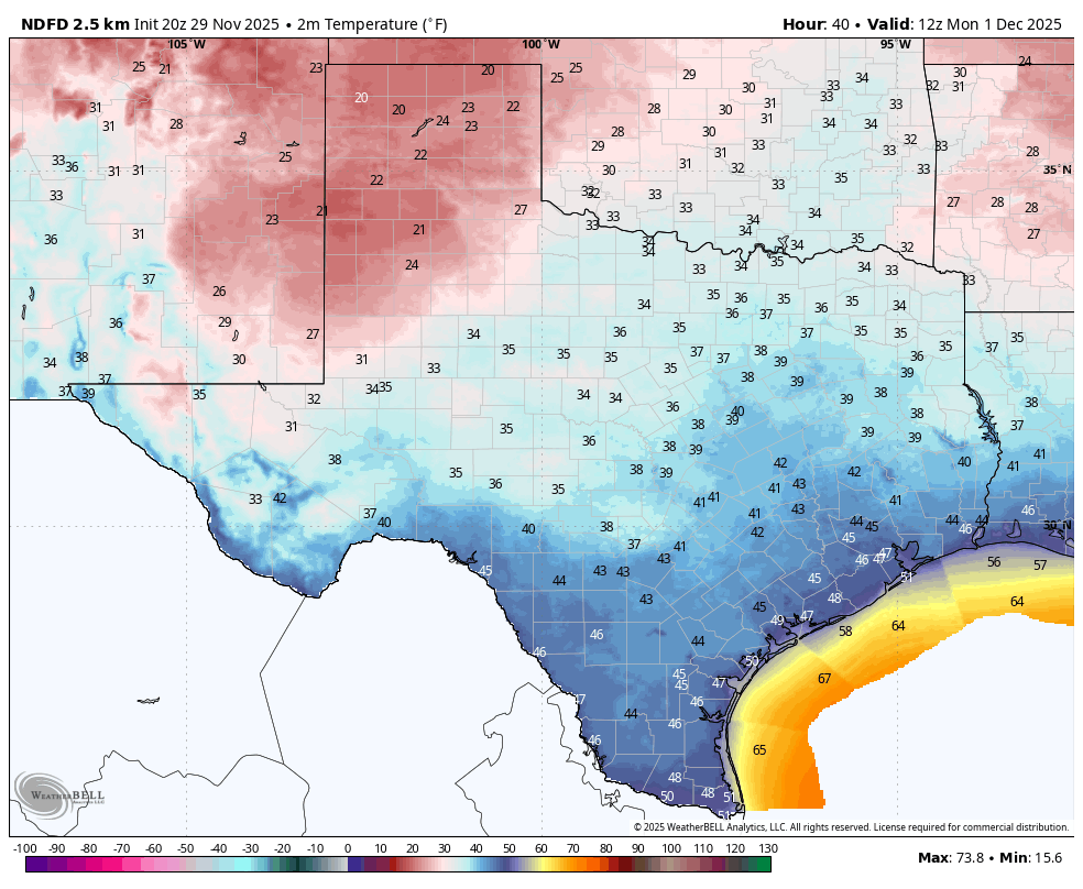
As I look at the latest temperatures, it’s pretty easy to see where our big bad cold front is…it’s currently in the 30’s and 40’s in the Panhandle behind the front, along with northerly winds gusting to over 30mph. The front will continue to make a dive our direction during the afternoon and should be through the northern Hill Country around 7pm, San Antonio around 10pm and down to Corpus around 3am. I have included a few wind graphics showing arrival times below. There will be a broken line of storms forming along the front as it pushes into San Antonio and Austin, then becoming more filled in as the front moves into the coastal plains. For once, the odds for rain in the coastal plains is better than the northern counties over the next week! Sunday will be a cloudy, cold and windy day, with most locations struggling to get out of the 40’s. Winds will be gusting up to 35mph tonight and Sunday, so batten down those hatches!
A couple of disturbances and a surface low that will form along the cold front off the coast, will give south Texas and the southern counties of south-central Texas a chance for more rain on Sunday night and Monday. Clouds will try to thin out on Monday afternoon…depending on how much it clears out will impact our lows on Tuesday. Winds shift back into the SE on Tuesday and we start a slow warming trend the rest of the week. Rain chances come back again as we head towards the end of the work week…more on that later.
Keep us posted on when the front arrives in your backyard and where!
Mark

This Update is brought to you by Blackland Ag Solutions. Boost your farm’s performance with Blackland Ag Solutions. We carry the latest Precision Planting technology to help you plant smarter and grow stronger. Plus, our rugged WAM Affordable Mud Wheels are priced at only $99. With trusted brands like Yetter, Martin, Wearparts 360 Yield Center, Unverferth and more, we’ve got the solutions that keep your operation ahead of the curve. Parts inventories available in Bartlett and Itasca Texas or shipped directly to your farm. Contact us with any of your planter parts needs.
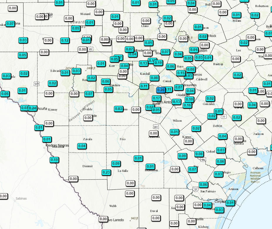
24hr rainfall totals.

Current location of our big bad cold front!

3pm temperatures.

AI by Mark!
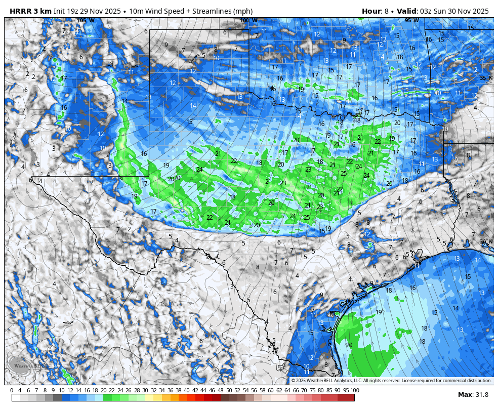
Front location forecast for 8pm tonight.
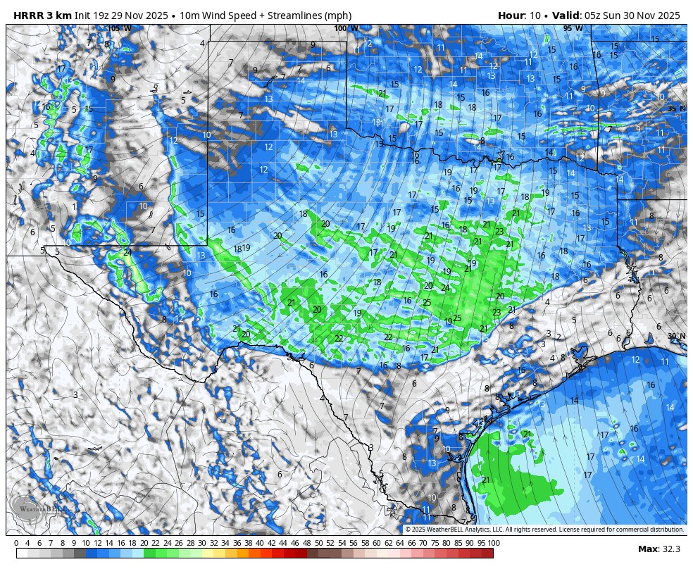
Front location forecast for 10pm tonight.
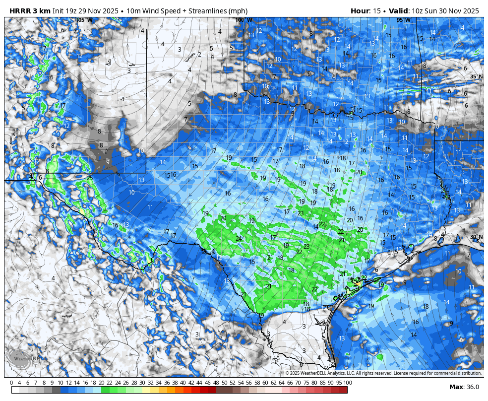
Front location forecast for 3am tonight.
Tomorrow morning's wind chill forecast.
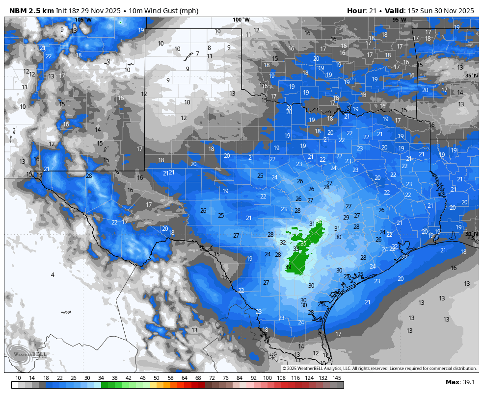
Sunday's wind gust forecast.
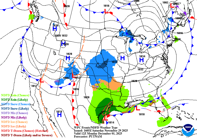
A surface low will develop along the front and give us a chance for rain on Sunday night and Monday.

There is a slight chance for excessive rain tonight in the green zone.
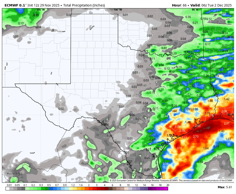
How much rain the latest models think will fall from tonight through Monday. Click on images to see them larger.


Forecast lows for Monday.

Forecast lows for Tuesday.