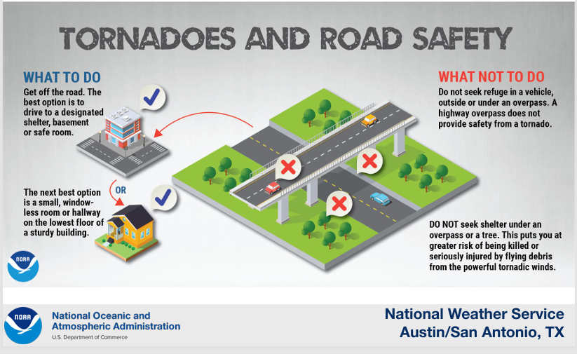
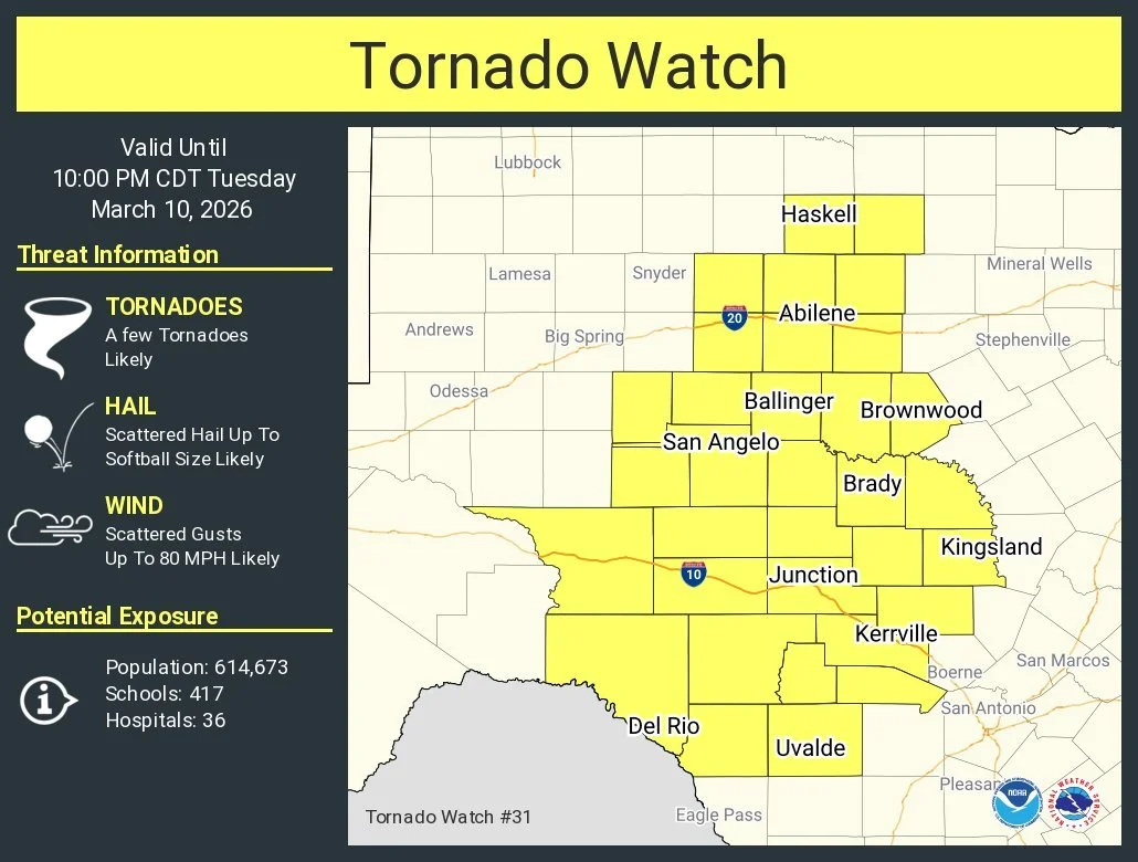
A Tornado watch will be issued!
3-10-26. 3pm. This update is brought to you by Dietz Mclean Optical Company. www.dmoptical.com As a family-owned business, our independence, in house lab, great customer service and eyewear warranties, allows us to tailor your eyeglasses, lenses, and fittings: we want you to only expect the best after working with us. With six conveniently located optical shops in San Antonio, Boerne, Marble Falls and Temple, it’s easy to love what you see.
As soon as I finish posting this I’m convinced that the NWS will see my post, then issue a Tornado Watch for our western counties! The reason I know this will happen is because the NWS has already issued a Mesoscale Discussion in which they say there is a 95% chance of one being issued at some point this afternoon. Even though the odds for severe weather will be greatest in our western and NW counties, please make sure your weather apps and NOAA weather radio are on because this system is likely to arrive during the late hours tonight when most of us will be asleep.
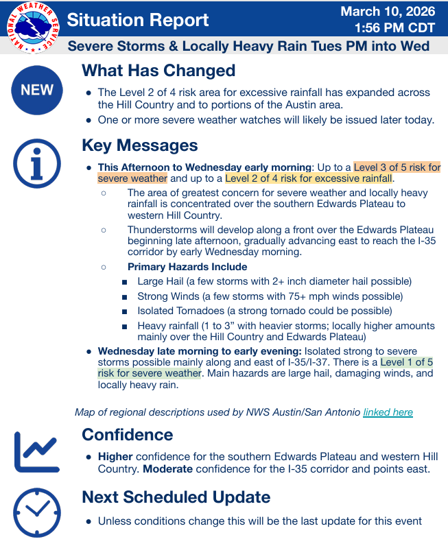
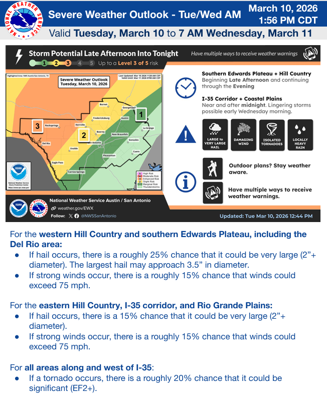
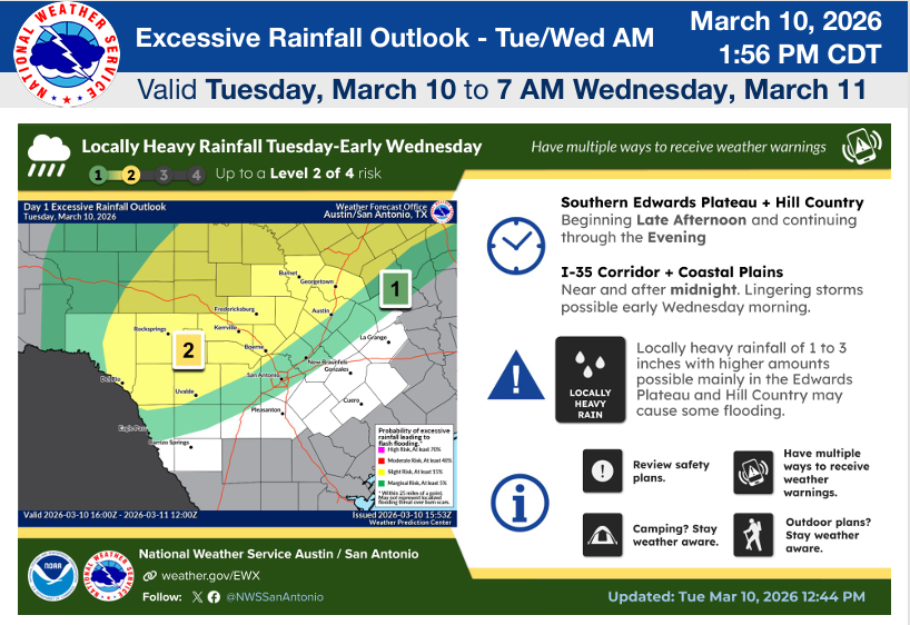
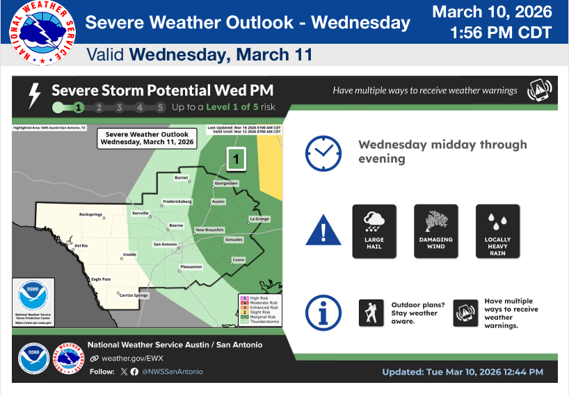
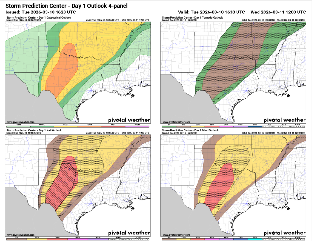
From the NWS: “Thunderstorms are expected to develop over the Edwards Plateau beginning late afternoon today. Severe thunderstorms and locally heavy rain are possible as these storms move east across South-Central Texas through the evening into tonight. Large hail, strong winds, isolated tornadoes, and heavy rainfall capable of localized flash flooding are possible especially across the Edwards Plateau and western parts of the Hill Country. One or more severe weather watches will likely be issued later today. Additional scattered showers and thunderstorms with a few possibly strong to severe are expected along and east of I-35/I-37 Wednesday midday through evening.”
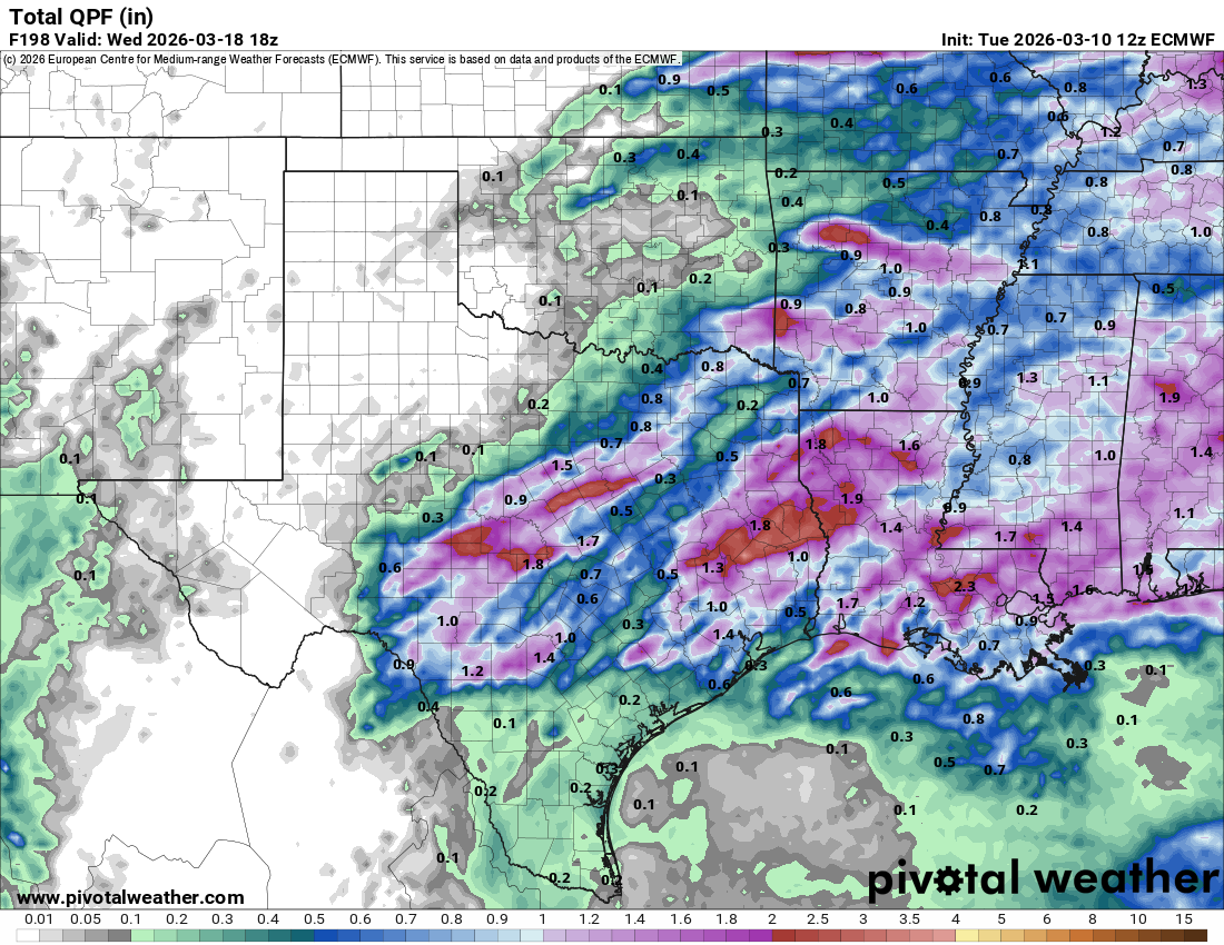
As has been the case all season, the best odds for rain will stay north of HWY 90, but I’m hoping a few cells will drift further south as the latest HRRR model suggests.
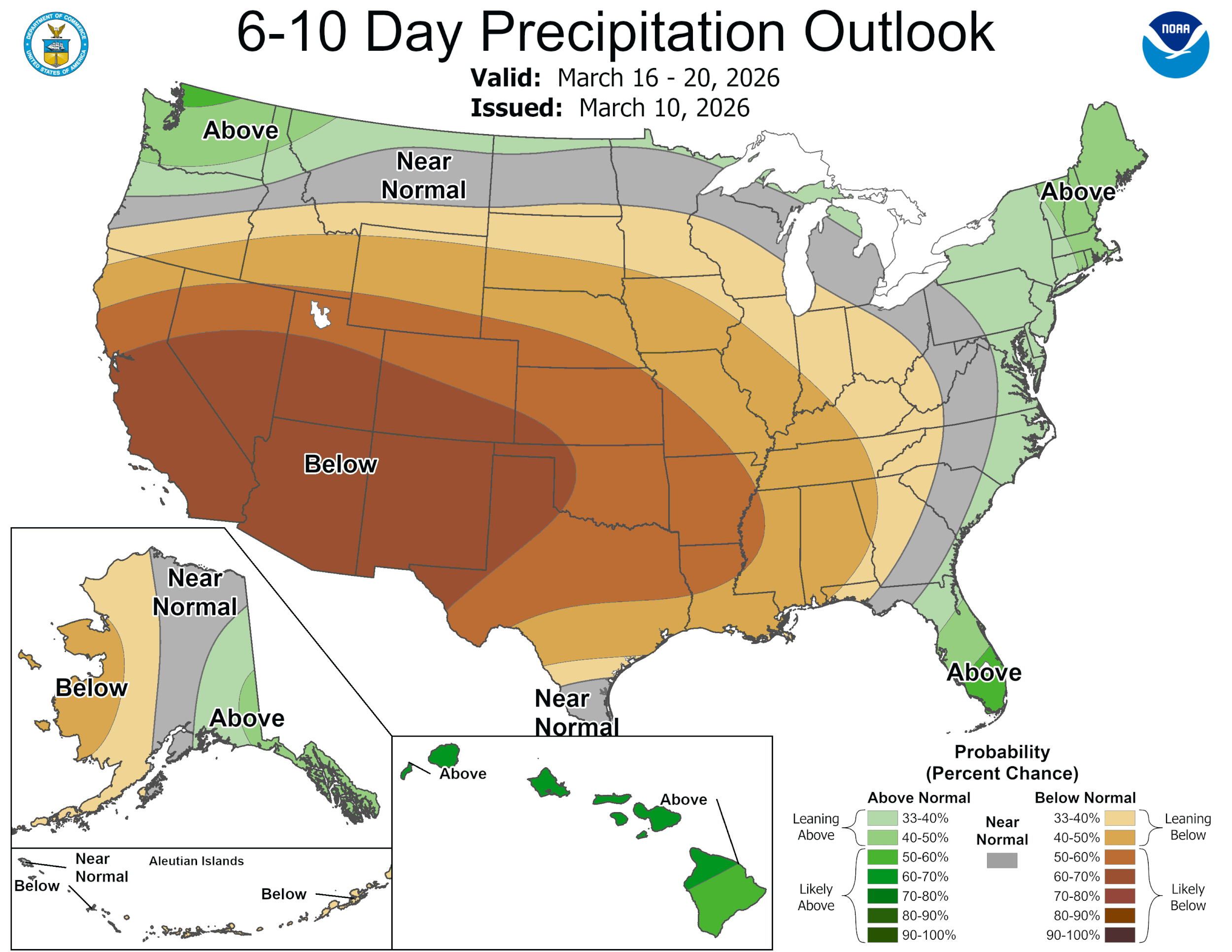
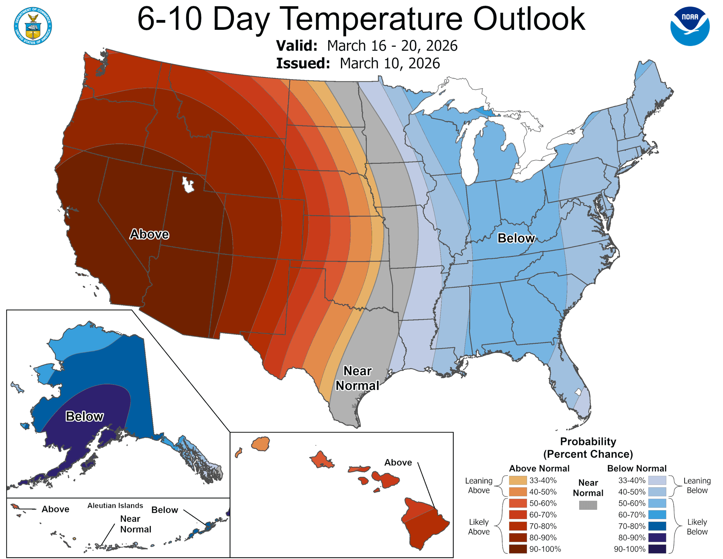
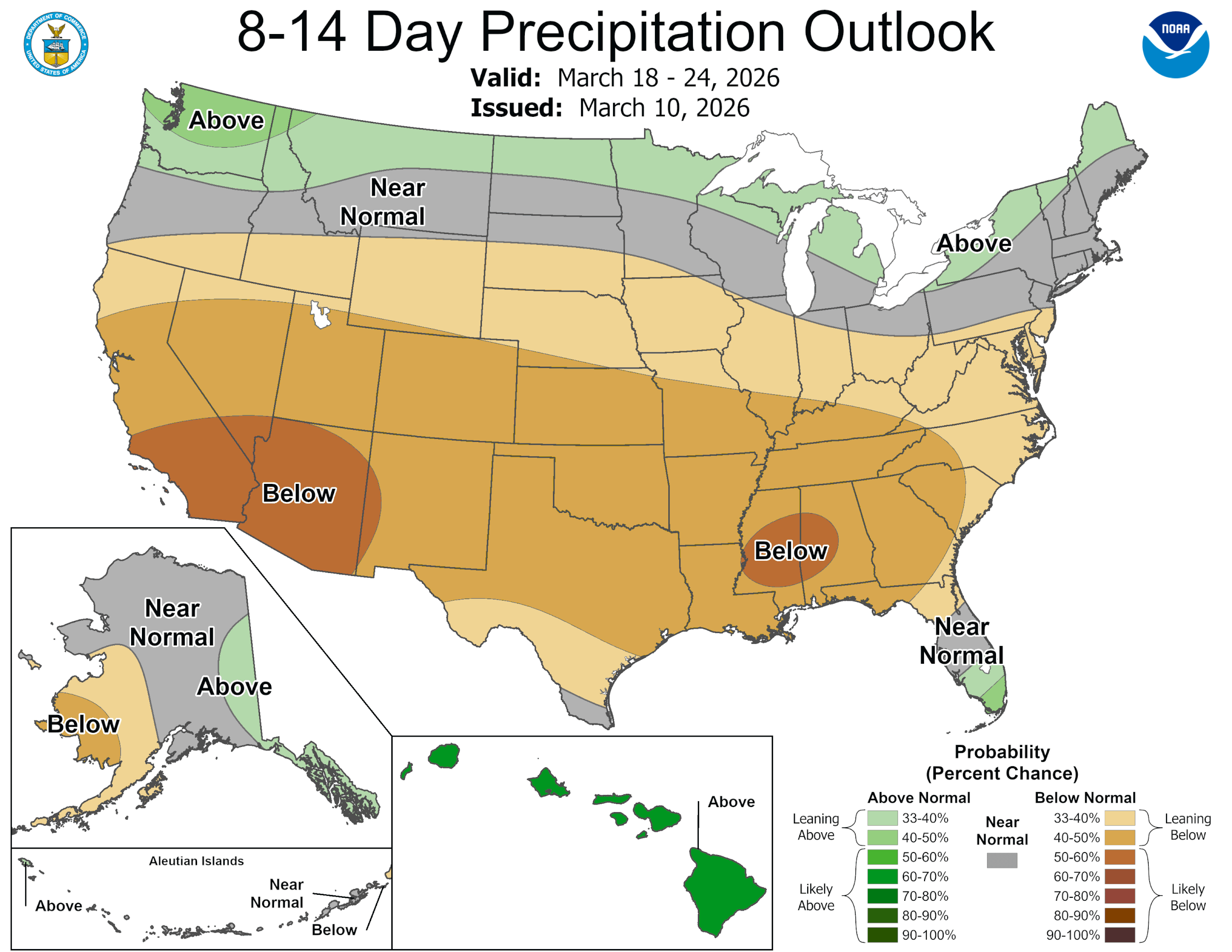
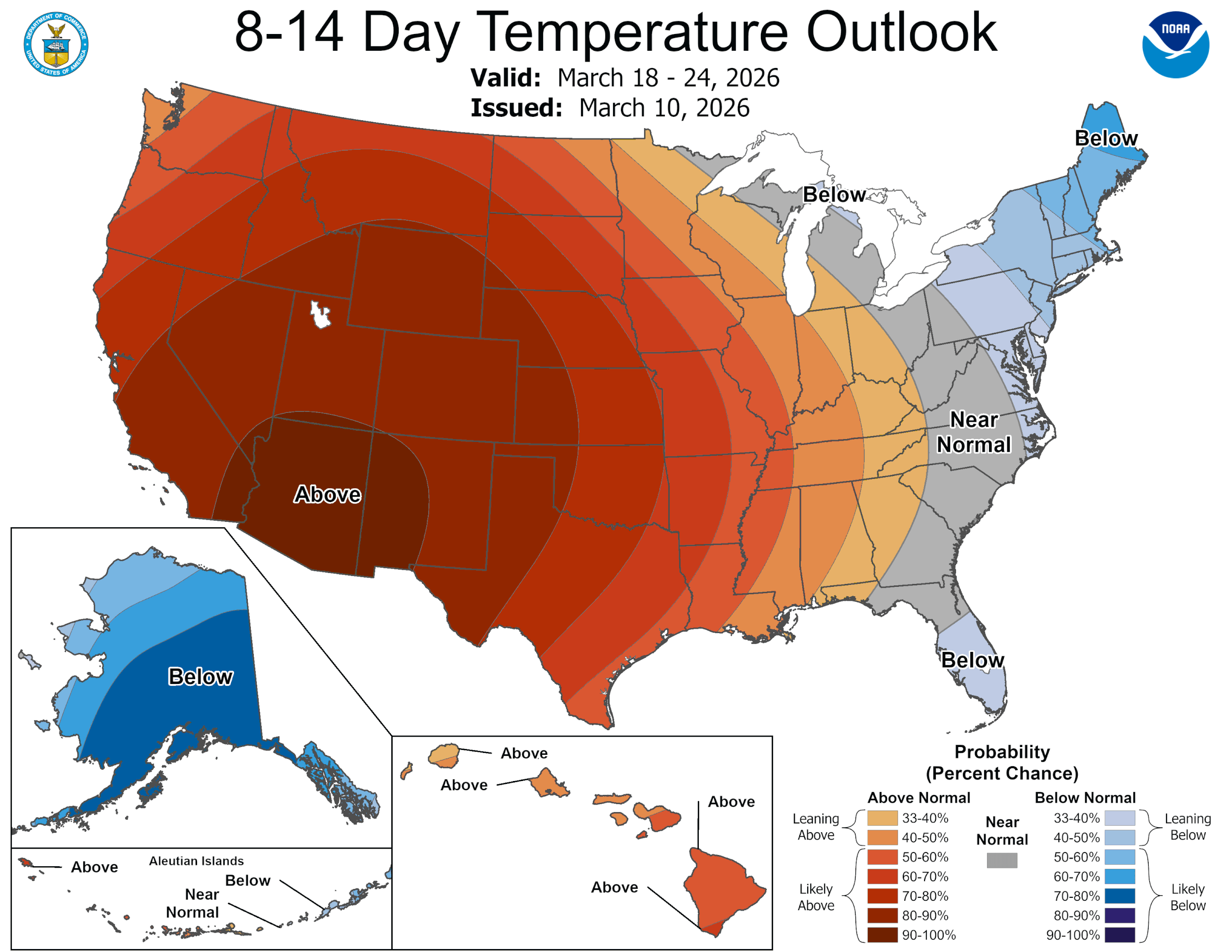
I’m hoping all of you get some rain tonight without the damage…unfortunately, we go into at least 10 days of dry weather after this system moves through.
Please feel free to post storm videos and rainfall totals!
Mark
This update is brought to you by Dietz Mclean Optical Company. www.dmoptical.com As a family-owned business, our independence, in house lab, great customer service and eyewear warranties, allows us to tailor your eyeglasses, lenses, and fittings: we want you to only expect the best after working with us. With six conveniently located optical shops in San Antonio, Boerne, Marble Falls and Temple, it’s easy to love what you see.
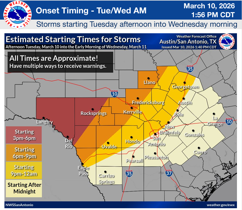
The latest update from the NWS. Click on images to see them larger.
AI by Mark!
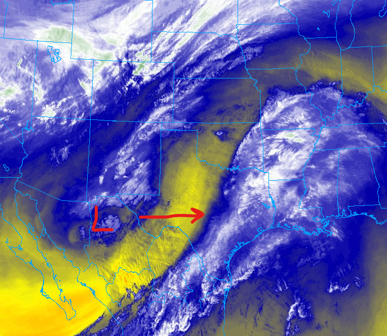
Our low over Mexico will continue drifting east, linking up with a surface front to boost our rain chances this evening and tomorrow morning.
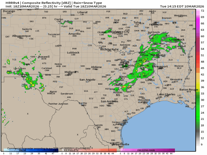
How the latest HRRR model thinks our radar will look like over the next 24hrs.
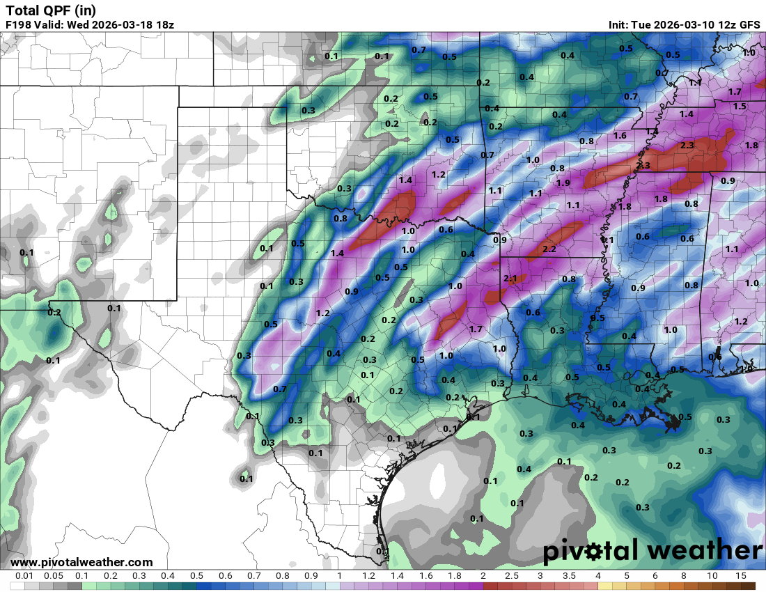
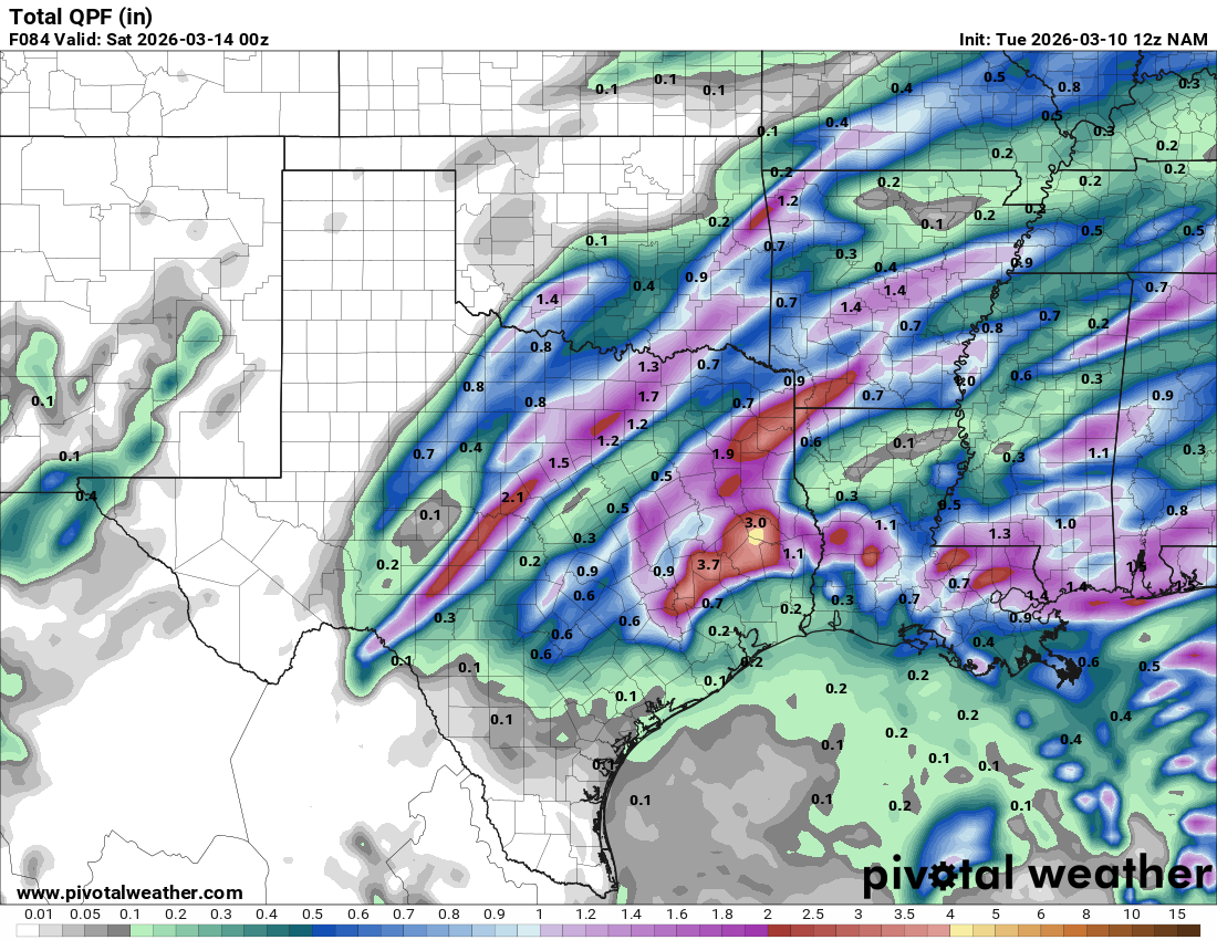
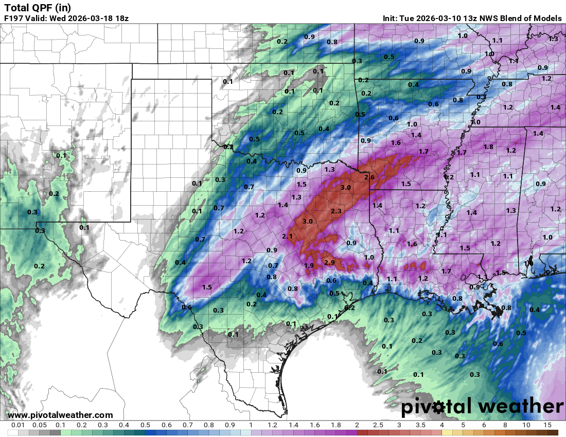
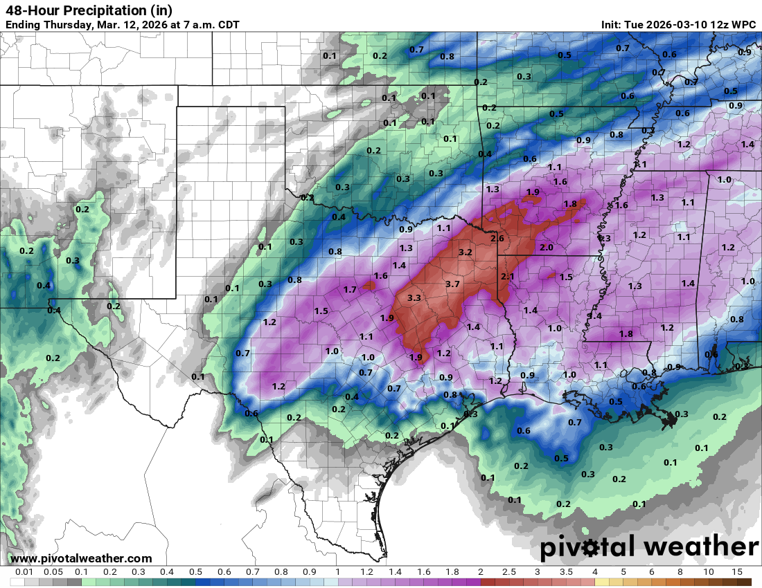
How much rain the latest models think will fall over the next 24hrs. Click on images to see them larger.
The latest depressing CPC outlooks. Click on images to see them larger.