A chilly night ahead!
10-25-25. 3:15pm. This post is sponsored by Standby Solutions. With winter just around the corner, and the potential for Polar Vortexes, now is the time to get a quote from our sponsor since it takes only one ice storm to potentially take out your power for days! Synergy Standby Solutions is a trusted provider of sales, maintenance, repairs, and fueling services for standby generators in South Central Texas. We specialize in ensuring your backup power systems remain reliable and fully operational, giving you peace of mind during power outages. With a commitment to excellence and customer satisfaction, our expert team is ready to handle all your generator needs. Learn more at www.synergystandby.com.
I know we need the rain, but other than the wind being a nuisance today, it’s great to finally experience some fall temperatures with our highs only in the 60’s and low 70’s! With dew points dropping dramatically behind dry air, we could see some lows flirting with a freeze tonight, especially in the Hill Country. The NWS just issued this: “ Special Weather Statement National Weather Service Austin/San Antonio TX 1242 PM CDT Wed Oct 29 2025 TXZ171-186>189-301100- Llano-Kerr-Bandera-Gillespie-Kendall- Including the cities of Llano, Kerrville, Bandera, Fredericksburg, and Boerne 1242 PM CDT Wed Oct 29 2025 ...Near Freezing Temperatures Thursday Morning... Clear skies, dry air, and diminishing winds later tonight will allow temperatures to fall into the mid 30s by sunrise Thursday morning. A few lower spots in elevation may briefly dip to freezing, which could result in damage to sensitive plants that are not covered or brought inside.”
While temperatures will gradually warm up a bit over the next couple of days, we should still see lows in the 40’s and 50’s, with highs in the 70’s. Our next (backdoor front) arrives on Saturday and may even kick up a few storms as it moves in from the NE. Unfortunately, most of the models are keeping the best rain odds east of an I-35 and I-37 line, but a few of you may luck into a tenth of an inch.
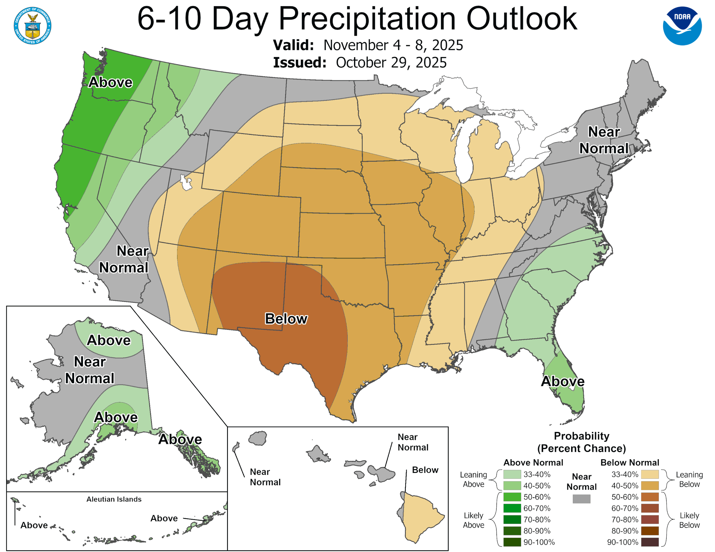
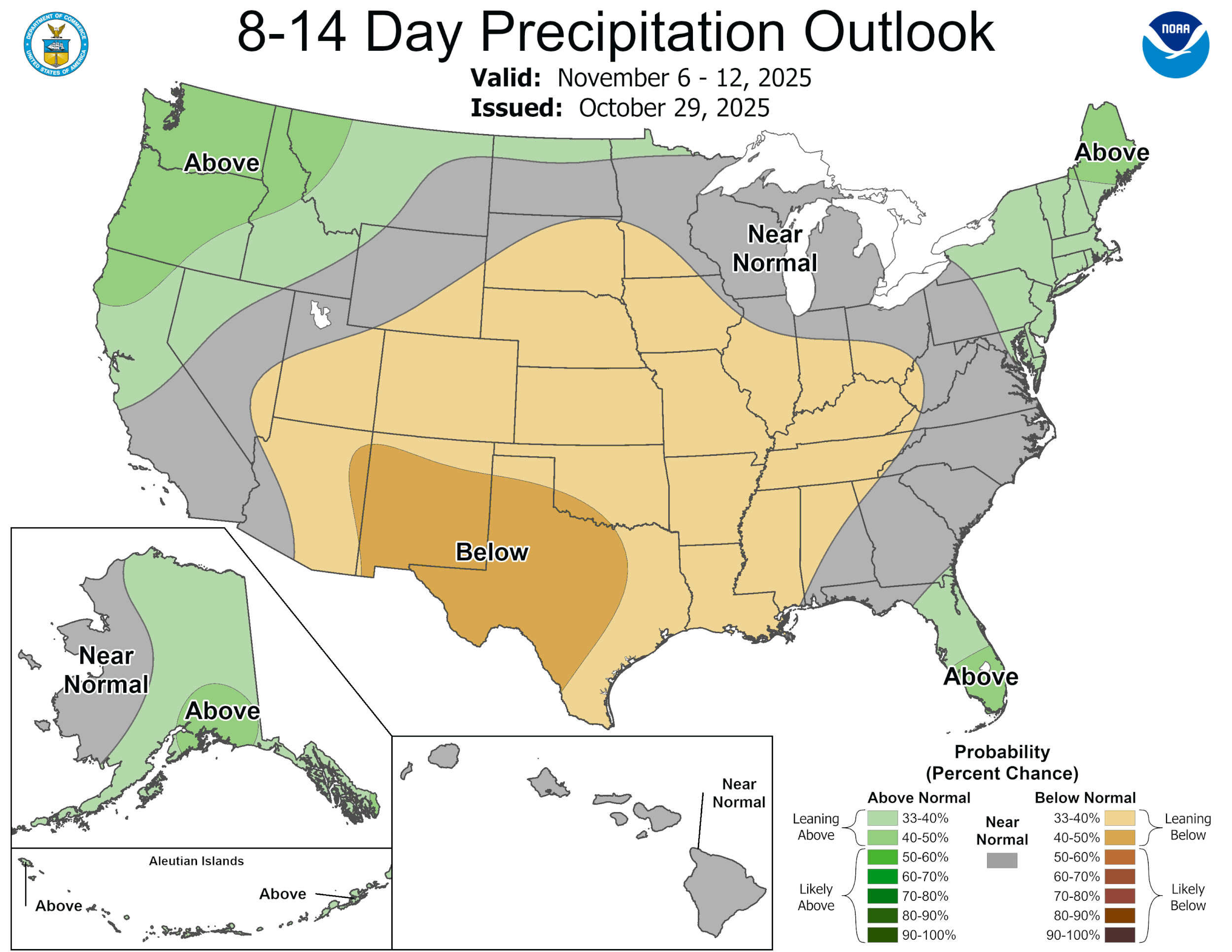
Looking further down the calendar, most of the models are still forecasting several chances for rain once we get past the 15th of November…let’s hope they verify!
Mark

This post is sponsored by Standby Solutions. With winter just around the corner, and the potential for Polar Vortexes, now is the time to get a quote from our sponsor since it takes only one ice storm to potentially take out your power for days! Synergy Standby Solutions is a trusted provider of sales, maintenance, repairs, and fueling services for standby generators in South Central Texas. We specialize in ensuring your backup power systems remain reliable and fully operational, giving you peace of mind during power outages. With a commitment to excellence and customer satisfaction, our expert team is ready to handle all your generator needs. Learn more at www.synergystandby.com.

We have a Red Flag Warning until 7pm tonight.

3pm wind gusts

3pm temperatures.

Forecast lows for tomorrow morning!

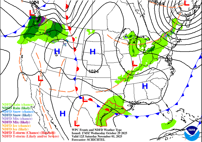
Saturday's backdoor front may kick up a few storms in our eastern counties.
How much rain the latest models think will fall on Saturday. Click on images to see them larger.


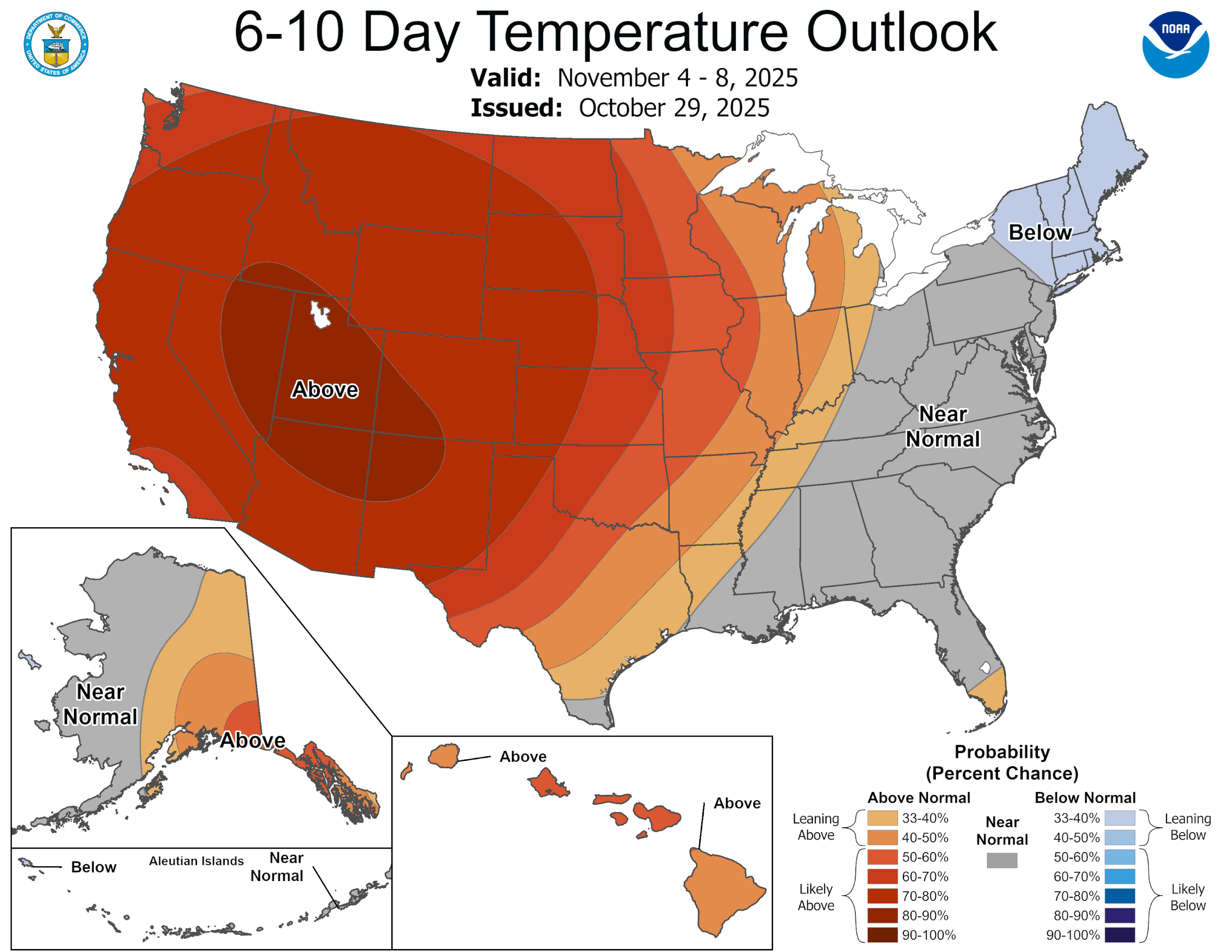
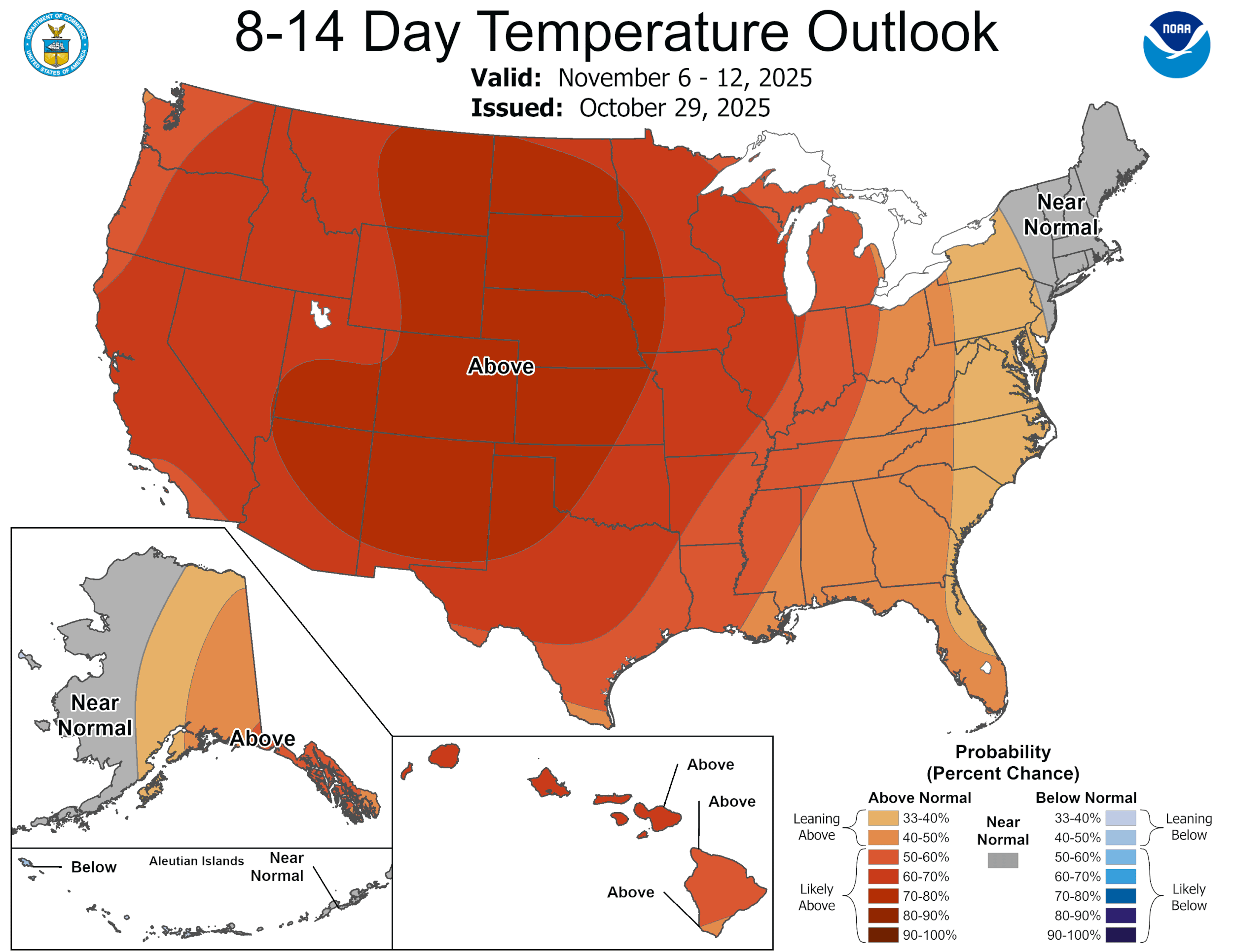
The latest CPC outlooks. Click on images to see them larger.