Waiting for front #2.
1-9-25. 3:45pm. This post is sponsored by Synergy Standby Solutions. With the potential for arctic air over the winter, now is the time to get a quote from our sponsor since it takes only one ice storm to potentially take out your power for days! Synergy Standby Solutions is a trusted provider of sales, maintenance, repairs, and fueling services for standby generators in South Central Texas. We specialize in ensuring your backup power systems remain reliable and fully operational, giving you peace of mind during power outages. With a commitment to excellence and customer satisfaction, our expert team is ready to handle all your generator needs. Learn more at www.synergystandby.com.
Front number one is slowly moving through our area and has just drifted to the south of San Antonio as of post time. While there have been a few light showers in our area, storms have only formed on the eastern side of the front, leaving most of us with either zero or a few hundredths of an inch of rain. As the front moves south this afternoon, there is still a chance a couple of scattered storms may form in the coastal plains and along the coast. The second front will move through around midnight for south-central Texas, then closer to daybreak for south Texas. The good news is that these fronts will chase away all of the smoke that has been coming into our area from Mexico…very early to see Mexican smoke from crop burning already!
A windy day tomorrow with gusts over 30mph…combined with temperatures in the 40’s in the morning, it will certainly feel like winter again! Clouds will break in the afternoon, allowing temperatures to drop into the 30’s and 40’s on Sunday morning. Depending on if clouds return during the night, we could see a lot of freezes on Sunday morning, especially in south-central Texas. Clouds will hang around through Tuesday, keeping us cool during that time frame. By Wednesday, the sun re-appears and we should start seeing high temperatures rise back into the upper 60’s and low 70’s.
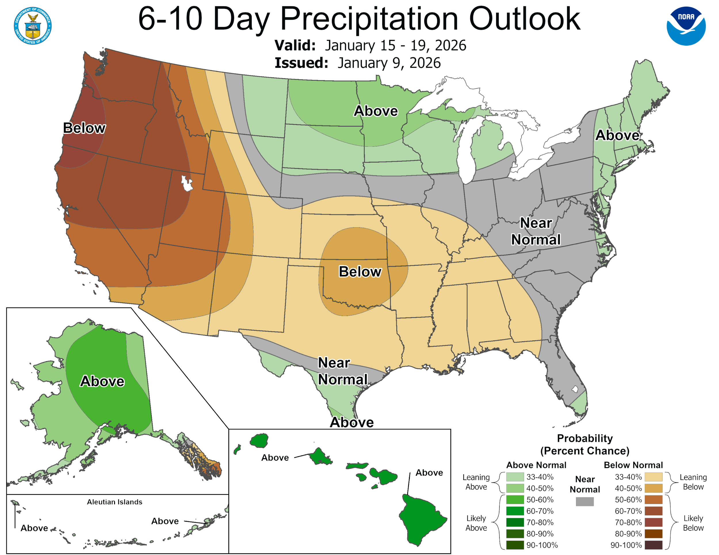
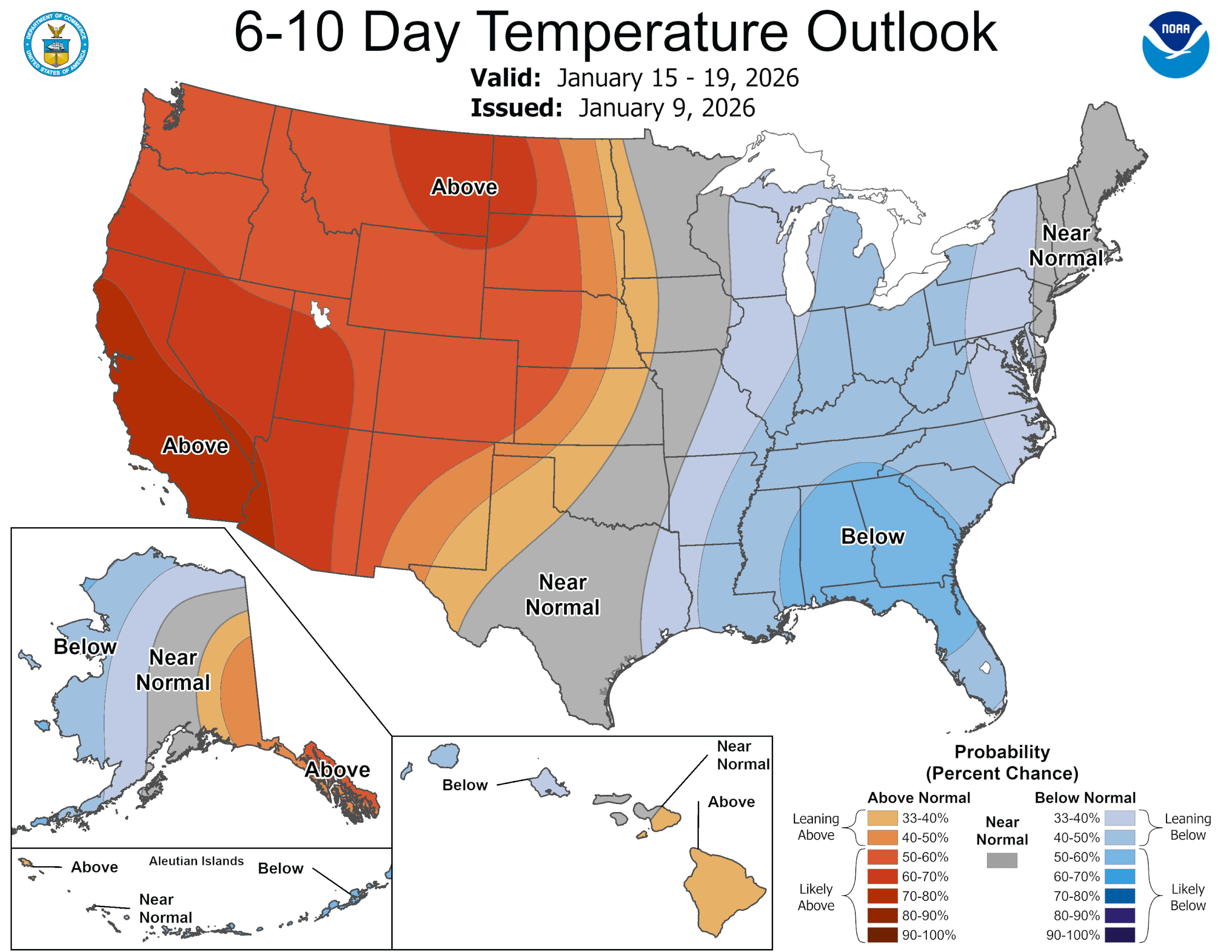
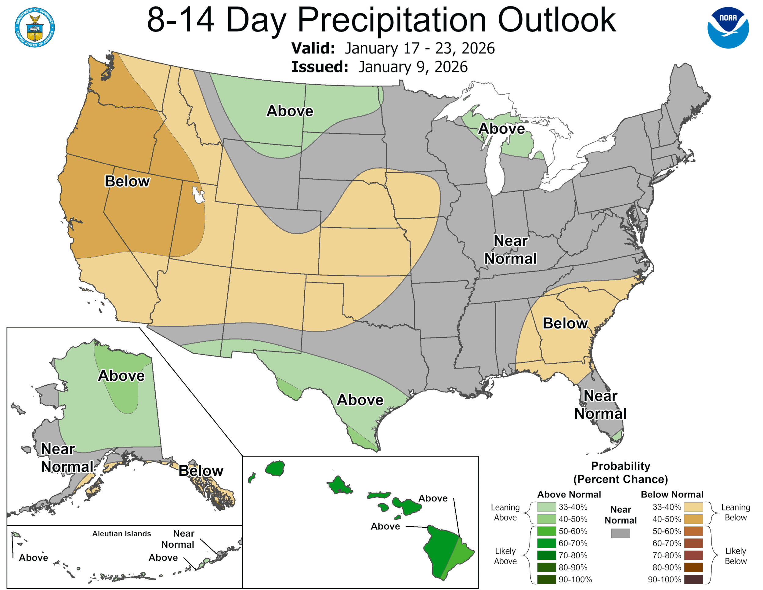
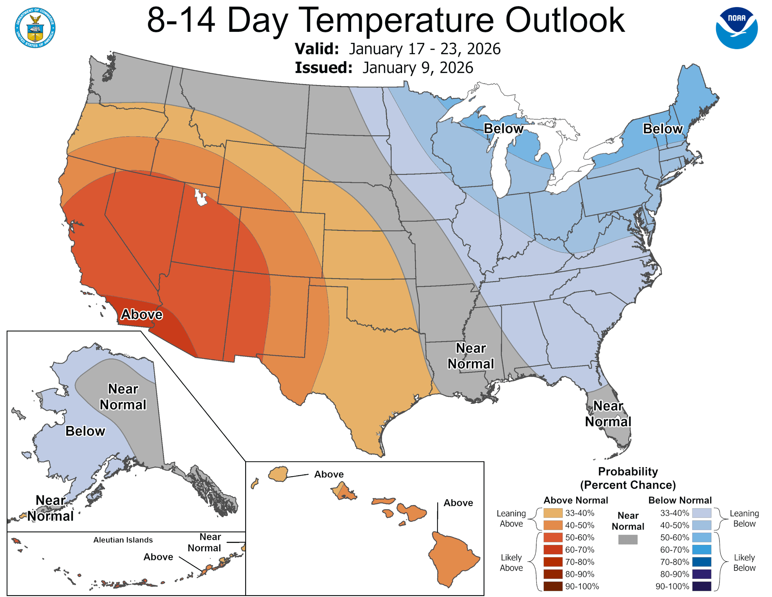
As of post time, I’m not seeing any arctic air on the way, but our temperatures should stay closer to normal for this time of the year. Unfortunately, I’m also not seeing a decent rain event.
Mark

This post is sponsored by Synergy Standby Solutions. With the potential for arctic air over the winter, now is the time to get a quote from our sponsor since it takes only one ice storm to potentially take out your power for days! Synergy Standby Solutions is a trusted provider of sales, maintenance, repairs, and fueling services for standby generators in South Central Texas. We specialize in ensuring your backup power systems remain reliable and fully operational, giving you peace of mind during power outages. With a commitment to excellence and customer satisfaction, our expert team is ready to handle all your generator needs. Learn more at www.synergystandby.com.
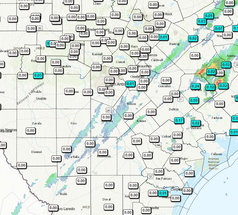
12hr rainfall totals so far.
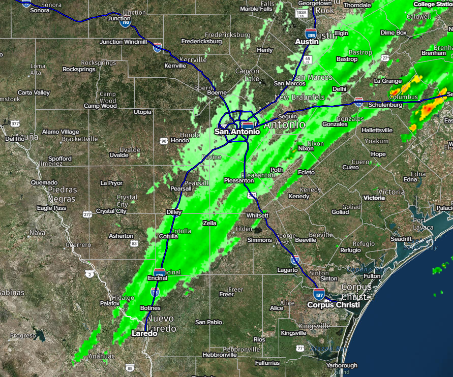
3:30pm radar.
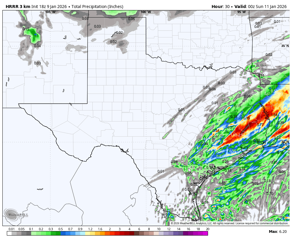
How much rain may fall over the next 6 hours.
Our first front is moving through south Texas right now. The strong front will arrive around midnight.
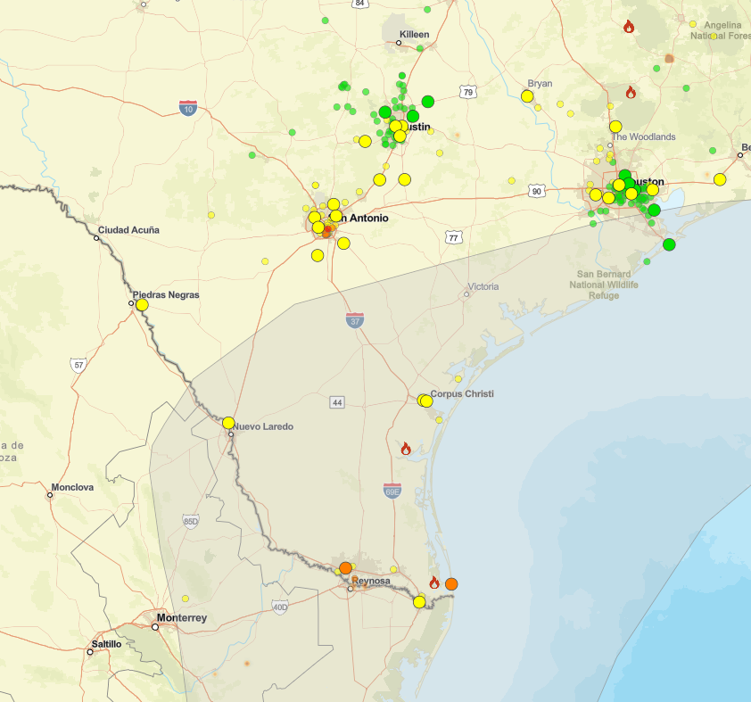
Air quality will be improving as the duel fronts move through, blowing the smoke back to Mexico.
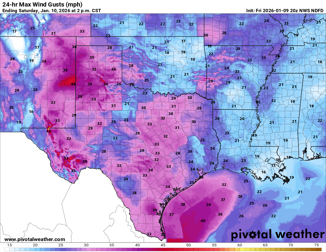
Forecast wind gusts for tomorrow.
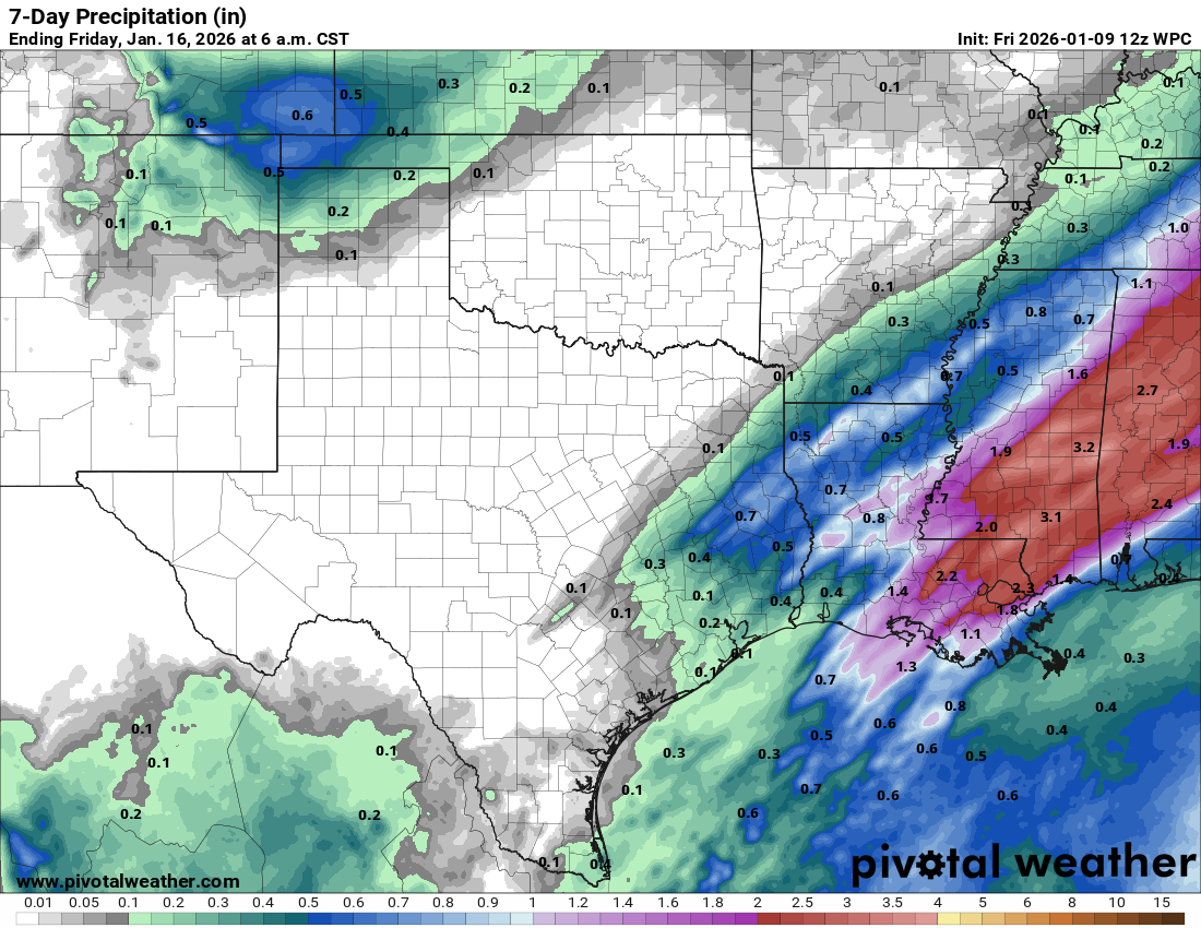
7day rainfall forecast.
CPC outlooks. Click on images to see them larger.