A chance for rain this week!
10-19-25. 3pm. This Update is brought to you by Dietz-McLean Optical. www.dmoptical.com As a family-owned business, our independence, in house lab, great customer service and eyewear warranties, allows us to tailor your eyeglasses, lenses, and fittings: we want you to only expect the best after working with us. With six conveniently located optical shops in San Antonio, Boerne, Marble Falls and Temple, it’s easy to love what you see.
You know you are getting desperate when even a slight chance for rain in five days is a big deal! Another dry front moves through on Tuesday, but then on Friday, there is a chance that our next front will drop some rain on us. As of today, the best odds for rain will be east of I-35 and I-37, but even that would help our counties SE and East of San Antonio that have seen very little rain over the past two months. I’m hoping the models get wetter as we progress through the week.
In the tropics we have disturbance 98L, which now has a 70% chance of becoming a depression or tropical storm over the next week. While it’s in a pretty decent location that could have impacted us two months ago, steering winds will drive any storm that forms to the north and east, like we have been seeing since late in September.
Our models continue to forecast a strong cold front near the end of the month, giving us another shot of rain and dropping our lows into the 40’s and highs in the 70’s. I’m hoping these models verify for the sake of our trick or treaters so they won’t be passing out due to heat exhaustion on Halloween!
Mark

This Update is brought to you by Dietz-McLean Optical. www.dmoptical.com As a family-owned business, our independence, in house lab, great customer service and eyewear warranties, allows us to tailor your eyeglasses, lenses, and fittings: we want you to only expect the best after working with us. With six conveniently located optical shops in San Antonio, Boerne, Marble Falls and Temple, it’s easy to love what you see.

High temps are much nicer than we saw yesterday!

High wind gusts so far today.

Forecast lows for tomorrow morning.
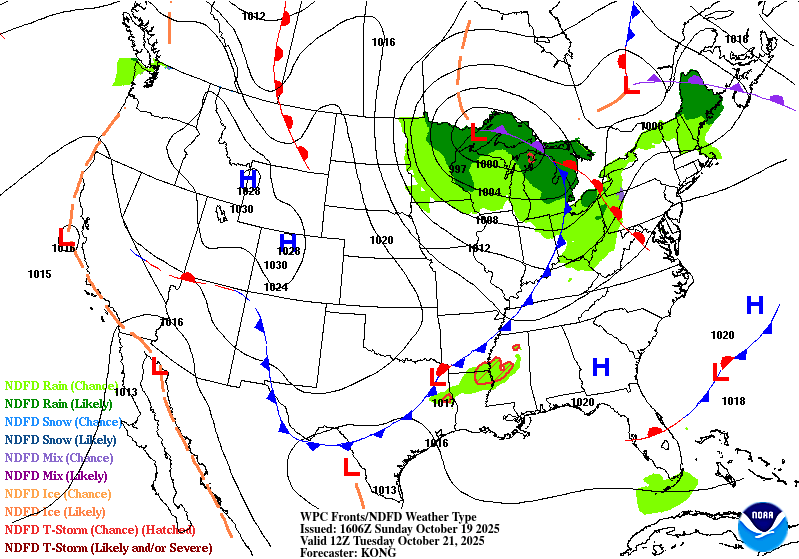
Our next dry front arrives on Tuesday.
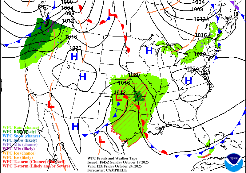
Friday's front may spark some showers and thunderstorms, mainly east of I-35 and I-37.
How much rain the latest models think will fall between Friday and Saturday. Click on images to see them larger.


