Hot!
8-23-26. 3:30pm. This update is brought to you by Dietz Mclean Optical Company. www.dmoptical.com As a family-owned business, our independence, in house lab, great customer service and eyewear warranties, allows us to tailor your eyeglasses, lenses, and fittings: we want you to only expect the best after working with us. With six conveniently located optical shops in San Antonio, Boerne, Marble Falls and Temple, it’s easy to love what you see.
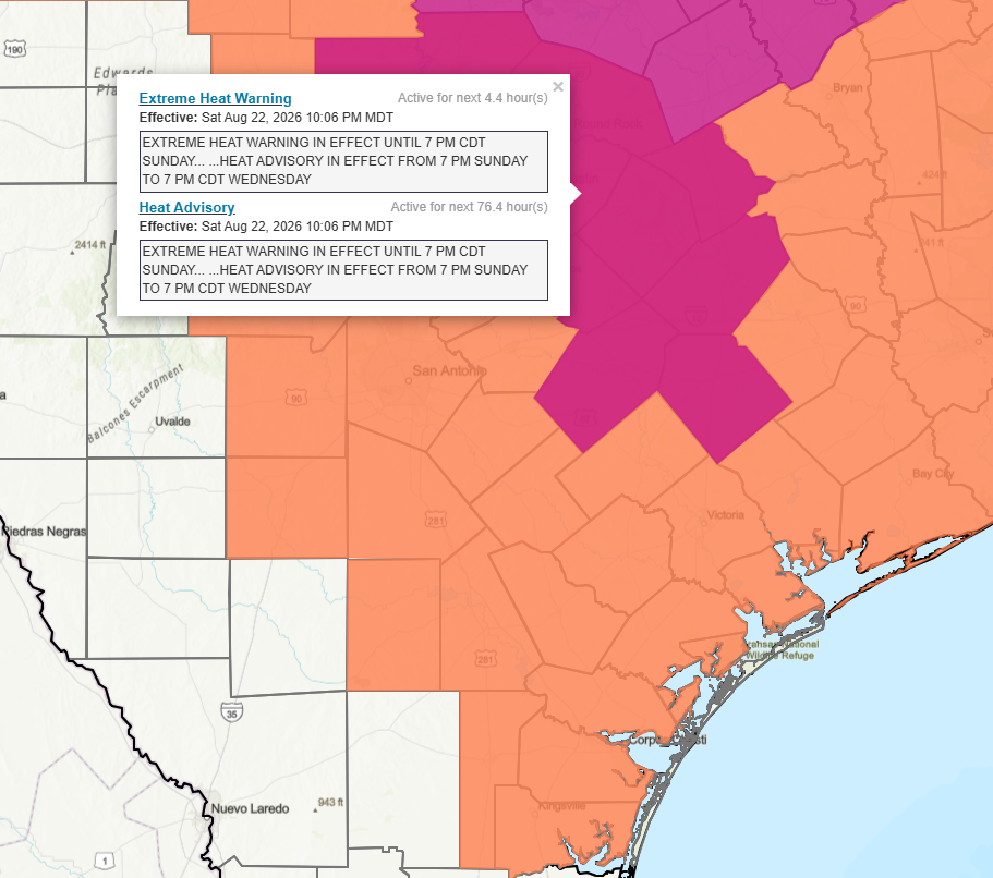
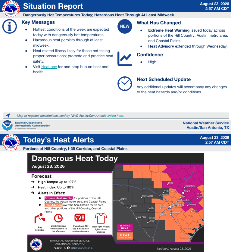
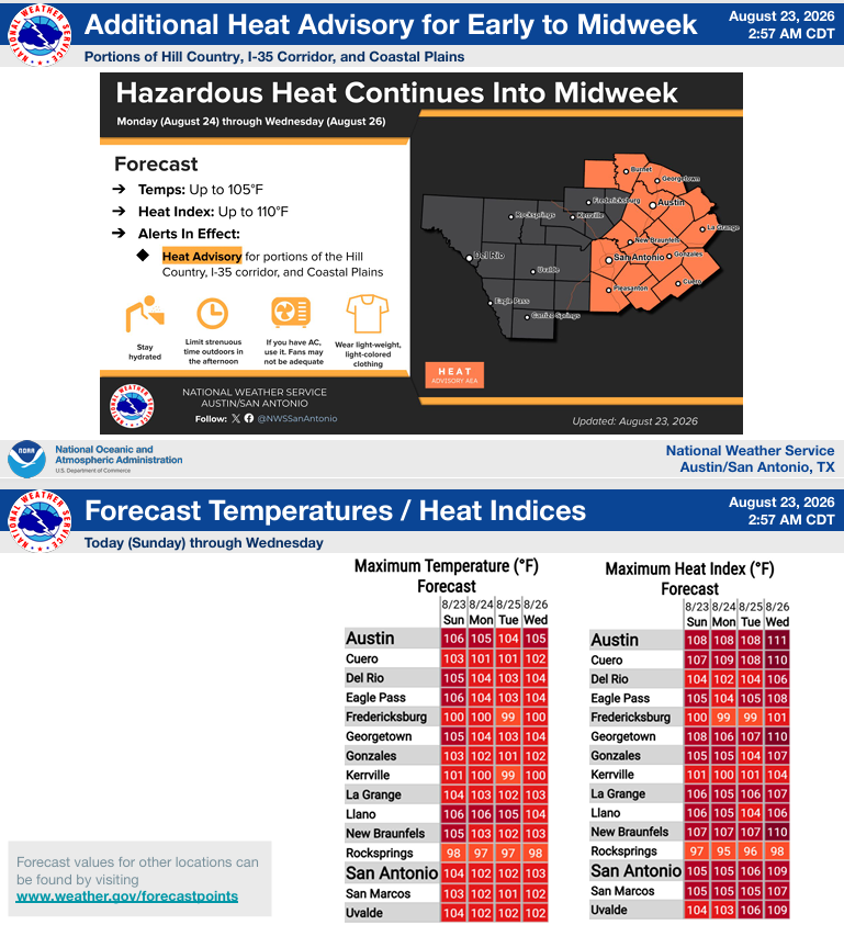
From the NWS: “Dangerously hot temperatures are expected this afternoon with Extreme Heat Warnings in effect across portions of the region. The heat remains hazardous into at least midweek with a Heat Advisory now extended through Wednesday across much of the I-35 corridor, Coastal Plains, and into portions of the Hill Country.”
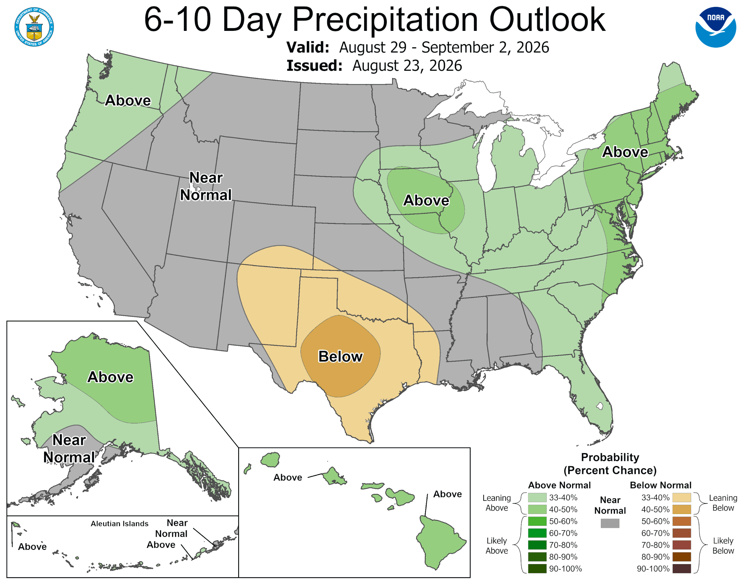
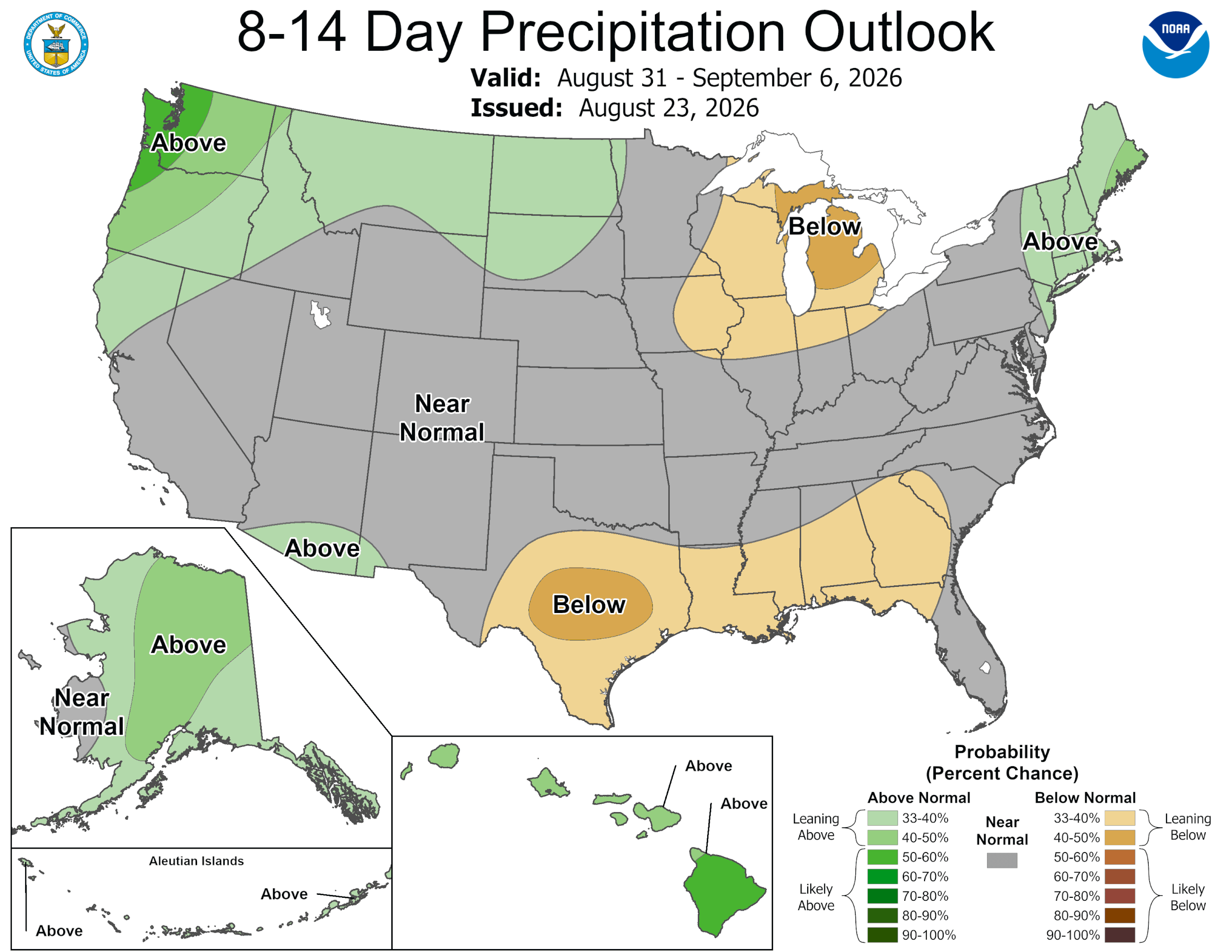
Still watching the tropics for a potential wave to form. Details are on the graphics. The GFS and Euro models continue to forecast a slight chance for rain around the end of the first week of September, but the CPC continues to give us better than 50/50 odds for seeing below normal rainfall through the 6th.
Mark

This update is brought to you by Dietz Mclean Optical Company. www.dmoptical.com As a family-owned business, our independence, in house lab, great customer service and eyewear warranties, allows us to tailor your eyeglasses, lenses, and fittings: we want you to only expect the best after working with us. With six conveniently located optical shops in San Antonio, Boerne, Marble Falls and Temple, it’s easy to love what you see.
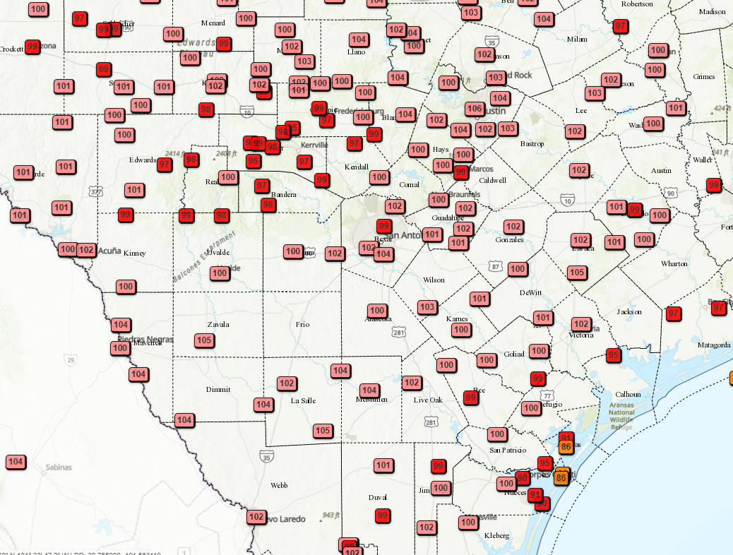
3pm real temperatures.
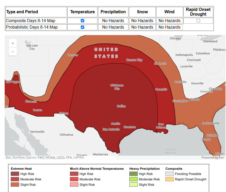
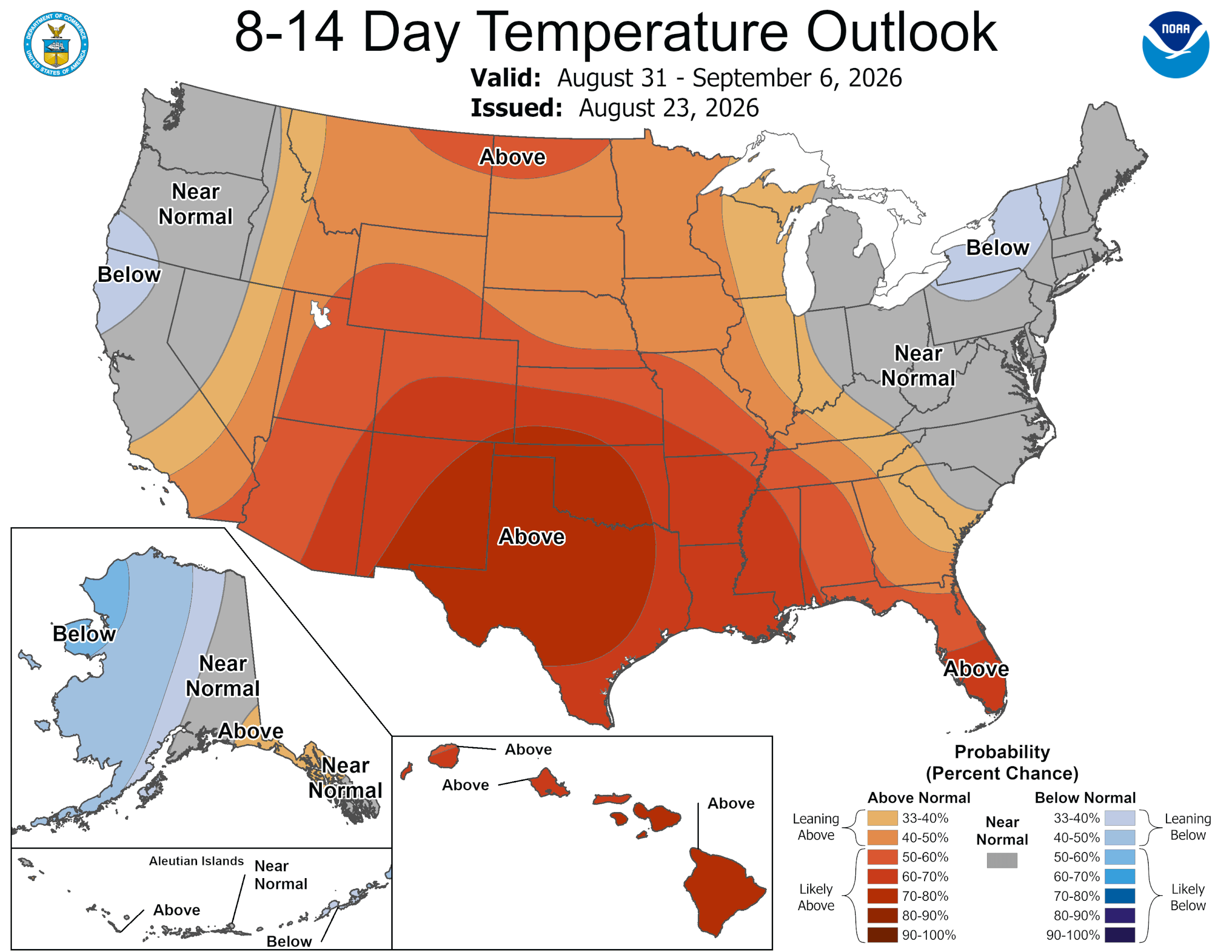
8-14 day forecast continues much above temperatures for much us.
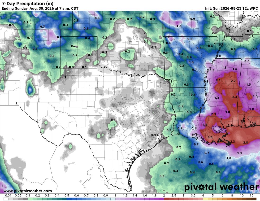
7day rainfall forecast.
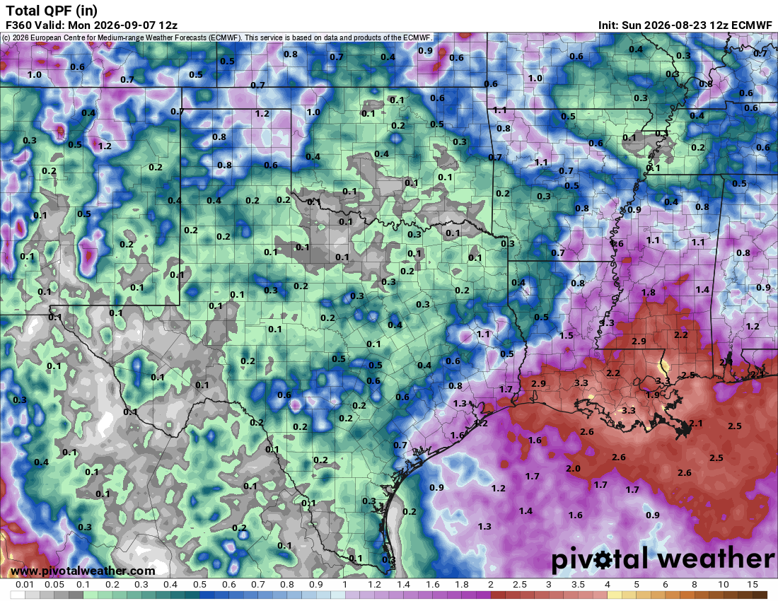
How much rain the latest Euro model thinks will fall through the 7th of September.
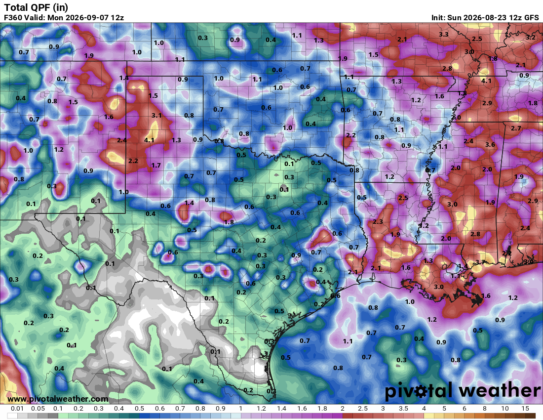
How much rain the latest GFS model thinks will fall through the 7th of September.
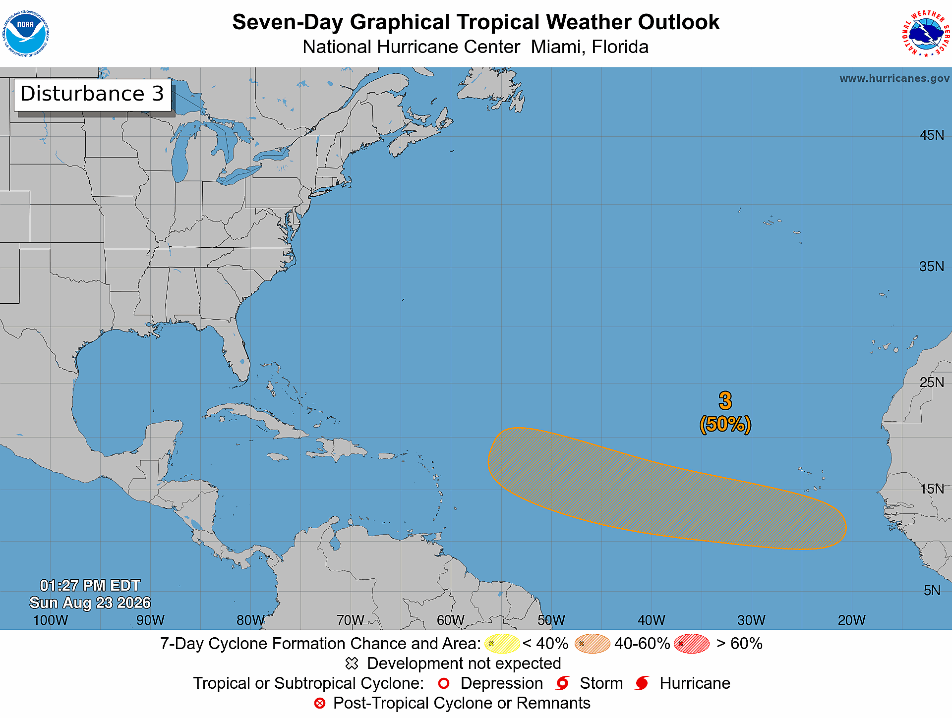
A tropical wave is expected to move off the west coast of Africa on
Monday, and an area of low pressure could form in association with
the wave early this week. Environmental conditions are forecast to
be marginally conducive for development, and a tropical depression
could form by the middle to latter portions of the week while the
system moves generally westward at 15 to 20 mph across the eastern
and central tropical Atlantic.
* Formation chance through 48 hours...low...near 0 percent.
* Formation chance through 7 days...medium...50 percent.
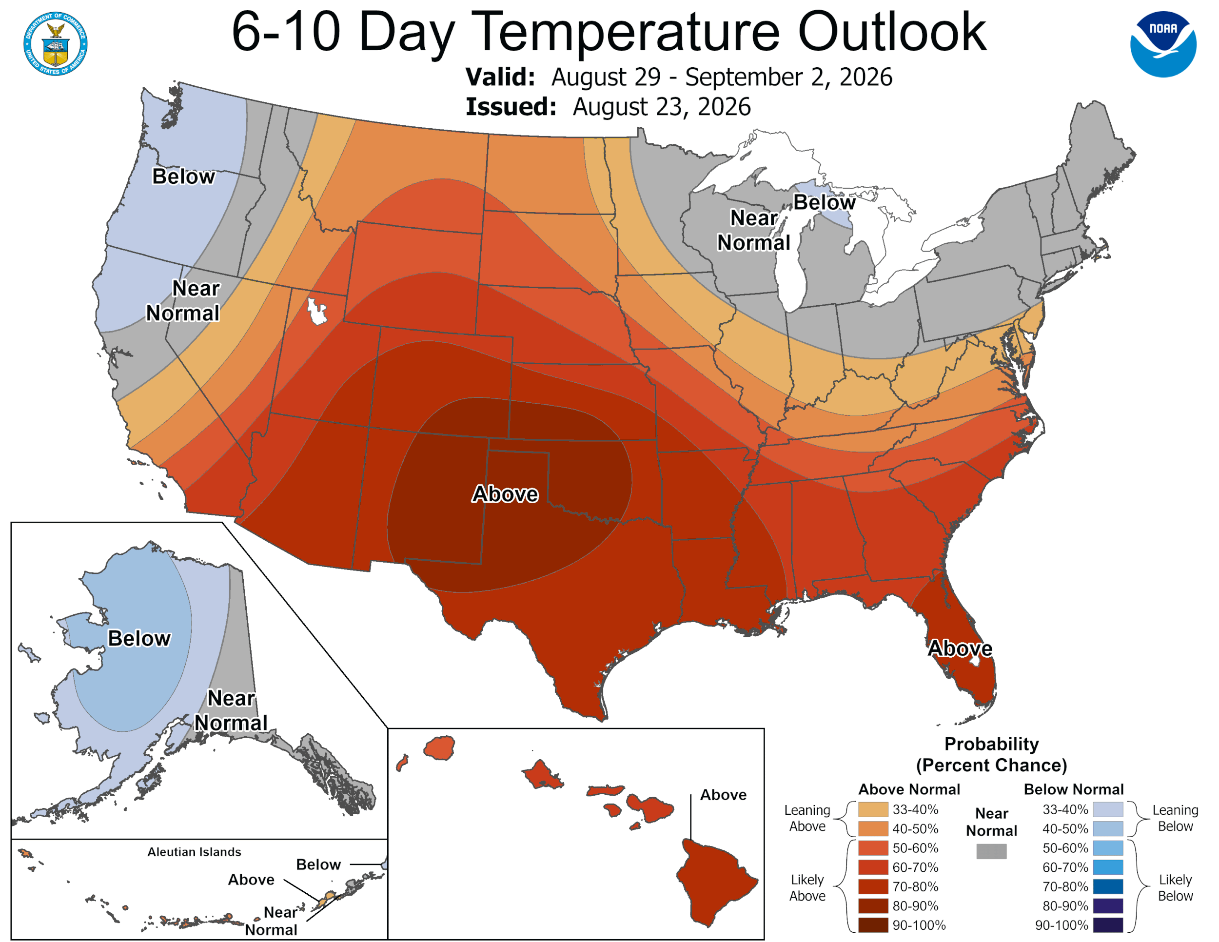
The latest CPC outlooks. Click on images to see them larger.