This could get serious…
7-14-26. 2:45pm This update is brought to you by South Texas Grass Farms. South Texas Grass Farms LLC is a family owned and operated business located just outside of Pearsall, Texas. We specialize in growing Tifway 419 Bermuda, Scotts ProVista St. Augustine, Raleigh St. Augustine and Floratam St. Augustine. We are conveniently located 1 +/- hour from San Antonio, 1.5 +/- hours from Del Rio and Laredo, 2 +/- hours from Austin. Customer pickup available at the farm. We also have delivery and installation options. We have drivers willing to deliver just about anywhere in Texas. Contact us for more information (210) 875-3532.
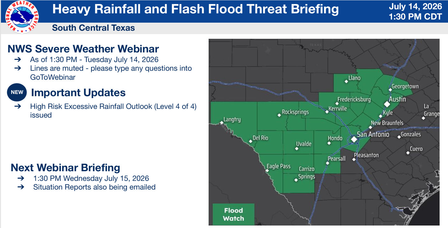
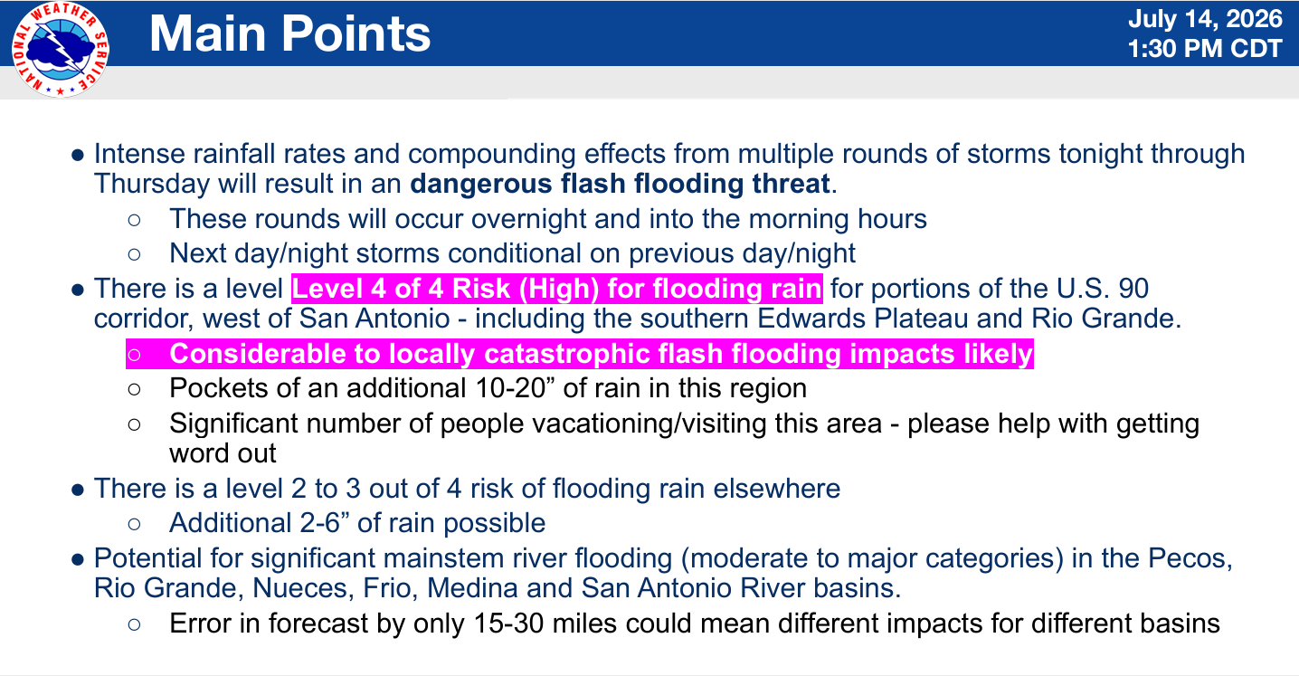
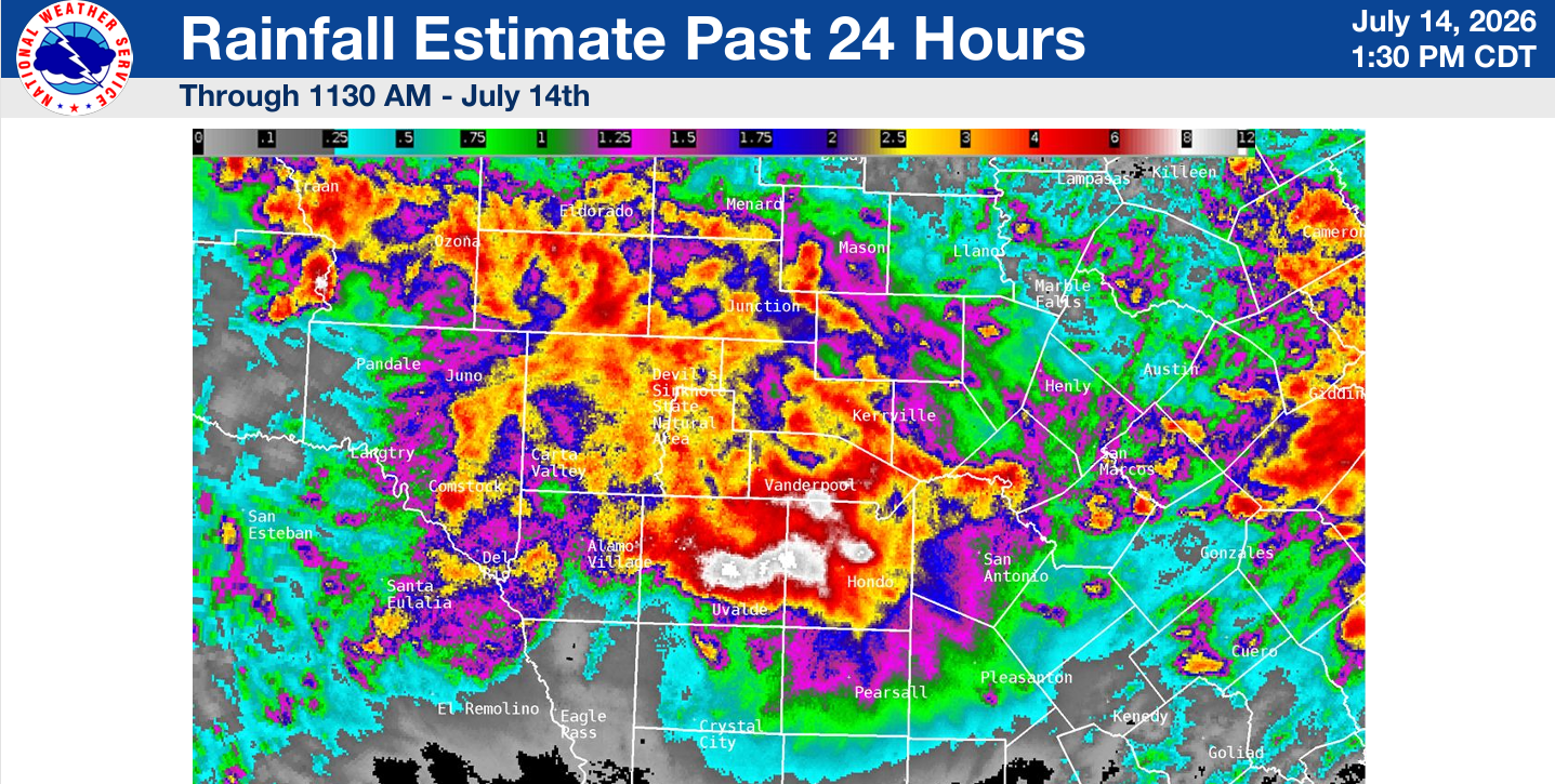
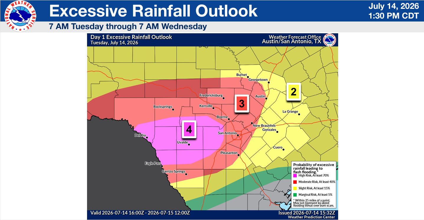
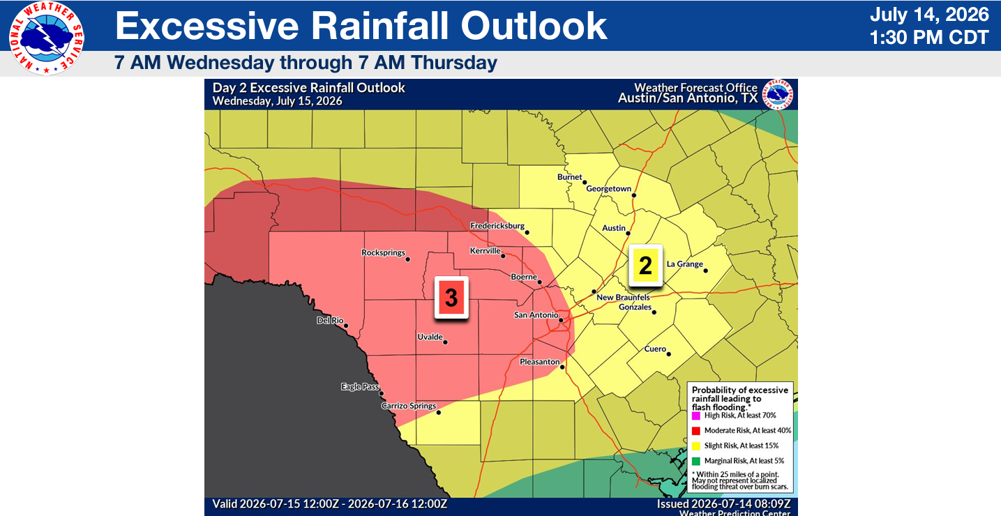
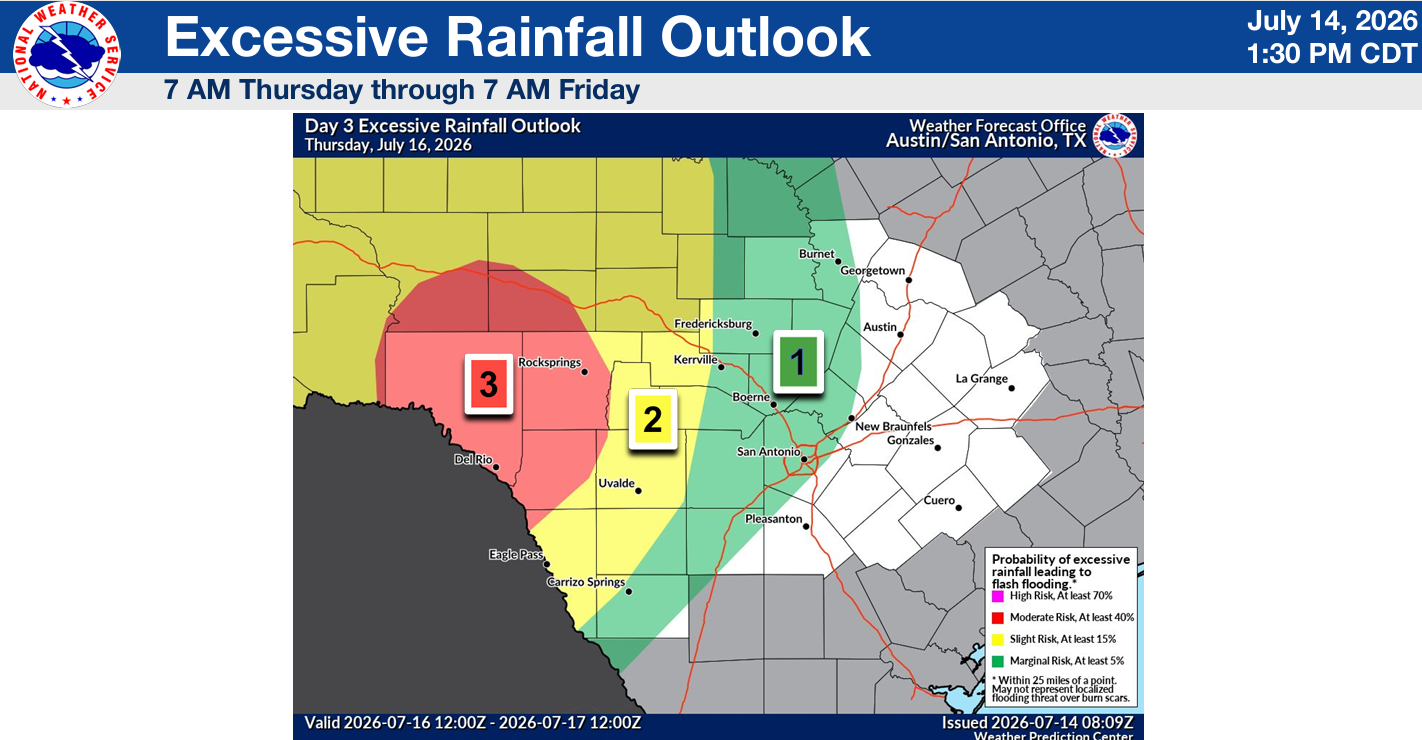
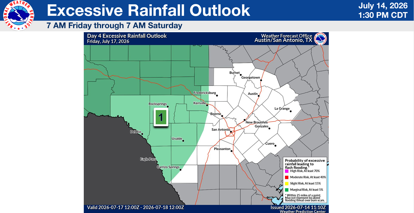
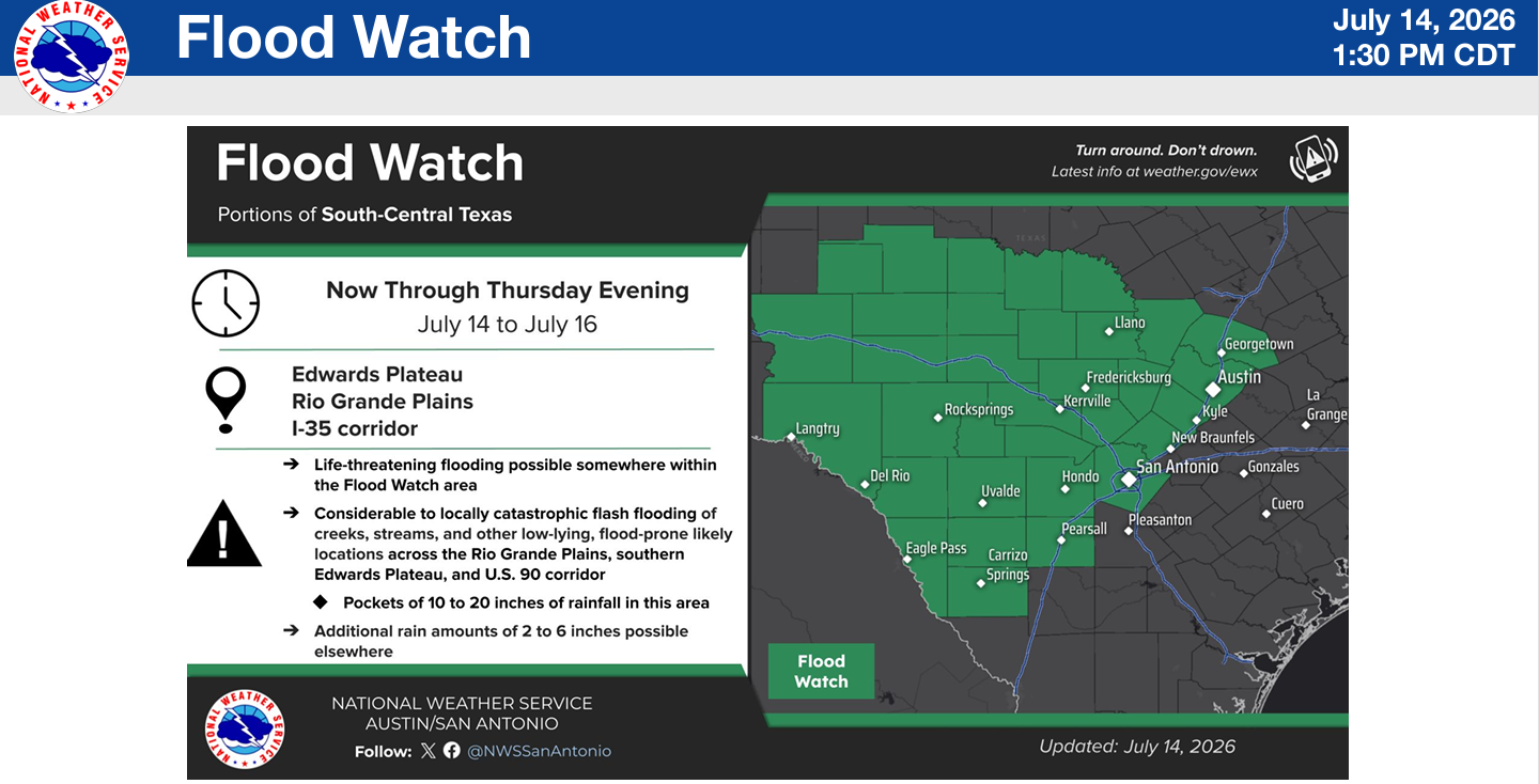
From the NWS: ”A significant threat of torrential rainfall, significant flash flooding, and downstream river rises continues tonight. There is a High Risk (the highest risk category, Level 4 of 4) of heavy rain capable of causing flash flooding along the southern Edwards Plateau and throughout the Highway 90 corridor west of San Antonio. Considerable to locally catastrophic flash flooding is possible for these areas. Significant downstream river flooding to Moderate or Major flood stages will be possible. A Flood Watch highlighting the potential for life-threatening flash flooding remains in effect from now into Thursday evening for the southern Edwards Plateau, Rio Grande, Winter Garden region, Hill Country, and I-35 corridor. While the High Risk region delineates the area of greatest concern, heavy rain will be capable of causing flash flooding anywhere within the broader watch area. As of noon Tuesday, up to a foot of rain has fallen in portions of these areas, with the heaviest rains so far impacting Bandera, Medina, and Uvalde counties. On top of these already considerable amounts, another round torrential downpours is expected tonight. The most persistent storms may produce over a foot of rain tonight into Wednesday (between 10 and 20 inches) with extreme rain rates exceeding 3 or 4 inches per hour at times. The southern Edwards Plateau, western Hill Country, and Rio Grande Plains are at greatest risk for significant additional rainfall. This could occur over the same areas hardest hit from rains last night and this morning.”
Our uncapped atmosphere remains in place, with a stationary front to our north and disturbances moving through our area. Please make sure your weather apps are on the alert mode because flooding could occur during the evenings. While this system will mainly impact south-central Texas, northern counties of south Texas should also stay aware as some storms could move further south than forecast. Drier air will move in by this weekend.
Please share your rainfall totals so far and your location.
Thanks!

This update is brought to you by South Texas Grass Farms. South Texas Grass Farms LLC is a family owned and operated business located just outside of Pearsall, Texas. We specialize in growing Tifway 419 Bermuda, Scotts ProVista St. Augustine, Raleigh St. Augustine and Floratam St. Augustine. We are conveniently located 1 +/- hour from San Antonio, 1.5 +/- hours from Del Rio and Laredo, 2 +/- hours from Austin. Customer pickup available at the farm. We also have delivery and installation options. We have drivers willing to deliver just about anywhere in Texas. Contact us for more information (210) 875-3532.
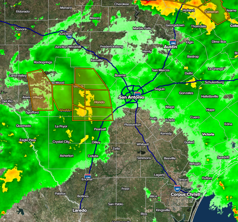
2:30pm radar.
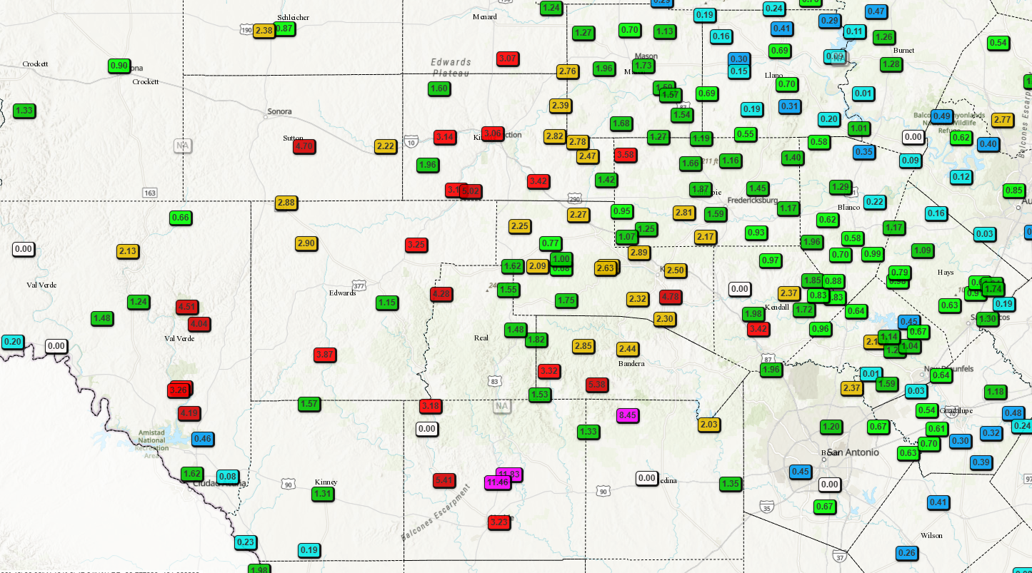
24hr rainfall totals so far.
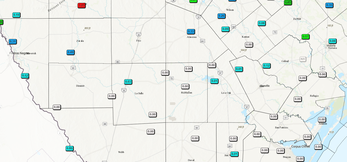
24hr rainfall totals so far.
Heavy rainfall and flash flood threat briefing from the NWS. Click on images to see them larger.
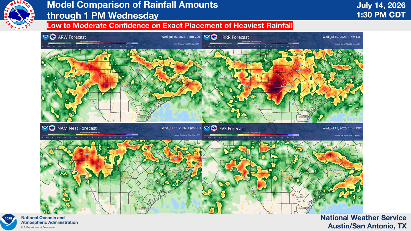
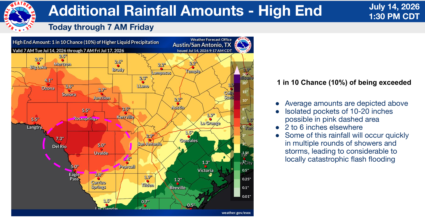
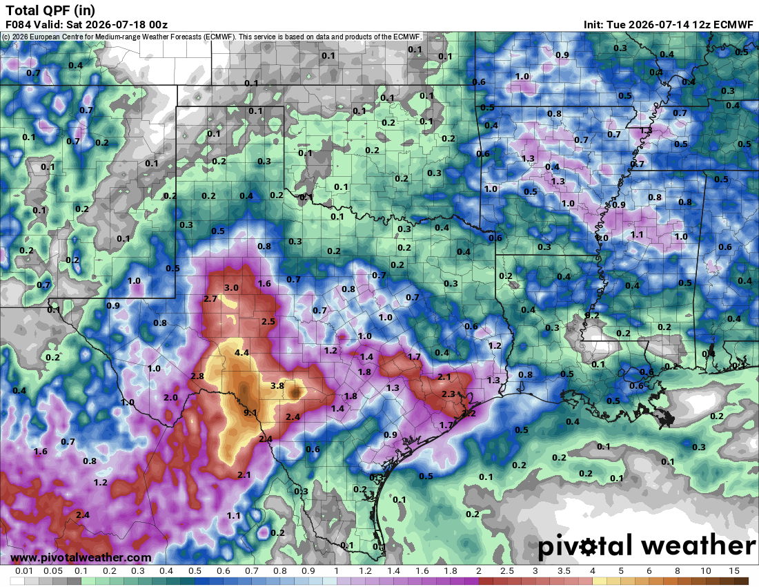
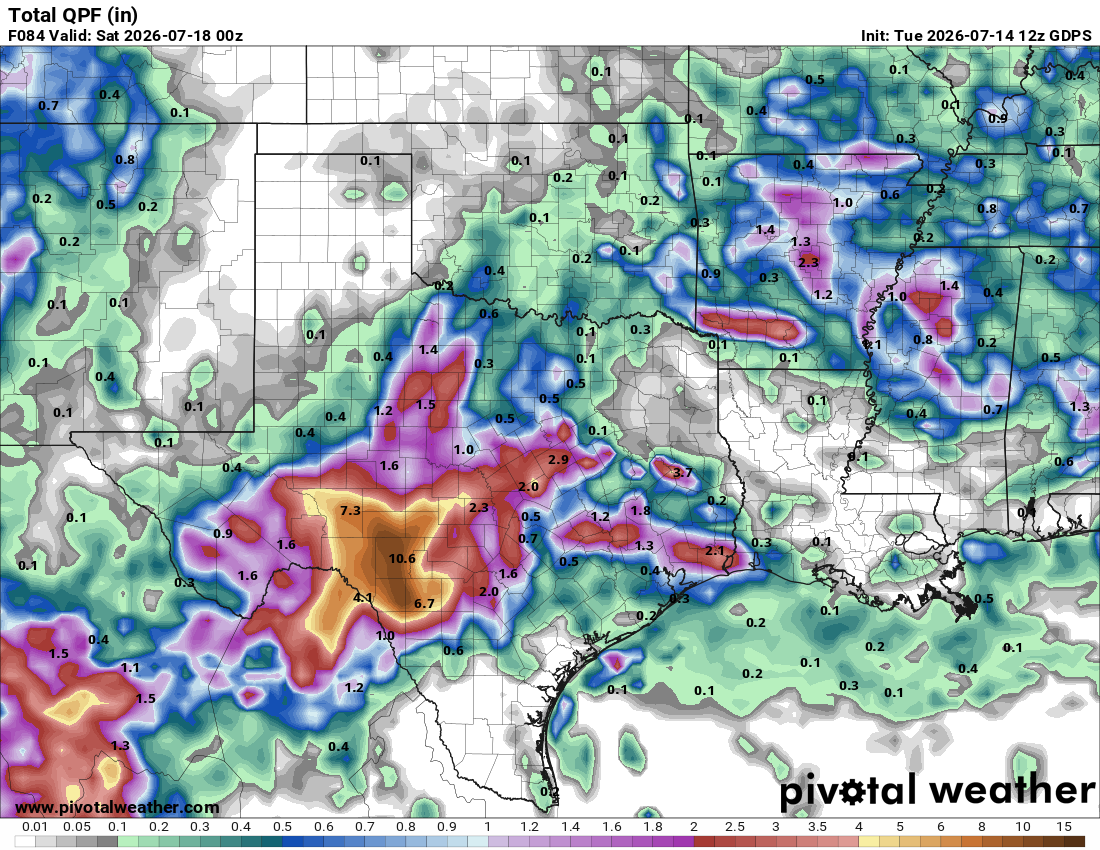
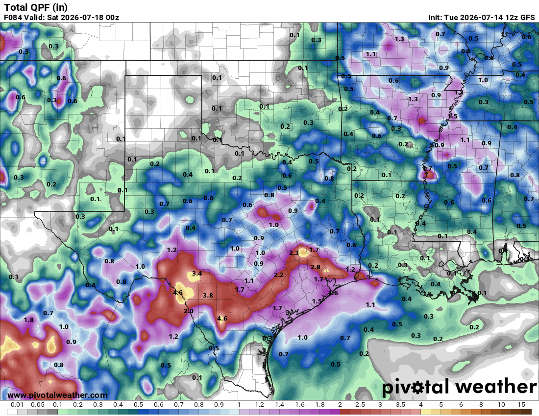
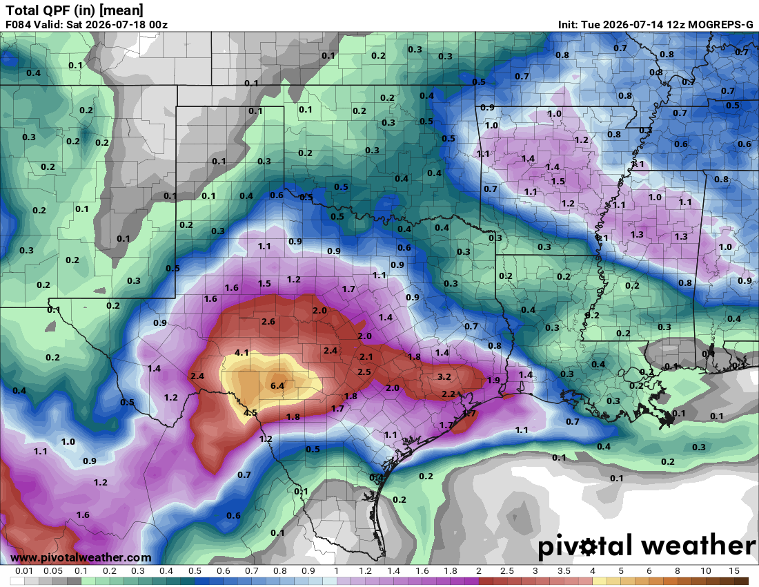
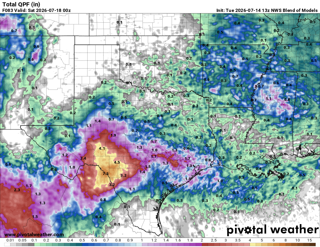
How much rain the latest models think will fall between today and Friday. Click on images to see them larger.