It could have been worse…
5-14-25. 6pm This Update is brought to you by Synergy Standby Solutions. Synergy Standby Solutions is a trusted provider of sales, maintenance, repairs, and fueling services for standby generators in South Central Texas. We specialize in ensuring your backup power systems remain reliable and fully operational, giving you peace of mind during power outages. With a commitment to excellence and customer satisfaction, our expert team is ready to handle all your generator needs. Learn more at www.synergystandby.com.
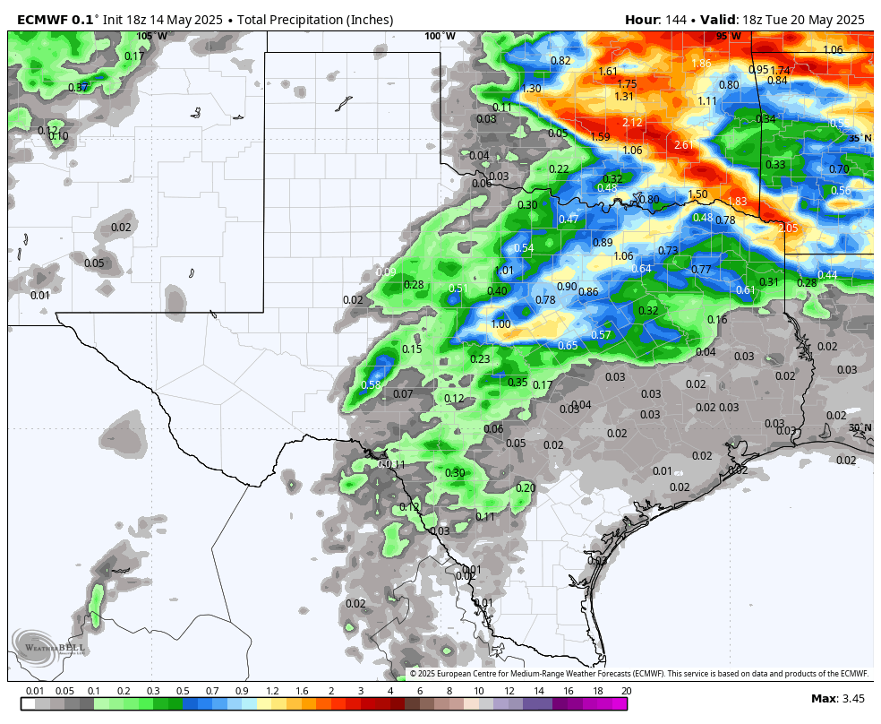
Thanks to some clouds, our highs today only reached record daily highs instead of all time record highs! It was still certainly hot out there and we will continue to see highs over 100 degrees for most locations through the weekend. Speaking of the weekend, a dry-line in West Texas and some disturbances, may kick up a few thunderstorms starting Saturday-Tuesday. The latest model runs are forecasting some rain, mainly in the Hill Country and our northern counties. The long-range models are still bullish for us going into better rain odds during the last week of May.
How hot did it get at your place today and where?
Mark


High temps today.

The clouds tempered our highs just a bit!

Forecast highs for Thursday.

Forecast highs for Friday.
How much rain these models think will fall between Saturday-Tuesday. Click on images to see them larger.