Trading record highs for high heat indexes!
5-15-25. 7:15pm. This Update is brought to you by Sedley's Grass Fed Beef. Sedley's Grass Fed Beef is a family-owned farm to table beef cattle operation located in western Gonzales County roughly 50 miles east of San Antonio and 70 miles south of Austin. www.sedleysgrassfedbeef.com
More record highs fell today in Austin, Del Rio and Corpus. Starting tomorrow, we’ll be trading record highs with high heat indexes, as our humidity increase! There is already a heat advisory out for tomorrow as heat indexes rise to 105-110 in the afternoon. The heat continues into next week, before a late season “not so hot” front moves through late Tuesday. A dry-line ahead of the front may touch off some storms on Monday night and Tuesday, but rain odds and coverage are looking slim and limited to the Hill Country and possible the western counties.
...RECORD HIGH TEMPERATURE SET AT CORPUS CHRISTI...

A RECORD HIGH TEMPERATURE OF 94 DEGREES WAS SET AT CORPUS CHRISTI
TODAY.
THIS BREAKS THE OLD RECORD OF 93 DEGREES SET IN 2008.
...RECORD HIGH TEMPERATURE SET AT AUSTIN BERGSTROM...
A RECORD HIGH TEMPERATURE OF 99 DEGREES WAS SET AT AUSTIN BERGSTROM
TODAY. THIS BREAKS THE OLD RECORD OF 96 DEGREES SET IN 2003.
...RECORD HIGH TEMPERATURE SET AT AUSTIN CAMP MABRY...

A RECORD HIGH TEMPERATURE OF 99 DEGREES WAS SET AT AUSTIN CAMP MABRY
TODAY. THIS BREAKS THE OLD RECORD OF 98 DEGREES SET IN 1925.
...RECORD HIGH TEMPERATURE SET AT DEL RIO...
A RECORD HIGH TEMPERATURE OF 103 DEGREES WAS SET AT DEL RIO TODAY.
THIS BREAKS THE OLD RECORD OF 102 DEGREES SET IN 2022.I’ll dive into the rest of the month tomorrow…it’s not looking as promising as it was a few days ago.
Mark

This Update is brought to you by Sedley's Grass Fed Beef. Sedley's Grass Fed Beef is a family-owned farm to table beef cattle operation located in western Gonzales County roughly 50 miles east of San Antonio and 70 miles south of Austin. www.sedleysgrassfedbeef.com

Today's high temps.
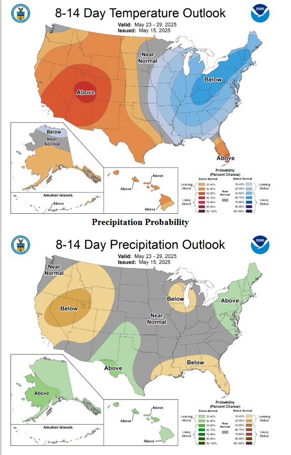
Heat update from the NWS. Click on images to see them larger.


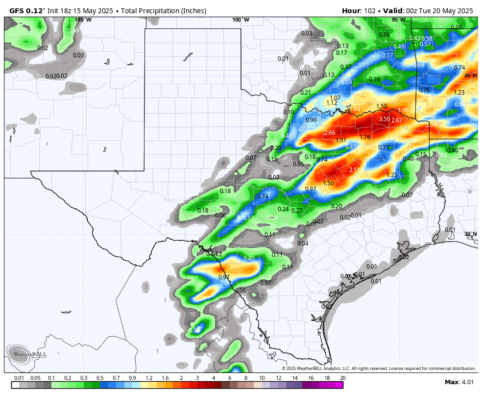
How much rain the latest models think will fall between Monday and Tuesday of next week. Click on images to see them larger.


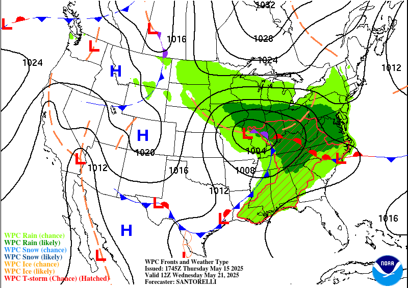
A "not so hot front" will arrive late on Tuesday of next week.