Chances for severe storms are increasing…
4-11-26. 2:45pm. This update is brought to you by Dietz Mclean Optical Company. www.dmoptical.com As a family-owned business, our independence, in house lab, great customer service and eyewear warranties, allows us to tailor your eyeglasses, lenses, and fittings: we want you to only expect the best after working with us. With six conveniently located optical shops in San Antonio, Boerne, Marble Falls and Temple, it’s easy to love what you see.
A disturbance moving east from northern Mexico will be our first trigger for severe storms and potentially heavy rain for our NW counties this evening and into early AM on Sunday for those of you living in San Antonio and Austin. Ahead of the disturbance, look for scattered PM poppers to continue to develop across all of our area this afternoon. As of post time, there are quite a few cells already showing on radar…movement is north.
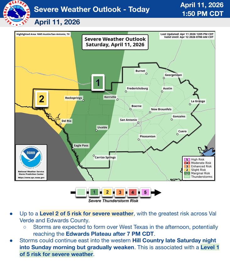
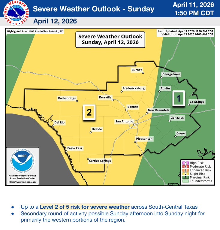
Details from the NWS are below. Biggest threat from storms will be large hail and high winds. Remember to keep your emergency apps turned on along with your NOAA radio, if you have one!
As always, please share storm videos and rainfall totals.
Mark

This update is brought to you by Dietz Mclean Optical Company. www.dmoptical.com As a family-owned business, our independence, in house lab, great customer service and eyewear warranties, allows us to tailor your eyeglasses, lenses, and fittings: we want you to only expect the best after working with us. With six conveniently located optical shops in San Antonio, Boerne, Marble Falls and Temple, it’s easy to love what you see.
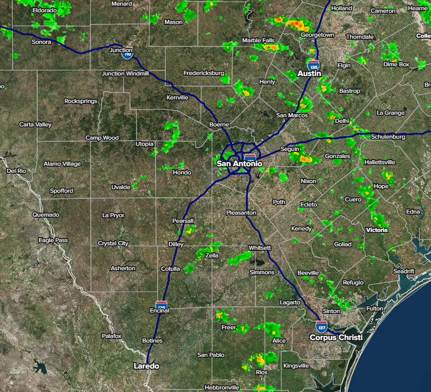
Post time radar. Storms are moving north.
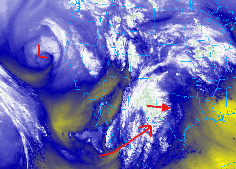
An upper level low over NW CA will move SE over the next 48hrs. Meanwhile, a disturbance over Mexico will move east into Texas over the next 24hrs, bringing in moisture from the SW.
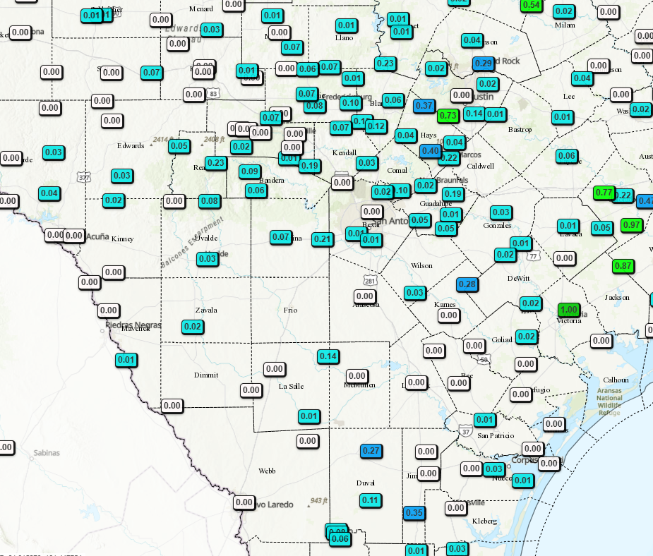
24hr rainfall totals.
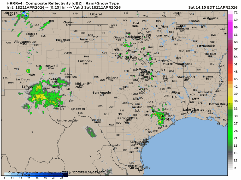
How the latest HRRR model thinks our radar will look like over the next 24hrs.
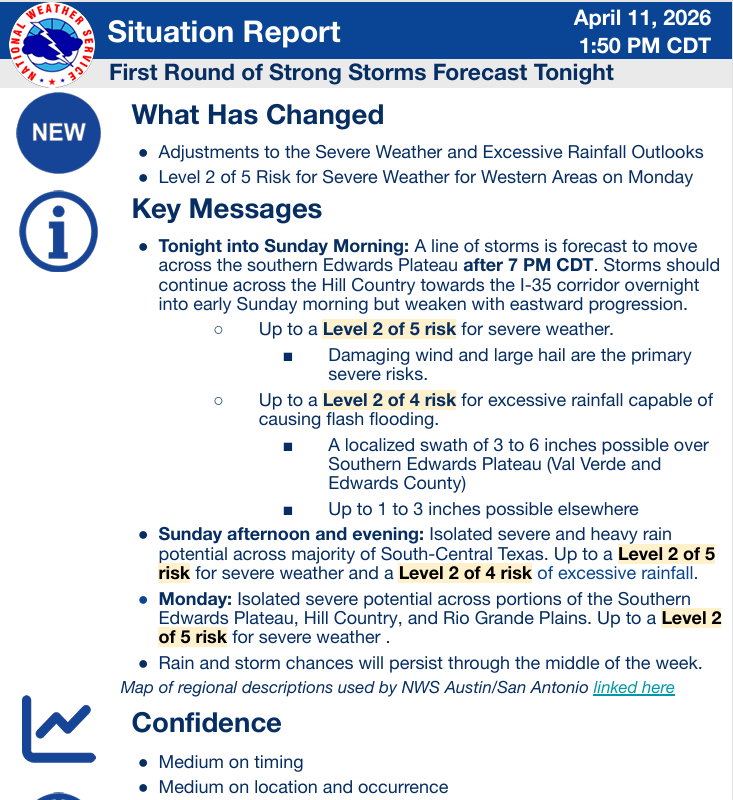
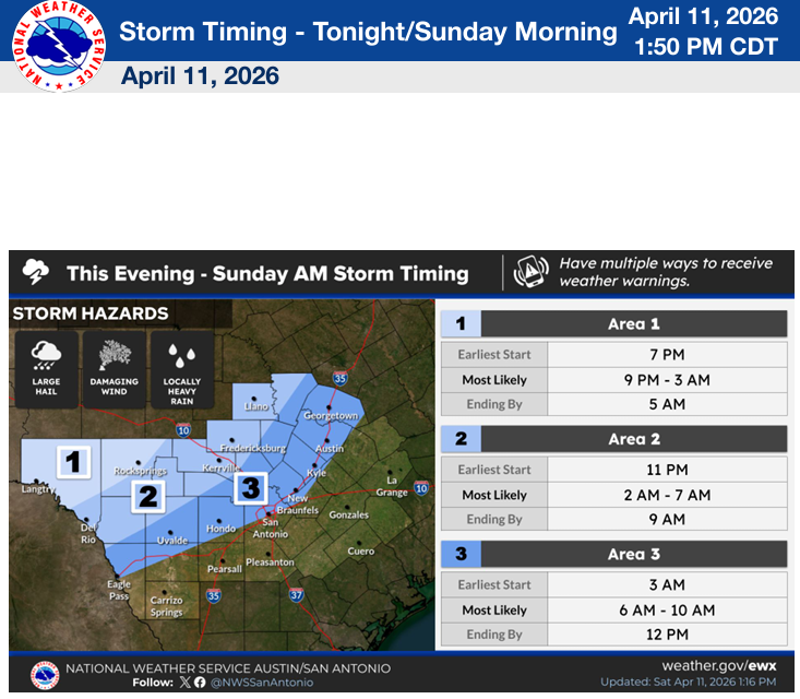
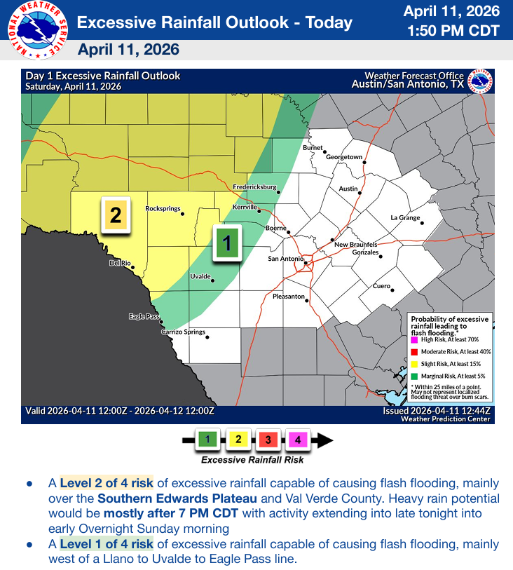
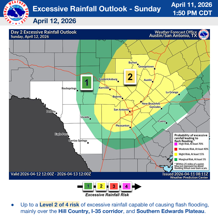
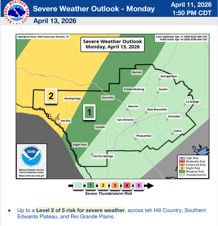
The latest update from the NWS. Click on images to see them larger.
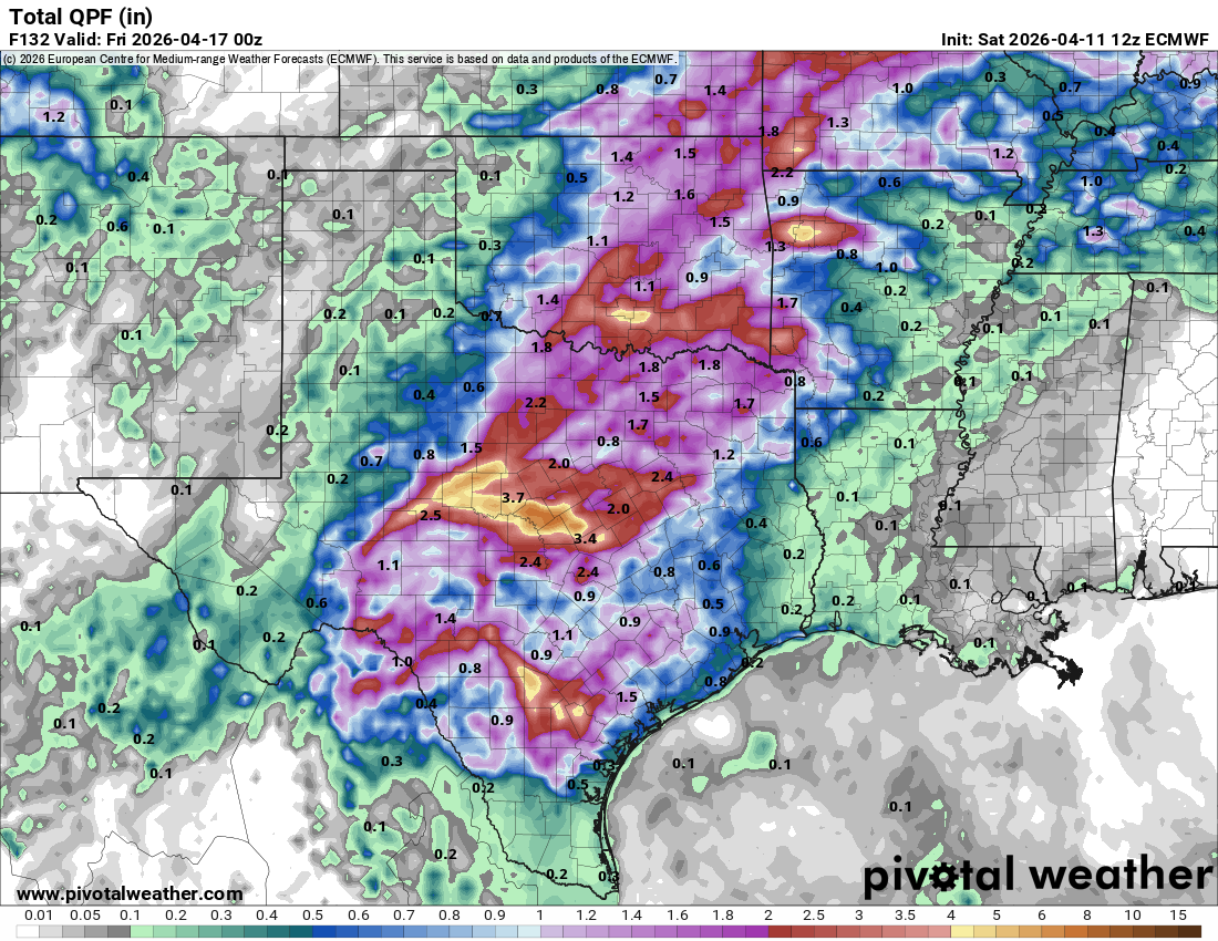
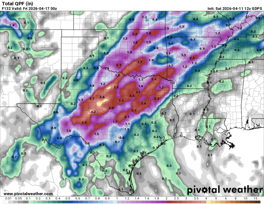
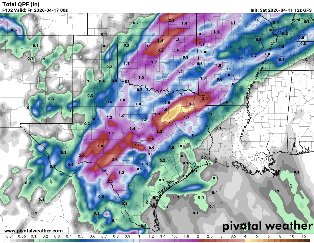
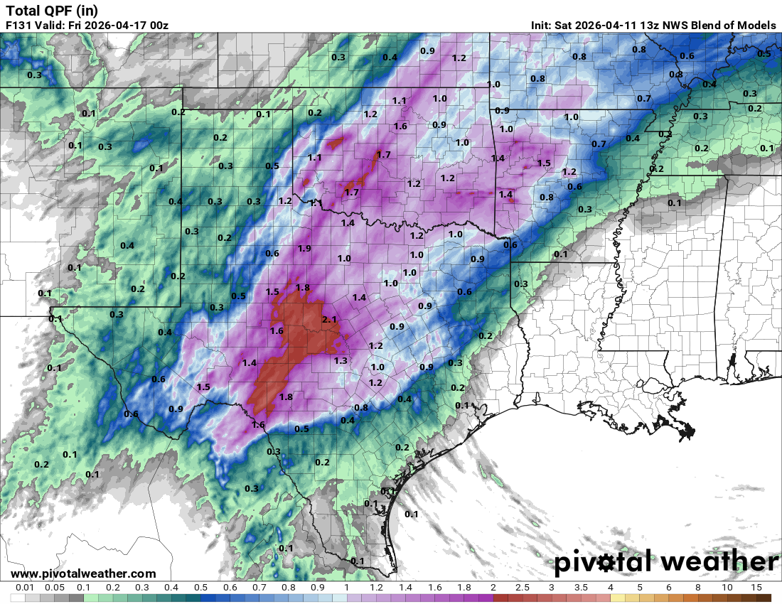
How much rain the latest models think will fall between this afternoon and next Thursday. Click on images to see them larger.