A lot of uncertainty ahead!
5-5-25. 2:45pm This Update is brought to you by Synergy Standby Solutions. Synergy Standby Solutions is a trusted provider of sales, maintenance, repairs, and fueling services for standby generators in South Central Texas. We specialize in ensuring your backup power systems remain reliable and fully operational, giving you peace of mind during power outages. With a commitment to excellence and customer satisfaction, our expert team is ready to handle all your generator needs. Learn more at www.synergystandby.com.
An upper-level low continues to spin over central AZ area today, before it moves SE, then NE over the next few days. This upper-level low dropped over an inch of snow and 3/4 of an inch of liquid on my backyard in SW CO this morning. Disturbances will move through Texas ahead of this system, then eventually a cool front that will go stationary over our area on Wednesday. Depending on how quickly these features move could have a major impact on how much rain we see through Thursday. Storms from this morning and early afternoon have already dropped some rain totals over an inch in a few spots and 1/2 and inch in others. My weather station in NW Bexar County recorded 0.45 inches so far today.
There is currently a Severe Thunderstorm Watch for our far eastern counties in effect until 8pm. Given the current severe threat being a level 3 in our NW counties, I would expect another Watch to be issued later this afternoon...when it does, I will post it in the comments section. Large hail and high winds are the primary threat, but a few tornadoes are also possible. Look for more scattered, potentially severe storms this afternoon, moving from south to north, then more storms tonight and tomorrow. Rain odds diminish on Wednesday and Thursday, but don't go away.
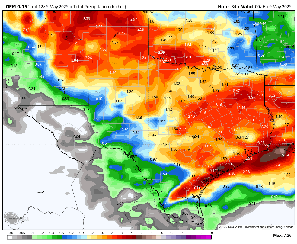
The models are posted below, but I wouldn't take any of them very seriously...this is a very convective situation so there could be a lot of surprises over the next 48hours!
As always, tune to your local NOAA weather radio or emergency apps for specific warnings for your location.
Mark

This Rainfall Roundup is brought to you by Synergy Standby Solutions. Synergy Standby Solutions is a trusted provider of sales, maintenance, repairs, and fueling services for standby generators in South Central Texas. We specialize in ensuring your backup power systems remain reliable and fully operational, giving you peace of mind during power outages. With a commitment to excellence and customer satisfaction, our expert team is ready to handle all your generator needs. Learn more at www.synergystandby.com.


12hr rainfall totals so far today.

2:20pm radar
NWS Storm Info for the next 48hrs. Click on images to see them larger.


An upper level low in AZ will move SE, then NE over the next couple of days.

A stalled front will give us more rain chances on Wednesday and Thursday.
How much rain the latest modes are forecasting from today through Thursday. Click on images to see them larger.