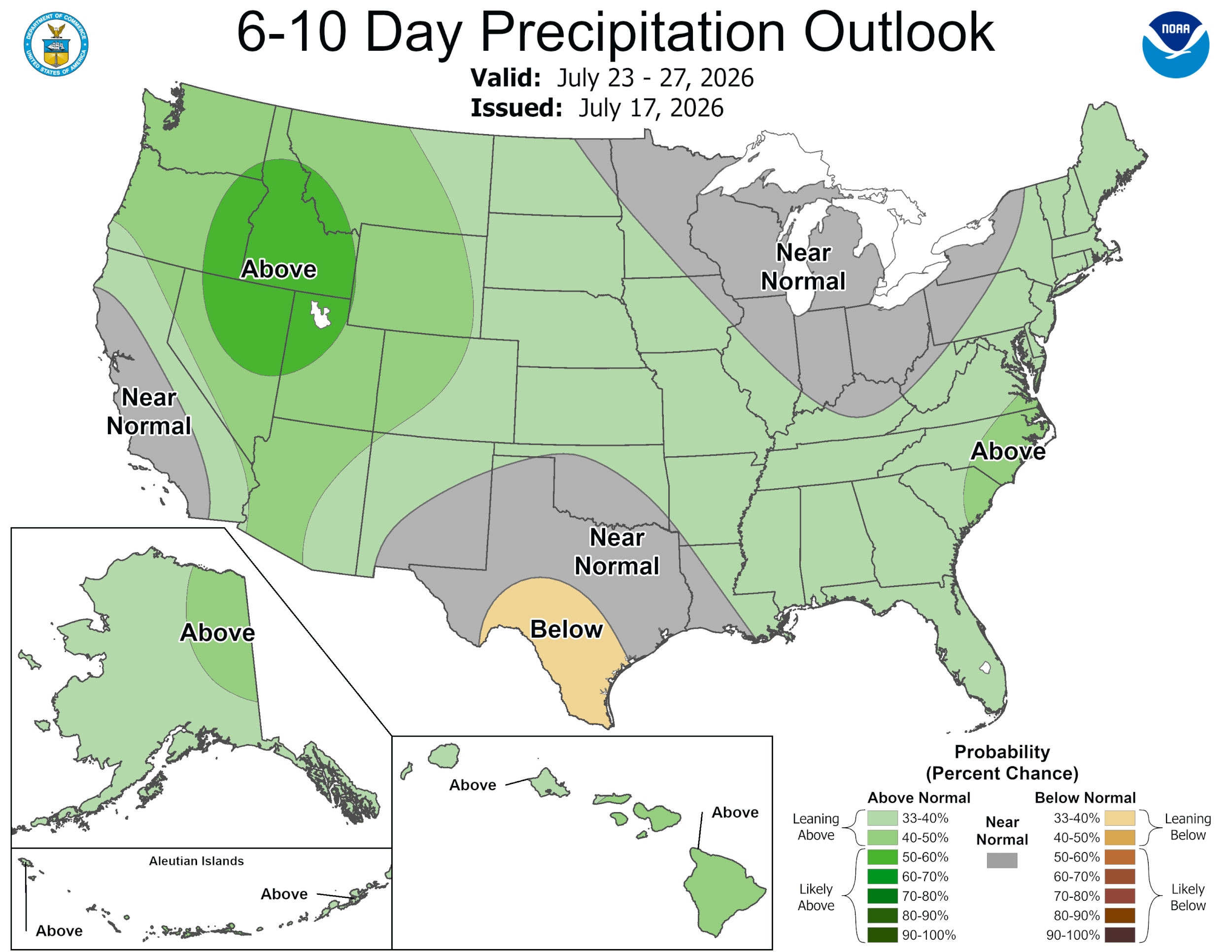
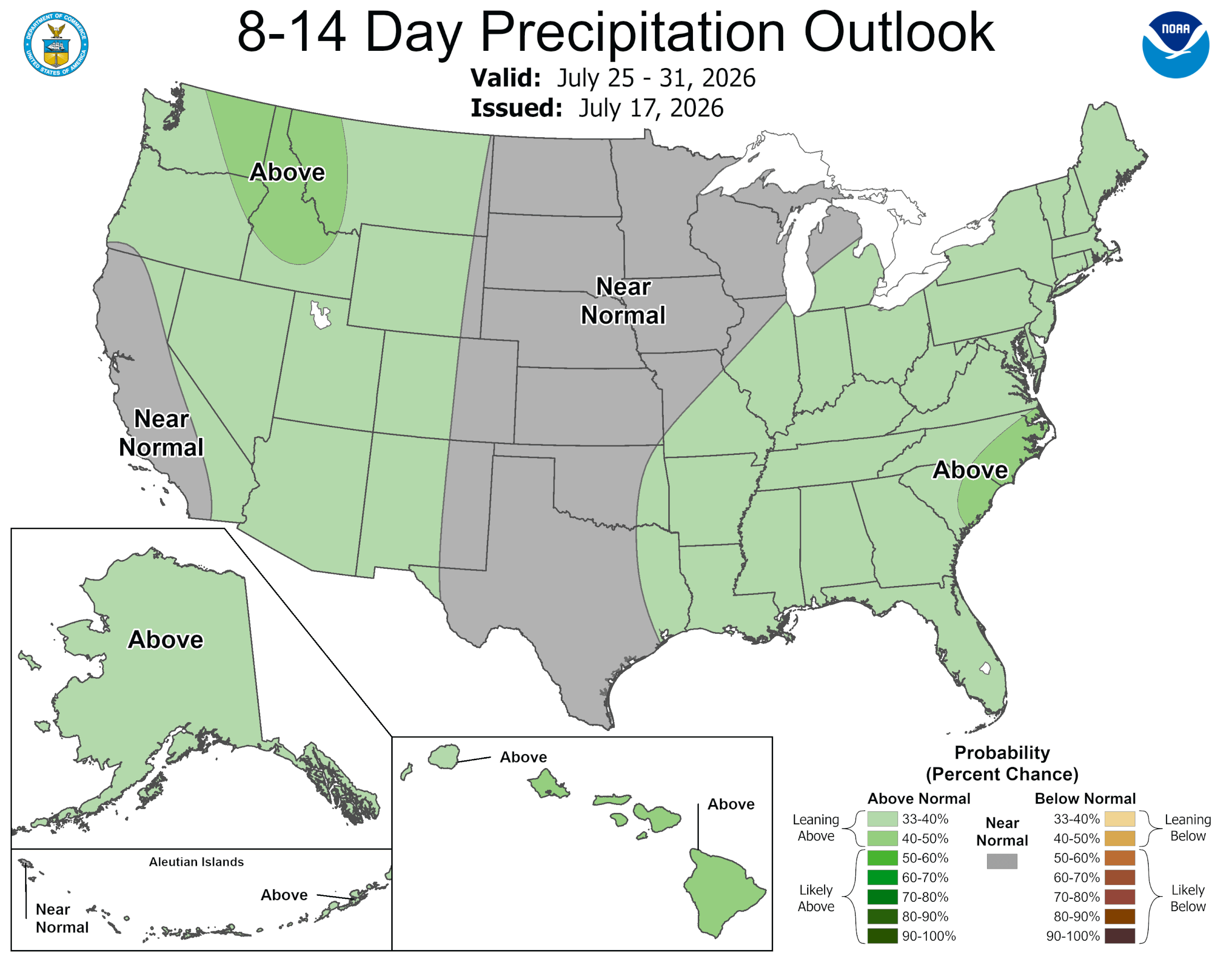
Something to watch in the Gulf…
7-18-26. 3:15pm. This update is brought to you by Dietz Mclean Optical Company. www.dmoptical.comAs a family-owned business, our independence, in house lab, great customer service and eyewear warranties, allows us to tailor your eyeglasses, lenses, and fittings: we want you to only expect the best after working with us. With six conveniently located optical shops in San Antonio, Boerne, Marble Falls and Temple, it’s easy to love what you see.
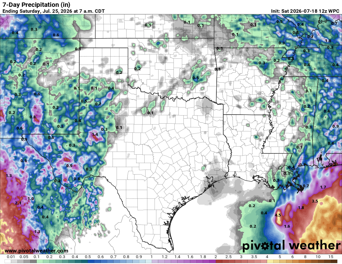
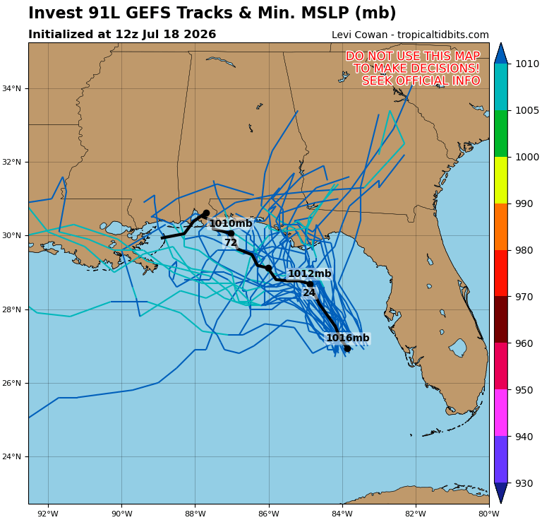
Though it is unlikely to impact our weather, we finally have something to watch in the Gulf (91L). It has a 40% chance for becoming a tropical something and is forecast to move north or NW….details below.
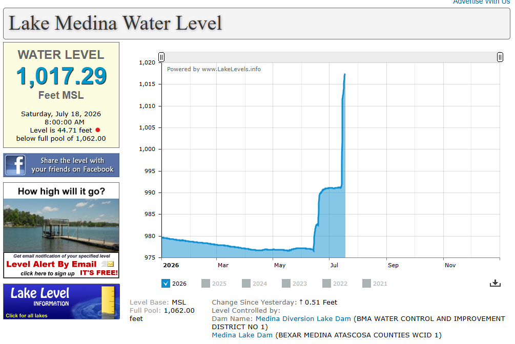
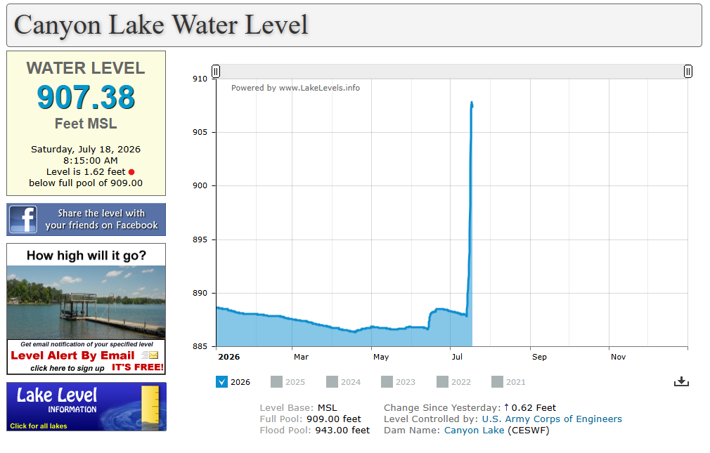
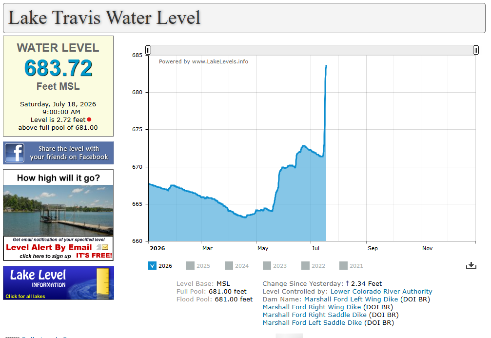
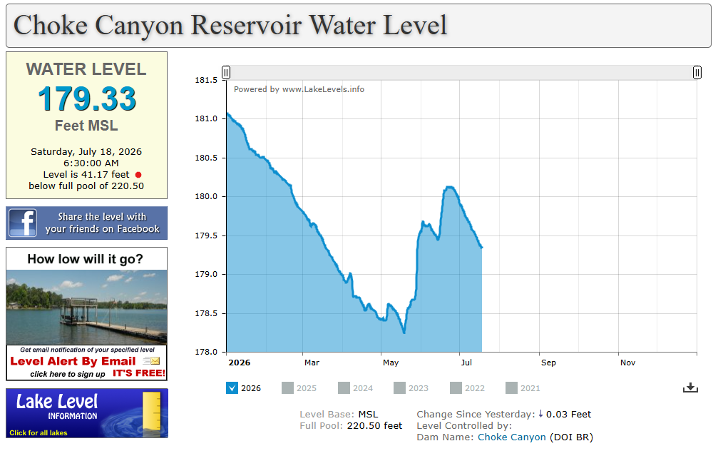
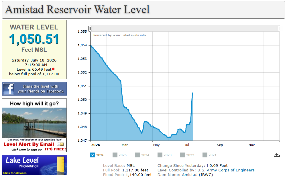
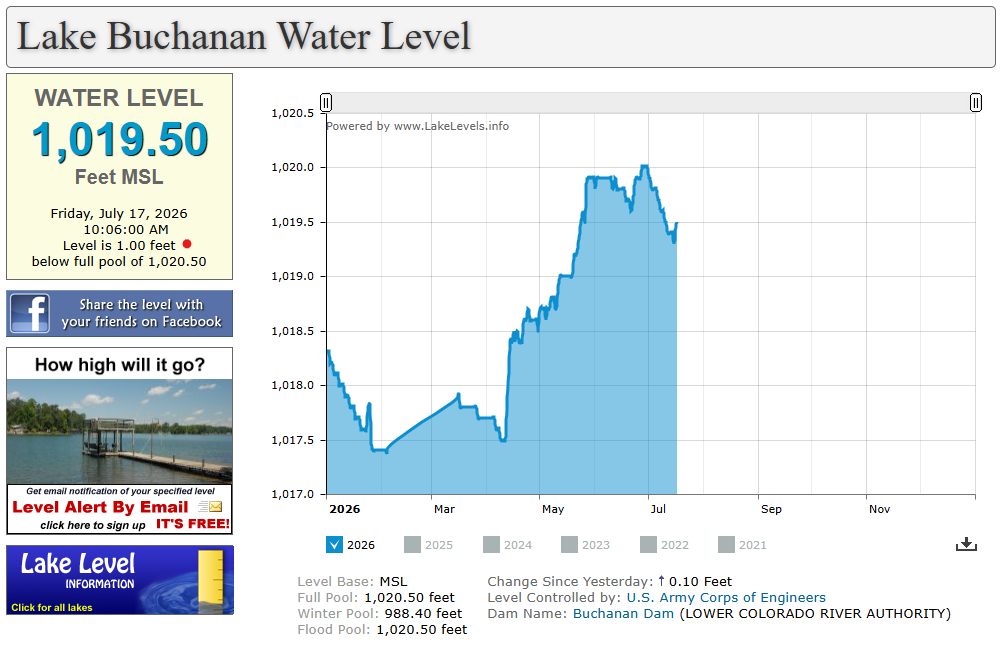
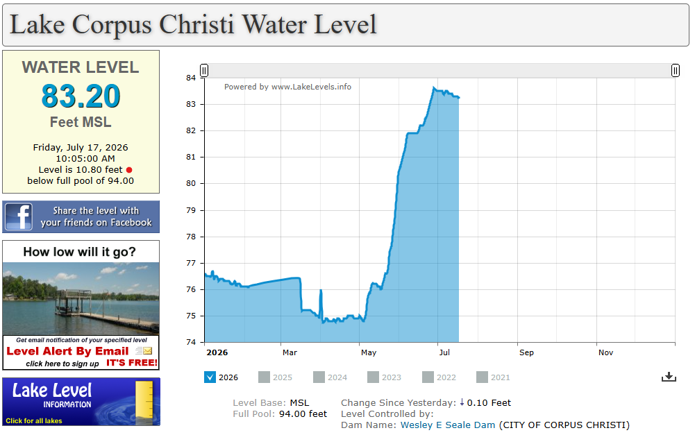
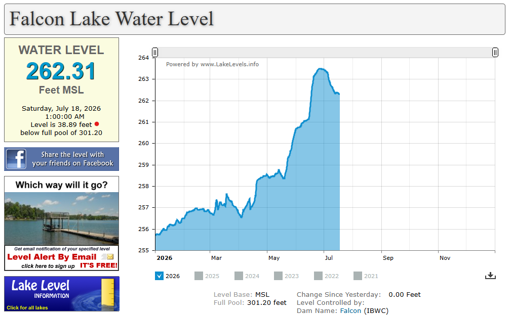
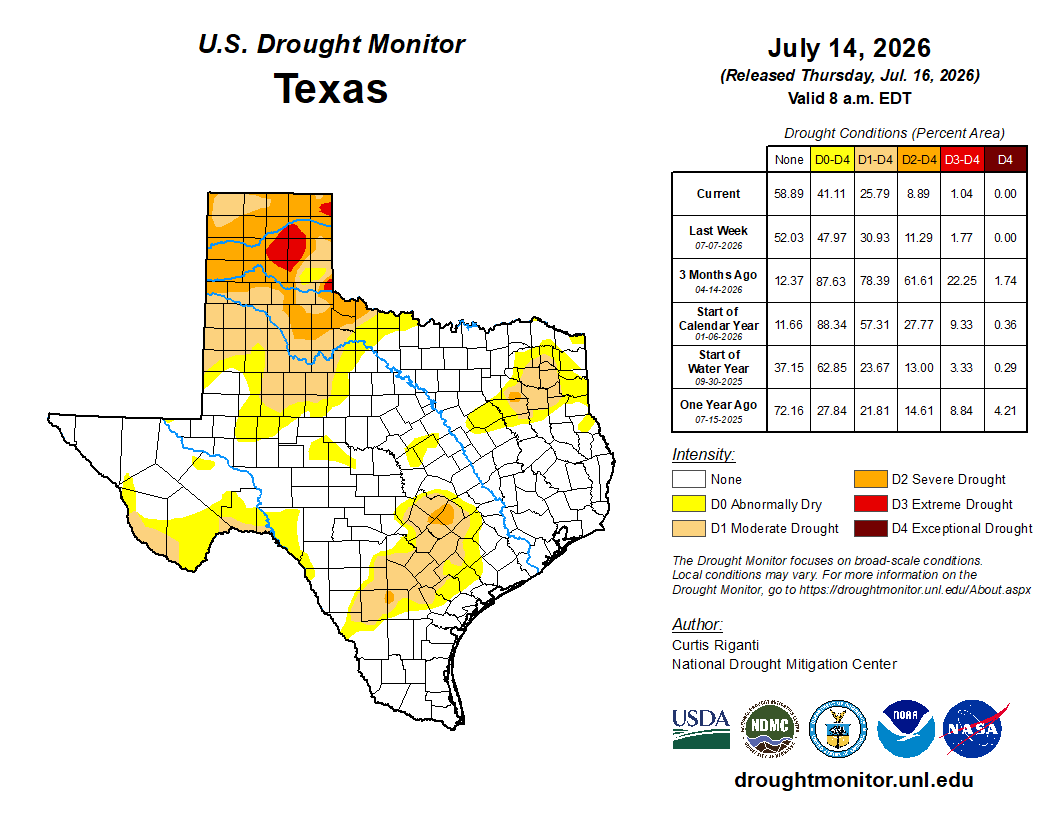
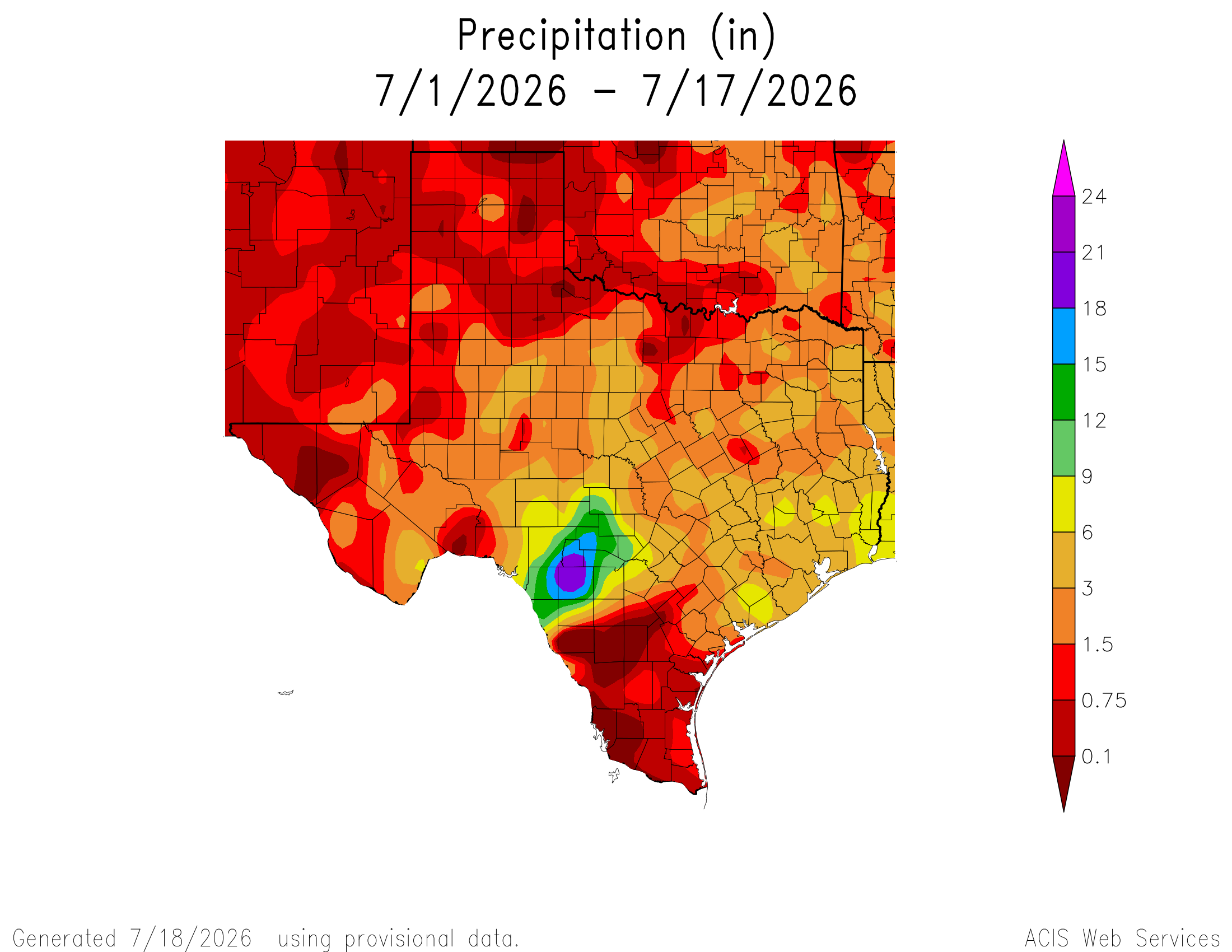
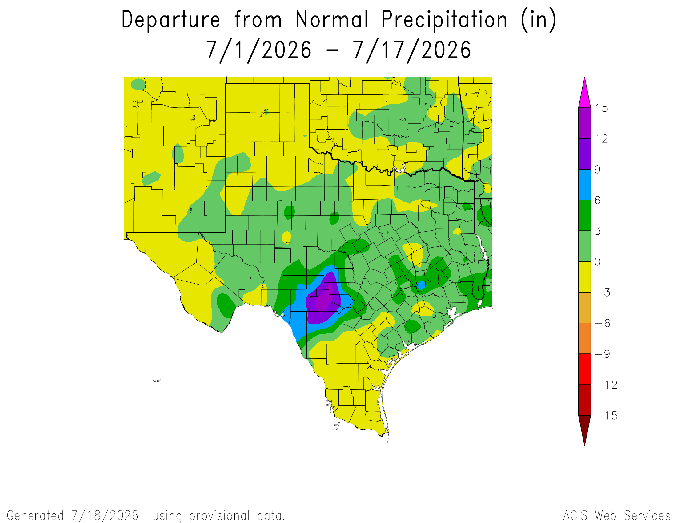
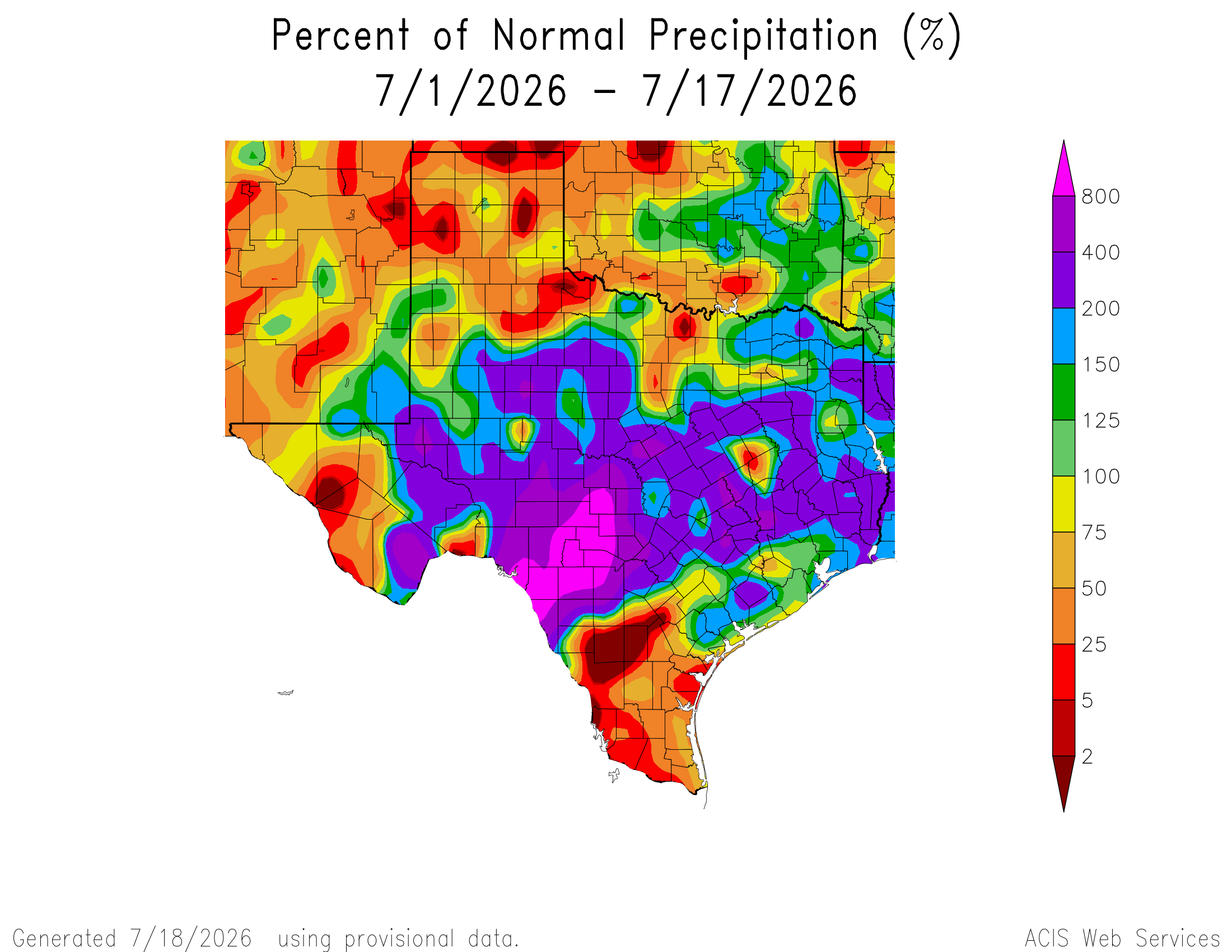
July has been a great rain month if you live north of HWY 90 and a not so great month if you live south, except for western counties along the border. I’ve got the latest drought update from Thursday (will likely change next week with the heavy rains) and July rainfall totals in today’s post. I have also included the latest lake level info…hopefully Medina Lake will continue to rise, but as of post time, is still 45 feet from full. Nice to see Canyon and Lake Travis filled with the recent storms!
Hot and humid weather this week with almost zero rain odds, unless 91L decides to change direction.
Mark

This update is brought to you by Dietz Mclean Optical Company. www.dmoptical.comAs a family-owned business, our independence, in house lab, great customer service and eyewear warranties, allows us to tailor your eyeglasses, lenses, and fittings: we want you to only expect the best after working with us. With six conveniently located optical shops in San Antonio, Boerne, Marble Falls and Temple, it’s easy to love what you see.
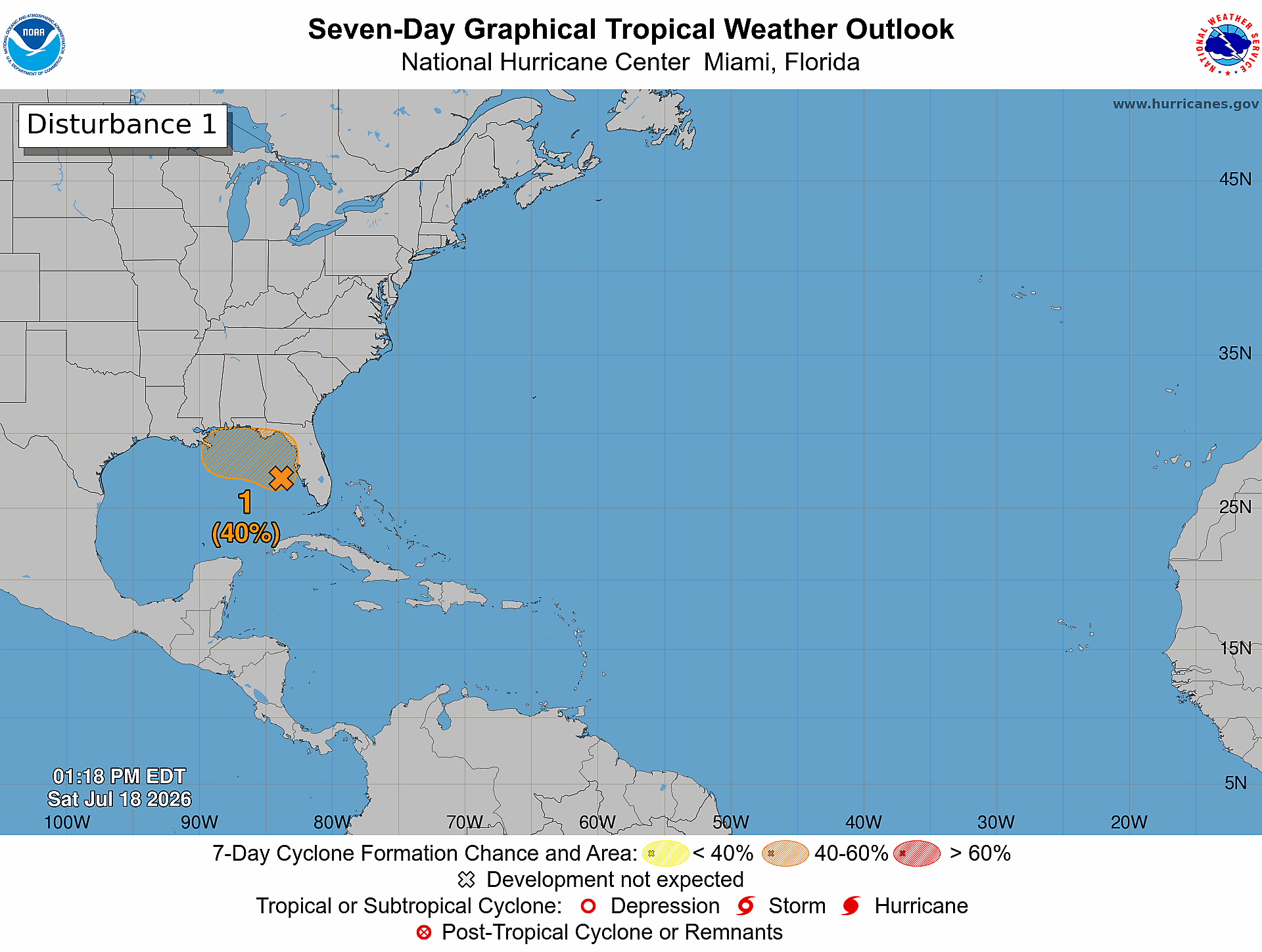
For the North Atlantic...Caribbean Sea and the Gulf of America:
1. Northern Gulf of America and near Florida (AL91):
Satellite images and surface observations indicate that a broad
surface low is forming over the eastern Gulf of America. However,
the associated winds remain light, and the showers and thunderstorms
are still disorganized. Gradual development of this system is
possible, and it could become a tropical depression while it moves
slowly northward or north-northwestward during the next few days.
Interests along the Florida Gulf coast, southern Alabama, and
southwestern Georgia should monitor the progress of this system as
it is expected to bring heavy rain to portions of that region during
the next several days. An Air Force Reserve reconnaissance aircraft
is scheduled to investigate the system on Sunday, if needed.
* Formation chance through 48 hours...low...30 percent.
* Formation chance through 7 days...medium...40 percent.
The latest July rainfall totals and drought update. Click on images to see them larger.
The latest lake levels for lakes in our area. Click on images to see them larger.